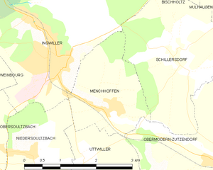
Ingwiller (Ingwiller)

- commune in Bas-Rhin, France
- Country:

- Postal Code: 67340
- Coordinates: 48° 52' 23" N, 7° 28' 37" E


- GPS tracks (wikiloc): [Link]
- Area: 18.05 sq km
- Population: 4106
- Web site: http://www.ingwiller.fr
- Wikipedia en: wiki(en)
- Wikipedia: wiki(fr)
- Wikidata storage: Wikidata: Q22507
- Wikipedia Commons Category: [Link]
- Freebase ID: [/m/03m4csh]
- Freebase ID: [/m/03m4csh]
- Freebase ID: [/m/03m4csh]
- GeoNames ID: Alt: [6441165]
- GeoNames ID: Alt: [6441165]
- GeoNames ID: Alt: [6441165]
- SIREN number: [216702225]
- SIREN number: [216702225]
- SIREN number: [216702225]
- BnF ID: [15271364z]
- BnF ID: [15271364z]
- BnF ID: [15271364z]
- VIAF ID: Alt: [241875126]
- VIAF ID: Alt: [241875126]
- VIAF ID: Alt: [241875126]
- PACTOLS thesaurus ID: [pcrt0U7ZVWmSK3]
- PACTOLS thesaurus ID: [pcrt0U7ZVWmSK3]
- PACTOLS thesaurus ID: [pcrt0U7ZVWmSK3]
- INSEE municipality code: 67222
- INSEE municipality code: 67222
- INSEE municipality code: 67222
Shares border with regions:


Bischholtz
- commune in Bas-Rhin, France
- Country:
- Postal Code: 67340
- Coordinates: 48° 53' 34" N, 7° 32' 25" E
- GPS tracks (wikiloc): [Link]
- Area: 2.39 sq km
- Population: 282


Niedersoultzbach
- commune in Bas-Rhin, France
- Country:
- Postal Code: 67330
- Coordinates: 48° 50' 58" N, 7° 27' 58" E
- GPS tracks (wikiloc): [Link]
- Area: 4.19 sq km
- Population: 253


Sparsbach
- commune in Bas-Rhin, France
- Country:
- Postal Code: 67340
- Coordinates: 48° 52' 43" N, 7° 24' 53" E
- GPS tracks (wikiloc): [Link]
- Area: 13.58 sq km
- Population: 248


Wimmenau
- commune in Bas-Rhin, France
- Country:
- Postal Code: 67290
- Coordinates: 48° 54' 44" N, 7° 25' 23" E
- GPS tracks (wikiloc): [Link]
- Area: 20.76 sq km
- Population: 1125
- Web site: [Link]


Schillersdorf
- commune in Bas-Rhin, France
- Country:
- Postal Code: 67340
- Coordinates: 48° 52' 15" N, 7° 31' 29" E
- GPS tracks (wikiloc): [Link]
- Area: 7.53 sq km
- Population: 441


Obersoultzbach
- commune in Bas-Rhin, France
- Country:
- Postal Code: 67330
- Coordinates: 48° 51' 5" N, 7° 26' 58" E
- GPS tracks (wikiloc): [Link]
- Area: 5.16 sq km
- Population: 433


Rothbach
- commune in Bas-Rhin, France
- Country:
- Postal Code: 67340
- Coordinates: 48° 54' 24" N, 7° 31' 44" E
- GPS tracks (wikiloc): [Link]
- Area: 7.99 sq km
- Population: 475
- Web site: [Link]


Lichtenberg
- commune in Bas-Rhin, France
- Country:
- Postal Code: 67340
- Coordinates: 48° 55' 15" N, 7° 28' 50" E
- GPS tracks (wikiloc): [Link]
- Area: 12.12 sq km
- Population: 565


Weinbourg
- commune in Bas-Rhin, France
- Country:
- Postal Code: 67340
- Coordinates: 48° 52' 16" N, 7° 26' 26" E
- GPS tracks (wikiloc): [Link]
- Area: 5.29 sq km
- Population: 434

Menchhoffen
- commune in Bas-Rhin, France
- Country:
- Postal Code: 67340
- Coordinates: 48° 51' 34" N, 7° 29' 54" E
- GPS tracks (wikiloc): [Link]
- Area: 4.27 sq km
- Population: 592
- Web site: [Link]