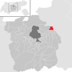
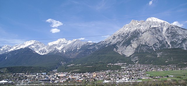
Innsbruck-Land District (Bezirk Innsbruck-Land)

- district of Austria
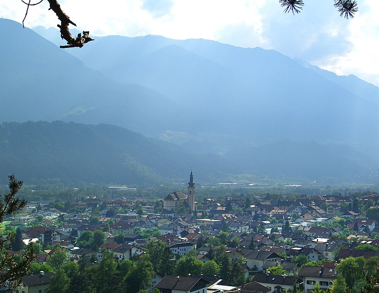
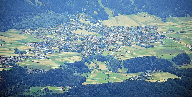
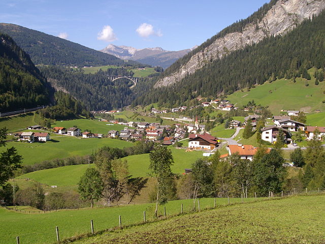
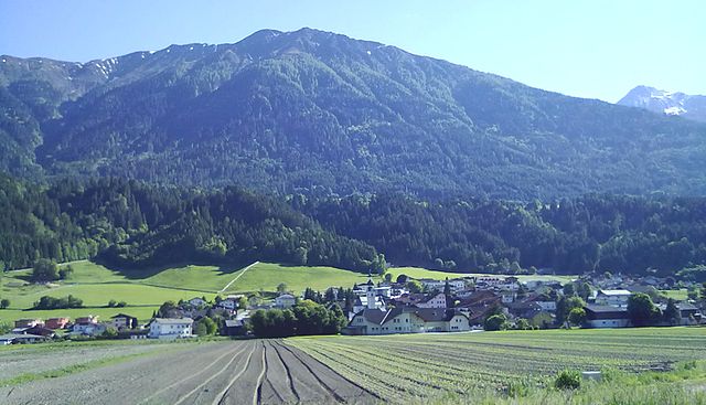
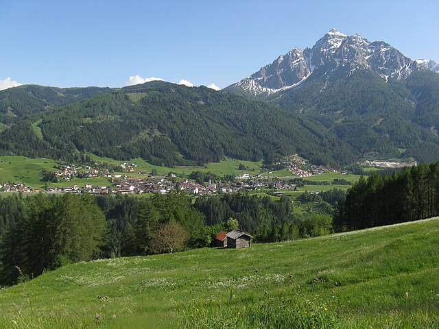
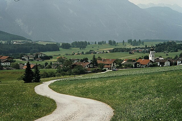
 Hiking in Innsbruck-Land District
Innsbruck-Land District, located in the Tyrol region of Austria, offers a remarkable hiking experience due to its stunning landscapes, diverse terrain, and a variety of trails suitable for all skill levels. Here are some highlights and tips for hiking in this picturesque area:
Scenic Trails
-
Nordkette Range: Just a short distance from Innsbruck, the Nordkette offers breathtaking views of the Inn Valley and is accessible via cable car. There are numerous hiking routes, from easy walks to challenging climbs, such as the ascent to the Hafelekar summit.
-
Patscherkofel Mountain: This famous hike leads to the summit of Patscherkofel, where you can enjoy panoramic views of Innsbruck and its surrounding mountains. The trail is well-marked and relatively moderate.
-
Stubai Valley: Just a short drive from Innsbruck, the Stubai Valley features numerous hiking trails, including walks around picturesque lakes, challenging alpine routes, and majestic glacier views.
-
Zirl to Seefeld: Known for its beautiful landscapes, this trail passes through forests, meadows, and offers views of various alpine plants and wildlife. The hike can be tailored to different levels of fitness.
Hiking Seasons
- Summer (June to September): The best time for hiking, as trails are typically clear of snow and weather is generally mild.
- Autumn (October): Offers beautiful fall colors, but be prepared for cooler temperatures and potential early snowfall in higher elevations.
Trail Preparation
- Difficulty Levels: Trails range from easy walks for families to challenging hikes for experienced mountaineers. Always check the trail markers and signage.
- Gear: Good hiking boots, weather-appropriate clothing, and a daypack with water and snacks are essential. Also consider trekking poles for stability on steep or rough terrain.
Safety Considerations
- Weather: Mountain weather can change quickly; always check the weather forecast before heading out.
- Navigation: Carry a map or use a hiking app to help with navigation, especially in less-marked areas.
- Wildlife: Respect local wildlife and maintain a safe distance from animals you may encounter.
Local Resources
- Tourist Information: Innsbruck-Land offers visitor centers with maps, trail information, and tips for local attractions and services.
- Guided Tours: For those unfamiliar with the area, consider joining a guided hiking tour to learn more about the region's ecology and history.
With its breathtaking scenery, diverse trail options, and rich cultural history, hiking in the Innsbruck-Land District is sure to be a memorable experience for any outdoor enthusiast!
- Country:

- Capital: Innsbruck
- Licence Plate Code: IL
- Coordinates: 47° 12' 0" N, 11° 24' 0" E


- GPS tracks (wikiloc): [Link]
- AboveSeaLevel: 1931 м m
- Area: 1990.09 sq km
- Web site: http://www.tirol.gv.at/bh-innsbruck-land
- Wikipedia en: wiki(en)
- Wikipedia: wiki(de)
- Wikidata storage: Wikidata: Q699582
- Wikipedia Commons Category: [Link]
- Wikipedia Commons Maps Category: [Link]
- Freebase ID: [/m/06sl43]
- GeoNames ID: Alt: [2775219]
- VIAF ID: Alt: [242112864]
- GND ID: Alt: [4096295-7]
- archINFORM location ID: [14616]
Includes regions:

Mils, Tyrol
- municipality in Austria
Hiking in Mils, Tyrol
Mils is a charming village located in the Tyrol region of Austria, surrounded by picturesque Alpine scenery. It's a fantastic starting point for hiking enthusiasts, offering a variety of trails that cater to different skill levels, from easy walks to more challenging hikes....
- Country:
- Postal Code: 6068
- Local Dialing Code: 05223
- Licence Plate Code: IL
- Coordinates: 47° 17' 11" N, 11° 31' 36" E
- GPS tracks (wikiloc): [Link]
- AboveSeaLevel: 605 м m
- Area: 6.93 sq km
- Population: 4377
- Web site: [Link]
Zirl, Tyrol
- municipality in Austria
Hiking in Zirl, Tyrol
Zirl, located in Tyrol, Austria, is a charming village that serves as a great base for hikers looking to explore the stunning landscapes of the region. Here are some highlights and tips for hiking in and around Zirl:...
- Country:
- Postal Code: 6170
- Local Dialing Code: 05238
- Licence Plate Code: IL
- Coordinates: 47° 16' 24" N, 11° 14' 29" E
- GPS tracks (wikiloc): [Link]
- AboveSeaLevel: 622 м m
- Area: 57.24 sq km
- Population: 8162
- Web site: [Link]

Völs
- market town in Tyrol
Hiking in Völs
Völs, located in the Tyrol region of Austria, is a beautiful area for hiking enthusiasts. Nestled in the Innsbruck-Land District, it offers a variety of trails that cater to different skill levels, making it an excellent destination for both beginners and experienced hikers....
- Country:
- Postal Code: 6176
- Local Dialing Code: 0512
- Licence Plate Code: IL
- Coordinates: 47° 15' 0" N, 11° 20' 0" E
- GPS tracks (wikiloc): [Link]
- AboveSeaLevel: 574 м m
- Area: 5.62 sq km
- Population: 6738
- Web site: [Link]


Grinzens
- municipality in Austria
Hiking in Grinzens
Grinzens is a beautiful village located in the Tyrol region of Austria, near Innsbruck, making it an excellent base for hiking enthusiasts. The surrounding area boasts stunning alpine landscapes, picturesque trails, and a variety of hiking options suitable for different skill levels....
- Country:
- Postal Code: 6095
- Local Dialing Code: 05234
- Licence Plate Code: IL
- Coordinates: 47° 13' 37" N, 11° 15' 2" E
- GPS tracks (wikiloc): [Link]
- AboveSeaLevel: 945 м m
- Area: 28.71 sq km
- Population: 1399
- Web site: [Link]

Hall in Tirol
- municipality in Austria
Hiking in Hall in Tirol
Hall in Tirol is a picturesque town located in the Tyrol region of Austria, known for its beautiful natural surroundings and rich cultural heritage. The area is surrounded by the stunning Alps, making it a fantastic destination for hiking enthusiasts. Here are some key points about hiking in Hall in Tirol:...
- Country:
- Postal Code: 6060
- Local Dialing Code: 05223
- Licence Plate Code: IL
- Coordinates: 47° 17' 0" N, 11° 30' 0" E
- GPS tracks (wikiloc): [Link]
- AboveSeaLevel: 574 м m
- Area: 5.54 sq km
- Population: 13897
- Web site: [Link]


Absam
- municipality in Austria
Hiking in Absam
Absam, located in Tyrol, Austria, is a beautiful area surrounded by the stunning scenery of the Alps, making it a fantastic destination for hiking enthusiasts. Here are a few key points about hiking in Absam:...
- Country:
- Postal Code: 6067
- Local Dialing Code: 05223
- Licence Plate Code: IL
- Coordinates: 47° 17' 0" N, 11° 30' 0" E
- GPS tracks (wikiloc): [Link]
- AboveSeaLevel: 632 м m
- Area: 51.92 sq km
- Population: 7112
- Web site: [Link]

Axams
- municipality in Austria
Hiking in Axams
Axams is a beautiful village located in the Innsbruck-Land district of Tyrol, Austria, offering stunning landscapes and various hiking opportunities. It sits at the foot of the Nordkette mountain range and provides excellent access to the surrounding Alpine terrain, making it a great destination for hikers of all levels....
- Country:
- Postal Code: 6094
- Local Dialing Code: 05234
- Licence Plate Code: IL
- Coordinates: 47° 13' 49" N, 11° 16' 45" E
- GPS tracks (wikiloc): [Link]
- AboveSeaLevel: 874 м m
- Area: 22.16 sq km
- Population: 5499
- Web site: [Link]

Matrei am Brenner
- municipality in Austria
Hiking in Matrei am Brenner
Matrei am Brenner is a charming village located in the Tyrol region of Austria, nestled in the scenic Brenner Pass area. Known for its stunning natural landscapes, it offers a variety of hiking opportunities for both beginners and experienced hikers....
- Country:
- Postal Code: 6143
- Local Dialing Code: 05273
- Licence Plate Code: IL
- Coordinates: 47° 7' 51" N, 11° 27' 11" E
- GPS tracks (wikiloc): [Link]
- AboveSeaLevel: 992 м m
- Area: 0.36 sq km
- Population: 959
- Web site: [Link]


Ampass
- municipality in Austria
Hiking in Ampass
Ampass is a charming village located in Tyrol, Austria, near the city of Innsbruck. It’s an excellent starting point for various hiking trails that showcase the stunning alpine landscapes of the region. Here are some highlights and tips for hiking in and around Ampass:...
- Country:
- Postal Code: 6070
- Local Dialing Code: 0512
- Licence Plate Code: IL
- Coordinates: 47° 16' 0" N, 11° 26' 0" E
- GPS tracks (wikiloc): [Link]
- AboveSeaLevel: 651 м m
- Area: 7.9 sq km
- Population: 1827
- Web site: [Link]

Mutters
- municipality in Austria
Hiking in Mutters
Mutters is a picturesque village located in the Tyrol region of Austria, nestled in the Stubai Valley, just a short distance from Innsbruck. It's known for its stunning alpine scenery, making it a fantastic destination for hiking enthusiasts. Here are some highlights and tips for hiking in Mutters:...
- Country:
- Postal Code: 6162
- Local Dialing Code: 0512
- Licence Plate Code: IL
- Coordinates: 47° 14' 0" N, 11° 22' 0" E
- GPS tracks (wikiloc): [Link]
- AboveSeaLevel: 830 м m
- Area: 19.0 sq km
- Population: 2202
- Web site: [Link]

Neustift im Stubaital
- municipality in Austria
Hiking in Neustift im Stubaital
Neustift im Stubaital is a beautiful alpine village located in the Tyrol region of Austria, and it serves as an excellent base for hiking enthusiasts. Nestled in the Stubai Valley, this area is known for its stunning mountain scenery, rich flora and fauna, and a wide range of hiking trails suitable for various skill levels. Here’s an overview of what you can expect when hiking in Neustift im Stubaital:...
- Country:
- Postal Code: 6167
- Local Dialing Code: 05226
- Licence Plate Code: IL
- Coordinates: 47° 6' 37" N, 11° 18' 21" E
- GPS tracks (wikiloc): [Link]
- AboveSeaLevel: 994 м m
- Area: 248.99 sq km
- Population: 4747
- Web site: [Link]
Vals, Tyrol
- municipality in Austria
Hiking in Vals, Tyrol
Vals, located in Tyrol, Austria, is a picturesque destination that offers stunning alpine landscapes, unique geological formations, and a variety of hiking trails suitable for all skill levels. Here’s what you need to know about hiking in this beautiful region:...
- Country:
- Postal Code: 6154
- Local Dialing Code: 05279
- Licence Plate Code: IL
- Coordinates: 47° 3' 45" N, 11° 30' 2" E
- GPS tracks (wikiloc): [Link]
- AboveSeaLevel: 1129 м m
- Area: 48.7 sq km
- Population: 532
- Web site: [Link]
Sistrans
- municipality in Austria
Hiking in Sistrans
Sistrans is a small village located near Innsbruck in Tyrol, Austria. It offers several hiking opportunities that take you through the beautiful Tyrolean landscape, characterized by stunning views of the Alps, lush forests, and charming alpine meadows. Here are some key points about hiking in Sistrans:...
- Country:
- Postal Code: 6073
- Local Dialing Code: 0512
- Licence Plate Code: IL
- Coordinates: 47° 14' 17" N, 11° 26' 48" E
- GPS tracks (wikiloc): [Link]
- AboveSeaLevel: 919 м m
- Area: 7.9 sq km
- Population: 2255
- Web site: [Link]

Oberperfuss
- municipality in Austria
Hiking in Oberperfuss
Oberperfuss is a charming village located in the Tyrol region of Austria, surrounded by stunning alpine landscapes, making it a fantastic destination for hiking enthusiasts. The area offers a variety of hiking trails that cater to different skill levels, from gentle walks suitable for families to more challenging routes for experienced hikers....
- Country:
- Postal Code: 6173
- Local Dialing Code: 05232
- Licence Plate Code: IL
- Coordinates: 47° 15' 0" N, 11° 15' 0" E
- GPS tracks (wikiloc): [Link]
- AboveSeaLevel: 812 м m
- Area: 15.29 sq km
- Population: 3043
- Web site: [Link]

Schönberg im Stubaital
- municipality in Austria
Hiking in Schönberg im Stubaital
Schönberg im Stubaital is a beautiful village located in the Stubai Valley of Tyrol, Austria, known for its stunning alpine scenery and outdoor activities, particularly hiking. Here are some highlights about hiking in this picturesque area:...
- Country:
- Postal Code: 6141
- Local Dialing Code: 05225
- Licence Plate Code: IL
- Coordinates: 47° 11' 11" N, 11° 24' 22" E
- GPS tracks (wikiloc): [Link]
- AboveSeaLevel: 1013 м m
- Area: 7.48 sq km
- Population: 1101
- Web site: [Link]

Gnadenwald
- municipality in Austria
Hiking in Gnadenwald
Gnadenwald is a charming area in Austria located in the Tyrol region, just a short distance from the city of Innsbruck. Known for its beautiful landscapes and serene environment, it offers a range of hiking opportunities suitable for various skill levels....
- Country:
- Postal Code: 6069
- Local Dialing Code: 05223
- Licence Plate Code: IL
- Coordinates: 47° 19' 0" N, 11° 33' 0" E
- GPS tracks (wikiloc): [Link]
- AboveSeaLevel: 879 м m
- Area: 11.49 sq km
- Population: 826
- Web site: [Link]

Telfs
- municipality in Austria
Hiking in Telfs
Telfs is a beautiful town located in the Tyrol region of Austria, surrounded by the stunning landscapes of the Alps. It offers a variety of hiking opportunities suitable for different skill levels, making it a great destination for outdoor enthusiasts....
- Country:
- Local Dialing Code: 05262
- Licence Plate Code: IL
- Coordinates: 47° 18' 25" N, 11° 4' 20" E
- GPS tracks (wikiloc): [Link]
- AboveSeaLevel: 634 м m
- Area: 45.48 sq km
- Population: 15747
- Web site: [Link]

Seefeld in Tirol
- municipality in Austria
Hiking in Seefeld in Tirol
Seefeld in Tirol is a stunning destination for hiking enthusiasts, nestled in the Tyrol region of Austria. Known for its beautiful landscapes, the area offers a variety of trails suitable for all levels of hikers, from beginners to advanced. Here are some highlights and tips for hiking in Seefeld:...
- Country:
- Postal Code: 6100
- Local Dialing Code: 05212
- Licence Plate Code: IL
- Coordinates: 47° 19' 46" N, 11° 11' 21" E
- GPS tracks (wikiloc): [Link]
- AboveSeaLevel: 1180 м m
- Area: 17.4 sq km
- Population: 3440
- Web site: [Link]

Wattens
- municipality in Austria
Hiking in Wattens
Wattens, located in Tyrol, Austria, is a charming village known for its beautiful natural surroundings and proximity to the majestic Alps. If you're considering hiking in this area, there are a few highlights and tips to keep in mind....
- Country:
- Postal Code: 6112
- Local Dialing Code: 05224
- Licence Plate Code: IL
- Coordinates: 47° 17' 29" N, 11° 35' 33" E
- GPS tracks (wikiloc): [Link]
- AboveSeaLevel: 564 м m
- Area: 10.8 sq km
- Population: 7881
- Web site: [Link]
Scharnitz
- municipality in Austria
Hiking in Scharnitz
Scharnitz is a picturesque village located at the border between Germany and Austria, serving as a perfect starting point for various hiking adventures in the Tyrolean Alps. The area is known for its stunning natural beauty, diverse trails, and opportunities for outdoor activities....
- Country:
- Postal Code: 6108
- Local Dialing Code: 05213
- Licence Plate Code: IL
- Coordinates: 47° 23' 18" N, 11° 15' 54" E
- GPS tracks (wikiloc): [Link]
- AboveSeaLevel: 964 м m
- Area: 158.77 sq km
- Population: 1403
- Web site: [Link]

Leutasch
- municipality in the district Innsbruck-Land, Austria
Hiking in Leutasch
Leutasch is a stunning valley located in the Tyrol region of Austria, near the border with Germany. It's well-known for its picturesque landscapes, breath-taking mountain views, and a variety of hiking trails suitable for all experience levels. Here’s what you need to know about hiking in Leutasch:...
- Country:
- Postal Code: 6105
- Local Dialing Code: 05214
- Licence Plate Code: IL
- Coordinates: 47° 22' 0" N, 11° 9' 0" E
- GPS tracks (wikiloc): [Link]
- AboveSeaLevel: 1136 м m
- Area: 103.1 sq km
- Population: 2380
- Web site: [Link]


Baumkirchen
- municipality in Austria
Hiking in Baumkirchen
Baumkirchen, a charming village located in Austria, is surrounded by beautiful landscapes that make it an excellent destination for hiking enthusiasts. While the village itself is small, it offers access to various hiking trails that cater to different skill levels, from easy walks to more challenging hikes....
- Country:
- Postal Code: 6121
- Local Dialing Code: 05224
- Licence Plate Code: IL
- Coordinates: 47° 17' 59" N, 11° 33' 50" E
- GPS tracks (wikiloc): [Link]
- AboveSeaLevel: 593 м m
- Area: 4.0 sq km
- Population: 1284
- Web site: [Link]

Flaurling
- municipality in Austria
Hiking in Flaurling
Flaurling, located in Tyrol, Austria, is an ideal spot for hiking enthusiasts seeking beautiful landscapes and a connection with nature. The area is characterized by its stunning mountainous scenery and charming alpine villages, offering a wide range of hiking trails suitable for various skill levels. Here are some key points to consider when hiking in Flaurling:...
- Country:
- Postal Code: 6403
- Local Dialing Code: 05262
- Licence Plate Code: IL
- Coordinates: 47° 17' 32" N, 11° 7' 23" E
- GPS tracks (wikiloc): [Link]
- AboveSeaLevel: 675 м m
- Area: 19.6 sq km
- Population: 1285
- Web site: [Link]
Inzing
- municipality in Austria
Hiking in Inzing
Inzing is a charming village located in the Tyrol region of Austria, nestled in the scenic Inn Valley. It offers various hiking opportunities that appeal to both beginners and experienced hikers....
- Country:
- Postal Code: 6401
- Local Dialing Code: 05238
- Licence Plate Code: IL
- Coordinates: 47° 16' 20" N, 11° 12' 0" E
- GPS tracks (wikiloc): [Link]
- AboveSeaLevel: 616 м m
- Area: 19.37 sq km
- Population: 3847
- Web site: [Link]

Kolsass
- municipality in Austria
Hiking in Kolsass
Kolsass, located in the Tyrol region of Austria, is a wonderful destination for hiking enthusiasts, offering a variety of trails that cater to different skill levels. The area is known for its stunning alpine landscapes, quaint villages, and captivating views of the surrounding mountains....
- Country:
- Postal Code: 6114
- Local Dialing Code: 05224
- Licence Plate Code: IL
- Coordinates: 47° 18' 1" N, 11° 37' 51" E
- GPS tracks (wikiloc): [Link]
- AboveSeaLevel: 553 м m
- Area: 3.34 sq km
- Population: 1626
- Web site: [Link]

Pfaffenhofen
- municipality in Austria
Hiking in Pfaffenhofen
Pfaffenhofen, located in Tyrol, Austria, is a charming village nestled in the beautiful mountainous region of the Alps. Hiking in this area offers a fantastic experience for outdoor enthusiasts of all levels. Here are some highlights and tips for hiking in Pfaffenhofen:...
- Country:
- Postal Code: 6405
- Local Dialing Code: 05262
- Licence Plate Code: IL
- Coordinates: 47° 17' 0" N, 11° 4' 0" E
- GPS tracks (wikiloc): [Link]
- AboveSeaLevel: 642 м m
- Area: 7 sq km
- Population: 1102
- Web site: [Link]


Götzens
- municipality in Austria
Hiking in Götzens
Götzens is a charming village located in the Tyrol region of Austria, near the city of Innsbruck. Known for its stunning Alpine scenery, it offers a range of hiking opportunities suitable for various skill levels. Here are some key highlights for hiking in the Götzens area:...
- Country:
- Postal Code: 6091
- Local Dialing Code: 05234
- Licence Plate Code: IL
- Coordinates: 47° 14' 10" N, 11° 18' 41" E
- GPS tracks (wikiloc): [Link]
- AboveSeaLevel: 868 м m
- Area: 10 sq km
- Population: 4062
- Web site: [Link]

Rum
- municipality in Austria
Hiking in Rum
Hiking in Rum, a picturesque village located in the Tyrol region of Austria, offers stunning views of the surrounding mountains and a range of trails suitable for all levels of hikers. Nestled at the foot of the Nordkette mountain range and near the city of Innsbruck, Rum provides a perfect mix of access to both natural beauty and local culture....
- Country:
- Postal Code: 6063
- Local Dialing Code: 0512
- Licence Plate Code: IL
- Coordinates: 47° 17' 14" N, 11° 27' 29" E
- GPS tracks (wikiloc): [Link]
- AboveSeaLevel: 621 м m
- Area: 8.6 sq km
- Population: 9190
- Web site: [Link]


Gries am Brenner
- municipality in Austria
Hiking in Gries am Brenner
Gries am Brenner is a picturesque village located in the Austrian Alps, offering a variety of hiking opportunities for outdoor enthusiasts. Nestled at an elevation of about 1,000 meters, it serves as a great starting point for various hiking trails suitable for different skill levels....
- Country:
- Postal Code: 6156
- Local Dialing Code: 05274
- Licence Plate Code: IL
- Coordinates: 47° 2' 0" N, 11° 28' 0" E
- GPS tracks (wikiloc): [Link]
- AboveSeaLevel: 1165 м m
- Area: 55.8 sq km
- Population: 1361
- Web site: [Link]


Fulpmes
- municipality in Austria
Hiking in Fulpmes
Fulpmes is a charming village located in the Stubai Valley of Tyrol, Austria, and is an excellent destination for hiking enthusiasts. Surrounded by stunning Alpine scenery, Fulpmes offers a variety of hiking trails suitable for different levels of experience, making it a great spot for both beginners and seasoned hikers....
- Country:
- Postal Code: 6166
- Local Dialing Code: 05225
- Licence Plate Code: IL
- Coordinates: 47° 9' 12" N, 11° 20' 57" E
- GPS tracks (wikiloc): [Link]
- AboveSeaLevel: 937 м m
- Area: 16.77 sq km
- Population: 4378
- Web site: [Link]


Birgitz
- community in the district of Innsbruck in Tyrol
Hiking in Birgitz
Birgitz is a charming village in the Stubai Valley region of Austria, nestled within the beautiful Tyrolean Alps. It's a great base for hiking enthusiasts, offering a mix of trails suitable for various skill levels, from easy walks to more challenging hikes....
- Country:
- Postal Code: 6092
- Local Dialing Code: 05234
- Licence Plate Code: IL
- Coordinates: 47° 14' 3" N, 11° 18' 3" E
- GPS tracks (wikiloc): [Link]
- AboveSeaLevel: 859 м m
- Area: 4.78 sq km
- Population: 1419
- Web site: [Link]


Aldrans
- municipality in Austria
Hiking in Aldrans
Aldrans is a picturesque village located in the Tyrol region of Austria, just a few kilometers from Innsbruck. Its location near the mountains makes it an excellent base for hiking enthusiasts. Here are some highlights and suggestions for hiking in and around Aldrans:...
- Country:
- Postal Code: 6071
- Local Dialing Code: 0512
- Licence Plate Code: IL
- Coordinates: 47° 15' 0" N, 11° 26' 0" E
- GPS tracks (wikiloc): [Link]
- AboveSeaLevel: 760 м m
- Area: 8.89 sq km
- Population: 2684
- Web site: [Link]


Ellbögen
- municipality in Austria
Hiking in Ellbögen
Ellbögen is a charming village located in the Tyrol region of Austria, near Innsbruck. Surrounded by stunning alpine scenery, it offers a variety of hiking opportunities that cater to all skill levels....
- Country:
- Postal Code: 6083
- Local Dialing Code: 0512
- Licence Plate Code: IL
- Coordinates: 47° 10' 0" N, 11° 26' 0" E
- GPS tracks (wikiloc): [Link]
- AboveSeaLevel: 1070 м m
- Area: 34.5 sq km
- Population: 1109
- Web site: [Link]


Fritzens
- municipality in Austria
Hiking in Fritzens
Fritzens, located in the Tyrol region of Austria, is a wonderful destination for hiking enthusiasts. The area is characterized by stunning mountain landscapes, lush valleys, and picturesque trails suitable for various skill levels. Here are some highlights and tips for hiking in Fritzens:...
- Country:
- Postal Code: 6122
- Local Dialing Code: 05224
- Licence Plate Code: IL
- Coordinates: 47° 18' 19" N, 11° 35' 25" E
- GPS tracks (wikiloc): [Link]
- AboveSeaLevel: 591 м m
- Area: 6.1 sq km
- Population: 2148
- Web site: [Link]
Kolsassberg
- municipality in Austria
Hiking in Kolsassberg
Kolsassberg, located in the Tyrol region of Austria, offers a stunning backdrop for hiking enthusiasts with its picturesque landscapes, lush forests, and panoramic views of the surrounding mountains. Here are some highlights and tips for hiking in Kolsassberg:...
- Country:
- Postal Code: 6115
- Local Dialing Code: 05224
- Licence Plate Code: IL
- Coordinates: 47° 16' 57" N, 11° 39' 6" E
- GPS tracks (wikiloc): [Link]
- AboveSeaLevel: 906 м m
- Area: 35.37 sq km
- Population: 817
- Web site: [Link]


Volders
- municipality in Austria
Hiking in Volders
Volders, located in Tyrol, Austria, is a beautiful area that offers a variety of hiking opportunities. This region is characterized by its stunning mountain landscapes, alpine meadows, and picturesque views of the surrounding mountains, including the nearby Inn Valley....
- Country:
- Postal Code: 6111
- Local Dialing Code: 05224
- Licence Plate Code: IL
- Coordinates: 47° 17' 15" N, 11° 33' 55" E
- GPS tracks (wikiloc): [Link]
- AboveSeaLevel: 558 м m
- Area: 32.4 sq km
- Population: 4464
- Web site: [Link]

Oberhofen im Inntal
- municipality in Austria
Hiking in Oberhofen im Inntal
Oberhofen im Inntal, located in the Tyrol region of Austria, offers stunning landscapes and a variety of hiking trails suitable for different skill levels. Here are some highlights of hiking in this picturesque area:...
- Country:
- Postal Code: 6406
- Local Dialing Code: 05262
- Licence Plate Code: IL
- Coordinates: 47° 18' 11" N, 11° 5' 45" E
- GPS tracks (wikiloc): [Link]
- AboveSeaLevel: 622 м m
- Area: 18.6 sq km
- Population: 1857
- Web site: [Link]

Pettnau
- municipality in Austria
Hiking in Pettnau
Pettnau, located in the Tyrol region of Austria, offers a variety of beautiful hiking opportunities amidst stunning alpine scenery. Here are some key points to consider when hiking in and around Pettnau:...
- Country:
- Postal Code: 6408
- Local Dialing Code: 05238
- Licence Plate Code: IL
- Coordinates: 47° 17' 31" N, 11° 9' 36" E
- GPS tracks (wikiloc): [Link]
- AboveSeaLevel: 628 м m
- Area: 10.78 sq km
- Population: 1047
- Web site: [Link]


Ranggen
- municipality in Austria
Hiking in Ranggen
Ranggen, located near Innsbruck in Tyrol, Austria, offers a variety of hiking opportunities amidst stunning alpine scenery. The region is known for its picturesque landscapes, making it a great destination for both casual hikers and seasoned adventurers. Here are some key points about hiking in Ranggen:...
- Country:
- Postal Code: 6179
- Local Dialing Code: 05232
- Licence Plate Code: IL
- Coordinates: 47° 15' 27" N, 11° 12' 40" E
- GPS tracks (wikiloc): [Link]
- AboveSeaLevel: 826 м m
- Area: 6.97 sq km
- Population: 1072
- Web site: [Link]
Patsch
- municipality in Austria
Hiking in Patsch
Patsch, a charming village located near Innsbruck in Austria, offers a variety of hiking opportunities for outdoor enthusiasts. Nestled in the scenic Tyrolean Alps, this area is known for its stunning landscapes, making it a great destination for both casual walkers and experienced hikers....
- Country:
- Postal Code: 6082
- Local Dialing Code: 0512
- Licence Plate Code: IL
- Coordinates: 47° 12' 15" N, 11° 24' 55" E
- GPS tracks (wikiloc): [Link]
- AboveSeaLevel: 998 м m
- Area: 9.73 sq km
- Population: 1014
- Web site: [Link]

Pfons
- municipality in Austria
Hiking in Pfons
Pfons is a charming village in the Tyrol region of Austria, known for its stunning Alpine scenery and a variety of hiking trails suitable for all skill levels. Here’s what you need to know about hiking in Pfons:...
- Country:
- Postal Code: 6143
- Local Dialing Code: 05273
- Licence Plate Code: IL
- Coordinates: 47° 8' 33" N, 11° 27' 38" E
- GPS tracks (wikiloc): [Link]
- AboveSeaLevel: 1043 м m
- Area: 21.7 sq km
- Population: 1205
- Web site: [Link]

Polling in Tirol
- municipality in Austria
Hiking in Polling in Tirol
Polling in Tirol is a picturesque village situated in the Tyrolean region of Austria, known for its stunning landscapes, traditional Tyrolean architecture, and, of course, its hiking opportunities. The surrounding mountains offer a range of trails suitable for different skill levels, from leisurely walks to challenging hikes....
- Country:
- Postal Code: 6404
- Local Dialing Code: 05238
- Licence Plate Code: IL
- Coordinates: 47° 16' 53" N, 11° 9' 2" E
- GPS tracks (wikiloc): [Link]
- AboveSeaLevel: 615 м m
- Area: 4.97 sq km
- Population: 1073
- Web site: [Link]

Mühlbachl
- municipality in Austria
Hiking in Mühlbachl
Mühlbachl, a picturesque municipality in the Stubai Valley of Austria, offers a variety of hiking opportunities for all skill levels. Nestled in the Tyrolean Alps, this area is known for its stunning landscapes, with lush meadows, dense forests, and impressive mountain views....
- Country:
- Postal Code: 6143
- Local Dialing Code: 05273
- Licence Plate Code: IL
- Coordinates: 47° 8' 10" N, 11° 27' 7" E
- GPS tracks (wikiloc): [Link]
- AboveSeaLevel: 995 м m
- Area: 28.8 sq km
- Population: 1393
- Web site: [Link]

Kematen in Tirol
- municipality in Austria
Hiking in Kematen in Tirol
Kematen in Tirol, located near Innsbruck, offers beautiful hiking opportunities amidst the stunning Tyrolean Alps. The area is known for its picturesque landscapes, rich nature, and trails suitable for various fitness levels....
- Country:
- Postal Code: 6175
- Local Dialing Code: 05232
- Licence Plate Code: IL
- Coordinates: 47° 15' 15" N, 11° 16' 20" E
- GPS tracks (wikiloc): [Link]
- AboveSeaLevel: 610 м m
- Area: 6.99 sq km
- Population: 2931
- Web site: [Link]


Gries im Sellrain
- municipality in Austria
Hiking in Gries im Sellrain
Gries im Sellrain is a charming village located in the Tyrol region of Austria, nestled within the stunning Sellrain Valley. This area offers a variety of hiking opportunities, making it a fantastic destination for both novice and experienced hikers....
- Country:
- Postal Code: 6182
- Local Dialing Code: 05236
- Licence Plate Code: IL
- Coordinates: 47° 11' 44" N, 11° 9' 23" E
- GPS tracks (wikiloc): [Link]
- AboveSeaLevel: 1187 м m
- Area: 22.62 sq km
- Population: 610
- Web site: [Link]


Gschnitz
- municipality in Austria
Hiking in Gschnitz
Gschnitz is a picturesque village located in the Tyrol region of Austria, nestled in the beautiful Stubai Valley. The area is known for its stunning natural scenery, making it a popular destination for hiking enthusiasts. Here are some highlights and tips for hiking in Gschnitz:...
- Country:
- Postal Code: 6150
- Local Dialing Code: 05276
- Licence Plate Code: IL
- Coordinates: 47° 2' 39" N, 11° 20' 58" E
- GPS tracks (wikiloc): [Link]
- AboveSeaLevel: 1242 м m
- Area: 59.1 sq km
- Population: 434
- Web site: [Link]

Obernberg am Brenner
- municipality in Austria
Hiking in Obernberg am Brenner
Obernberg am Brenner is a scenic destination located in the Tyrol region of Austria, close to the Italian border. It offers a variety of hiking opportunities suitable for different skill levels, making it an excellent choice for both beginners and experienced hikers....
- Country:
- Postal Code: 6157
- Local Dialing Code: 05274
- Licence Plate Code: IL
- Coordinates: 47° 0' 59" N, 11° 25' 10" E
- GPS tracks (wikiloc): [Link]
- AboveSeaLevel: 1380 м m
- Area: 38.66 sq km
- Population: 363
- Web site: [Link]

Natters
- municipality in Austria
Hiking in Natters
Natters is a charming village located in Tyrol, Austria, nestled in the foothills of the Alps, making it an excellent destination for hiking enthusiasts. Here are some highlights of hiking in and around Natters:...
- Country:
- Postal Code: 6161
- Local Dialing Code: 0512
- Licence Plate Code: IL
- Coordinates: 47° 14' 2" N, 11° 22' 24" E
- GPS tracks (wikiloc): [Link]
- AboveSeaLevel: 783 м m
- Area: 7.33 sq km
- Population: 2020
- Web site: [Link]

Rinn
- municipality in Austria
Hiking in Rinn
Rinn, located in Austria, offers a serene and picturesque backdrop for hiking enthusiasts. The region is characterized by its stunning natural landscapes, including rolling hills, lush forests, and panoramic views of the Alps. Here are some key points to consider if you're planning a hiking trip in Rinn:...
- Country:
- Postal Code: 6074
- Local Dialing Code: 05223
- Licence Plate Code: IL
- Coordinates: 47° 14' 58" N, 11° 30' 13" E
- GPS tracks (wikiloc): [Link]
- AboveSeaLevel: 918 м m
- Area: 10.65 sq km
- Population: 1877
- Web site: [Link]


Hatting
- village and municipality in Tyrol, Austria
Hiking in Hatting
Hatting, located in Tyrol, Austria, is a charming village surrounded by stunning alpine landscapes, making it a great destination for hiking enthusiasts. The region offers a variety of trails suitable for different skill levels, from easy walks to challenging mountain hikes....
- Country:
- Postal Code: 6402
- Local Dialing Code: 05238
- Licence Plate Code: IL
- Coordinates: 47° 16' 40" N, 11° 10' 6" E
- GPS tracks (wikiloc): [Link]
- AboveSeaLevel: 616 м m
- Area: 7.07 sq km
- Population: 1444
- Web site: [Link]

Telfes
- municipality in Austria
Hiking in Telfes
Telfes in Tyrol, Austria, is a charming village located in the Stubai Valley, surrounded by stunning alpine scenery. It's a great base for hiking enthusiasts, offering a variety of trails suitable for different skill levels. Here are some key points to consider for hiking in Telfes:...
- Country:
- Postal Code: 6165
- Local Dialing Code: 05225
- Licence Plate Code: IL
- Coordinates: 47° 9' 53" N, 11° 21' 31" E
- GPS tracks (wikiloc): [Link]
- AboveSeaLevel: 987 м m
- Area: 27.38 sq km
- Population: 1570
- Web site: [Link]


Reith bei Seefeld
- municipality in Austria
Hiking in Reith bei Seefeld
Reith bei Seefeld is a picturesque village located in the Tyrolean region of Austria, nestled in the Alps. It’s a fantastic destination for hiking enthusiasts, offering a range of trails that cater to all skill levels. Here are some highlights for hiking in this area:...
- Country:
- Postal Code: 6103
- Local Dialing Code: 05212
- Licence Plate Code: IL
- Coordinates: 47° 17' 56" N, 11° 12' 14" E
- GPS tracks (wikiloc): [Link]
- AboveSeaLevel: 1130 м m
- Area: 21 sq km
- Population: 1370
- Web site: [Link]

Sankt Sigmund im Sellrain
- municipality in Austria
Hiking in Sankt Sigmund im Sellrain
Sankt Sigmund im Sellrain is a picturesque village located in the Sellrain Valley in the Tyrol region of Austria. It's a great base for hiking enthusiasts due to its stunning alpine scenery and well-maintained trails....
- Country:
- Postal Code: 6184
- Local Dialing Code: 5236
- Licence Plate Code: IL
- Coordinates: 47° 12' 0" N, 11° 6' 0" E
- GPS tracks (wikiloc): [Link]
- AboveSeaLevel: 1513 м m
- Area: 102.3 sq km
- Population: 175
- Web site: [Link]

Lans
- village in Tyrol, Austria
Hiking in Lans
Lans, a picturesque village located in Tyrol, Austria, is known for its stunning alpine landscapes and its proximity to the city of Innsbruck. Hiking in and around Lans offers a diverse range of trails suitable for various skill levels, making it an excellent destination for outdoor enthusiasts. Here’s a brief overview of what you can expect:...
- Country:
- Postal Code: 6072
- Local Dialing Code: 0512
- Licence Plate Code: IL
- Coordinates: 47° 14' 18" N, 11° 25' 53" E
- GPS tracks (wikiloc): [Link]
- AboveSeaLevel: 867 м m
- Area: 6.03 sq km
- Population: 1096
- Web site: [Link]
Mieders
- municipality in Austria
Hiking in Mieders
Mieders is a picturesque village located in the Stubai Valley of Tyrol, Austria, and is a great destination for hiking enthusiasts. The area is characterized by its stunning mountain scenery, lush forests, and varied trails suitable for all skill levels. Here are some key points about hiking in Mieders:...
- Country:
- Postal Code: 6142
- Local Dialing Code: 05225
- Licence Plate Code: IL
- Coordinates: 47° 10' 12" N, 11° 22' 53" E
- GPS tracks (wikiloc): [Link]
- AboveSeaLevel: 952 м m
- Area: 16.5 sq km
- Population: 1861
- Web site: [Link]
Wattenberg
- municipality in Austria
Hiking in Wattenberg
Wattenberg, located in Tyrol, Austria, is a wonderful destination for hiking enthusiasts. Nestled amidst the stunning scenery of the Austrian Alps, this charming village offers a variety of trails suitable for different skill levels, from leisurely walks to challenging hikes....
- Country:
- Postal Code: 6113
- Local Dialing Code: 05224
- Licence Plate Code: IL
- Coordinates: 47° 16' 24" N, 11° 36' 21" E
- GPS tracks (wikiloc): [Link]
- AboveSeaLevel: 1050 м m
- Area: 67.71 sq km
- Population: 739
- Web site: [Link]

Unterperfuss
- municipality in Austria
Hiking in Unterperfuss
Unterperfuss is a charming village located in the Innsbruck-Land district of Tyrol, Austria. It's surrounded by stunning alpine scenery, making it an excellent starting point for a variety of hiking trails....
- Country:
- Postal Code: 6178
- Local Dialing Code: 05232
- Licence Plate Code: IL
- Coordinates: 47° 15' 35" N, 11° 15' 32" E
- GPS tracks (wikiloc): [Link]
- AboveSeaLevel: 596 м m
- Area: 2.28 sq km
- Population: 224
Wildermieming
- municipality in Austria
Hiking in Wildermieming
Wildermieming is a picturesque village situated in the Tyrolean region of Austria, known for its stunning natural landscapes, charming alpine atmosphere, and a range of hiking opportunities. Here are some key points about hiking in Wildermieming:...
- Country:
- Postal Code: 6413
- Local Dialing Code: 05264
- Licence Plate Code: IL
- Coordinates: 47° 19' 6" N, 11° 0' 23" E
- GPS tracks (wikiloc): [Link]
- AboveSeaLevel: 872 м m
- Area: 31.24 sq km
- Population: 935
- Web site: [Link]

Sellrain
- municipality in Austria
Hiking in Sellrain
Sellrain is a picturesque valley located in the Tyrol region of Austria, known for its stunning natural beauty and outdoor recreational opportunities. Here are some key points about hiking in Sellrain:...
- Country:
- Postal Code: 6181
- Local Dialing Code: 05230
- Licence Plate Code: IL
- Coordinates: 47° 12' 48" N, 11° 12' 50" E
- GPS tracks (wikiloc): [Link]
- AboveSeaLevel: 908 м m
- Area: 62 sq km
- Population: 1333
- Web site: [Link]


Trins
- municipality in Austria
Hiking in Trins
Trins, a charming village in the Tyrol region of Austria, is a hidden gem for hiking enthusiasts. Situated in the beautiful Wipptal Valley, it offers stunning alpine scenery, varied trails, and a tranquil atmosphere....
- Country:
- Postal Code: 6152
- Local Dialing Code: 05275
- Licence Plate Code: IL
- Coordinates: 47° 4' 11" N, 11° 23' 52" E
- GPS tracks (wikiloc): [Link]
- AboveSeaLevel: 1201 м m
- Area: 48.8 sq km
- Population: 1277
- Web site: [Link]

Thaur
- municipality in Austria
Hiking in Thaur
Thaur, a small municipality located near Innsbruck in Tyrol, Austria, offers a variety of hiking opportunities set against the stunning backdrop of the Alps. The area is characterized by its beautiful landscapes, cultural heritage, and proximity to both gentle hills and more challenging alpine terrain, making it suitable for hikers of all skill levels....
- Country:
- Postal Code: 6065
- Local Dialing Code: 05223
- Licence Plate Code: IL
- Coordinates: 47° 17' 42" N, 11° 28' 19" E
- GPS tracks (wikiloc): [Link]
- AboveSeaLevel: 633 м m
- Area: 21.1 sq km
- Population: 3979
- Web site: [Link]

Tulfes
- municipality in Austria
Hiking in Tulfes
Tulfes is a charming village in Tyrol, Austria, located near Innsbruck, and it is surrounded by stunning alpine scenery, making it a fantastic destination for hiking enthusiasts. The area is known for its diverse trails that cater to hikers of all skill levels, from beginners to more experienced walkers....
- Country:
- Postal Code: 6075
- Local Dialing Code: 05223
- Licence Plate Code: IL
- Coordinates: 47° 15' 25" N, 11° 31' 49" E
- GPS tracks (wikiloc): [Link]
- AboveSeaLevel: 923 м m
- Area: 27.7 sq km
- Population: 1550
- Web site: [Link]


Steinach am Brenner
- municipality in Austria
Hiking in Steinach am Brenner
Steinach am Brenner is a charming village located in Tyrol, Austria, nestled in the scenic Brenner Pass region. It's a great location for hiking enthusiasts, offering a range of trails suited for various skill levels, from leisurely walks to challenging hikes....
- Country:
- Postal Code: 6150
- Local Dialing Code: 05272
- Licence Plate Code: IL
- Coordinates: 47° 5' 0" N, 11° 28' 0" E
- GPS tracks (wikiloc): [Link]
- AboveSeaLevel: 1048 м m
- Area: 28 sq km
- Population: 3622
- Web site: [Link]

Schmirn
- municipality in Austria
Hiking in Schmirn
Schmirn is a beautiful valley located in the Tyrol region of Austria, known for its picturesque landscapes and a range of hiking opportunities. Nestled in the Zillertal Alps, Schmirn offers both beginners and experienced hikers a variety of trails that showcase the stunning alpine scenery....
- Country:
- Postal Code: 6154
- Local Dialing Code: 05279
- Licence Plate Code: IL
- Coordinates: 47° 4' 46" N, 11° 33' 53" E
- GPS tracks (wikiloc): [Link]
- AboveSeaLevel: 1407 м m
- Area: 62.7 sq km
- Population: 872
- Web site: [Link]

Navis
- municipality in Austria
Hiking in Navis
Navis, a picturesque area in Austria, is known for its stunning landscapes and diverse hiking trails that cater to various skill levels. Nestled in the Tyrol region, it offers both natural beauty and cultural insights. Here are some highlights and tips for hiking in Navis:...
- Country:
- Postal Code: 6143
- Local Dialing Code: 05278
- Licence Plate Code: IL
- Coordinates: 47° 7' 52" N, 11° 32' 25" E
- GPS tracks (wikiloc): [Link]
- AboveSeaLevel: 1337 м m
- Area: 64.1 sq km
- Population: 2004
- Web site: [Link]
Shares border with regions:


Garmisch-Partenkirchen
- district of Bavaria, Germany
Hiking in Garmisch-Partenkirchen
Garmisch-Partenkirchen is a beautiful district located in Bavaria, Germany, and is renowned for its stunning alpine scenery and outdoor recreational activities, making it a popular destination for hikers. Here are some key points about hiking in this picturesque area:...
- Country:

- Capital: Garmisch-Partenkirchen
- Licence Plate Code: GAP
- Coordinates: 47° 34' 48" N, 11° 10' 12" E
- GPS tracks (wikiloc): [Link]
- AboveSeaLevel: 1296 м m
- Area: 1012.00 sq km
- Population: 78782
- Web site: [Link]