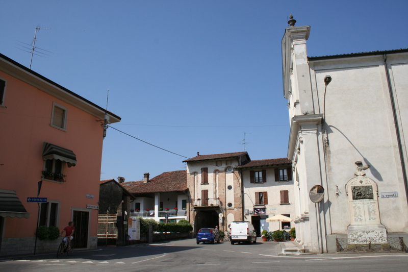
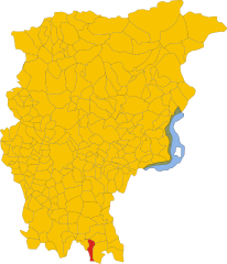
Isso, Lombardy (Isso)
.svg)
- Italian comune
 Hiking in Isso, Lombardy
Hiking in Isso, a charming village in Lombardy, Italy, offers an excellent opportunity to enjoy the beautiful landscapes and rich cultural heritage of the region. Nestled near the city of Cremona, Isso serves as a gateway to explore the natural beauty of the surrounding countryside, which features rolling hills, vineyards, and picturesque rural scenery.
Key Highlights for Hiking in Isso:
-
Scenic Trails: The area around Isso has various trails suitable for all levels of hikers. You can find paths that meander through agricultural fields, forests, and along the Po River.
-
Cultural Routes: Beyond the natural beauty, you can also explore trails that lead to historical sites and nearby towns, where you can enjoy local architecture and regional cuisine.
-
Wildlife and Nature: The region is home to diverse flora and fauna. Keep an eye out for local bird species and other wildlife, especially in the natural reserves and parks nearby.
-
Accessibility: Isso is well-connected to other towns and cities in Lombardy, making it a convenient starting point for various hiking adventures.
-
Local Tips:
- Consider visiting in the spring or early fall to enjoy mild weather and blooming landscapes.
- Bring plenty of water and snacks, and wear appropriate footwear.
-
Community Engagement: Engaging with local hiking clubs can provide guided experiences, allowing you to learn more about the area’s ecology and history.
-
Additional Attractions: After a day of hiking, you can explore local cuisine in Isso or visit nearby attractions, such as the historical city of Cremona, popular for its violin-making tradition.
Remember to check local trail conditions, and always follow Leave No Trace principles to help preserve the natural beauty of the region. Happy hiking!
- Country:

- Postal Code: 24040
- Local Dialing Code: 0363
- Licence Plate Code: BG
- Coordinates: 45° 28' 36" N, 9° 45' 34" E


- GPS tracks (wikiloc): [Link]
- AboveSeaLevel: 104 м m
- Area: 5.06 sq km
- Population: 638
- Web site: http://www.comune.isso.bg.it
- Wikipedia en: wiki(en)
- Wikipedia: wiki(it)
- Wikidata storage: Wikidata: Q101182
- Freebase ID: [/m/0gjbsk]
- GeoNames ID: Alt: [6543157]
- VIAF ID: Alt: [189138451]
- OSM relation ID: [45094]
- ISNI: Alt: [0000 0000 9120 6856]
- ISTAT ID: 016122
- Italian cadastre code: E370
Shares border with regions:


Covo
- Italian comune
Hiking in Covo
Covo is a charming destination for hiking, located in Italy’s beautiful region of Abruzzo. While it might not be as widely known as other hiking hotspots, it offers a unique blend of natural beauty and cultural experiences....
- Country:
- Postal Code: 24050
- Local Dialing Code: 0363
- Licence Plate Code: BG
- Coordinates: 45° 30' 0" N, 9° 46' 0" E
- GPS tracks (wikiloc): [Link]
- AboveSeaLevel: 115 м m
- Area: 12.94 sq km
- Population: 4088
- Web site: [Link]


Fara Olivana con Sola
- Italian comune
Hiking in Fara Olivana con Sola
Fara Olivana con Sola is a picturesque village located in the province of Bergamo, Italy, surrounded by the beautiful landscape of the Lombardy region. While it may not be as renowned as some other hiking destinations, it offers some lovely trails and opportunities to explore the natural beauty of the area....
- Country:
- Postal Code: 24058
- Local Dialing Code: 0363
- Licence Plate Code: BG
- Coordinates: 45° 29' 42" N, 9° 44' 57" E
- GPS tracks (wikiloc): [Link]
- AboveSeaLevel: 107 м m
- Area: 5.04 sq km
- Population: 1292
- Web site: [Link]
Castel Gabbiano
- Italian comune
Hiking in Castel Gabbiano
Castel Gabbiano is a picturesque village located in the province of Cremona in Lombardy, Italy. While it may not be as well-known for hiking as some other regions in Italy, there are still opportunities to explore the natural beauty and rural landscapes surrounding this charming area....
- Country:
- Postal Code: 26010
- Local Dialing Code: 0373
- Licence Plate Code: CR
- Coordinates: 45° 28' 0" N, 9° 42' 0" E
- GPS tracks (wikiloc): [Link]
- AboveSeaLevel: 100 м m
- Area: 5.79 sq km
- Population: 475
- Web site: [Link]
Camisano
- Italian comune
Hiking in Camisano
Camisano is a quaint village located in the province of Mantua in Lombardy, Italy. While it's not as widely known as some other hiking destinations in the region, it does offer beautiful landscapes and opportunities for outdoor activities, particularly for those looking to enjoy a peaceful, rural setting....
- Country:
- Postal Code: 26010
- Local Dialing Code: 0373
- Licence Plate Code: CR
- Coordinates: 45° 27' 0" N, 9° 45' 0" E
- GPS tracks (wikiloc): [Link]
- AboveSeaLevel: 92 м m
- Area: 10.95 sq km
- Population: 1268
- Web site: [Link]
Barbata
- Italian comune
Hiking in Barbata
Hiking in Barbata, a beautiful region, can be an exciting experience for outdoor enthusiasts. While Barbata isn't a specific location commonly recognized in hiking guidebooks, it could refer to a local area that may be known for its trails, landscapes, or nature....
- Country:
- Postal Code: 24040
- Local Dialing Code: 0363
- Licence Plate Code: BG
- Coordinates: 45° 29' 0" N, 9° 47' 0" E
- GPS tracks (wikiloc): [Link]
- AboveSeaLevel: 105 м m
- Area: 7.98 sq km
- Population: 712
- Web site: [Link]