Ivoy-le-Pré (Ivoy-le-Pré)

- commune in Cher, France
- Country:

- Postal Code: 18380
- Coordinates: 47° 20' 42" N, 2° 29' 13" E


- GPS tracks (wikiloc): [Link]
- Area: 98.74 sq km
- Population: 811
- Wikipedia en: wiki(en)
- Wikipedia: wiki(fr)
- Wikidata storage: Wikidata: Q1429635
- Wikipedia Commons Category: [Link]
- Freebase ID: [/m/03mfczz]
- GeoNames ID: Alt: [6428194]
- SIREN number: [211801154]
- INSEE municipality code: 18115
Shares border with regions:


La Chapelle-d'Angillon
- commune in Cher, France
- Country:
- Postal Code: 18380
- Coordinates: 47° 21' 48" N, 2° 25' 59" E
- GPS tracks (wikiloc): [Link]
- Area: 10.17 sq km
- Population: 645


Achères
- commune in Cher, France
- Country:
- Postal Code: 18250
- Coordinates: 47° 16' 42" N, 2° 26' 55" E
- GPS tracks (wikiloc): [Link]
- Area: 12.75 sq km
- Population: 378

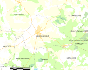
Henrichemont
- commune in Cher, France
- Country:
- Postal Code: 18250
- Coordinates: 47° 18' 11" N, 2° 31' 28" E
- GPS tracks (wikiloc): [Link]
- Area: 25.27 sq km
- Population: 1795
La Chapelotte
- commune in Cher, France
- Country:
- Postal Code: 18250
- Coordinates: 47° 21' 9" N, 2° 35' 26" E
- GPS tracks (wikiloc): [Link]
- Area: 28.5 sq km
- Population: 159


Oizon
- commune in Cher, France
- Country:
- Postal Code: 18700
- Coordinates: 47° 28' 27" N, 2° 30' 55" E
- GPS tracks (wikiloc): [Link]
- Area: 62.03 sq km
- Population: 687


Méry-ès-Bois
- commune in Cher, France
- Country:
- Postal Code: 18380
- Coordinates: 47° 18' 51" N, 2° 21' 47" E
- GPS tracks (wikiloc): [Link]
- Area: 91.59 sq km
- Population: 579
- Web site: [Link]
Villegenon
- commune in Cher, France
- Country:
- Postal Code: 18260
- Coordinates: 47° 25' 32" N, 2° 36' 21" E
- GPS tracks (wikiloc): [Link]
- Area: 32.93 sq km
- Population: 220


Ennordres
- commune in Cher, France
- Country:
- Postal Code: 18380
- Coordinates: 47° 25' 48" N, 2° 23' 0" E
- GPS tracks (wikiloc): [Link]
- Area: 63.79 sq km
- Population: 208


Jars
- commune in Cher, France
- Country:
- Postal Code: 18260
- Coordinates: 47° 23' 45" N, 2° 40' 58" E
- GPS tracks (wikiloc): [Link]
- Area: 37.34 sq km
- Population: 516