Jars (Jars)

- commune in Cher, France
- Country:

- Postal Code: 18260
- Coordinates: 47° 23' 45" N, 2° 40' 58" E


- GPS tracks (wikiloc): [Link]
- Area: 37.34 sq km
- Population: 516
- Wikipedia en: wiki(en)
- Wikipedia: wiki(fr)
- Wikidata storage: Wikidata: Q1442971
- Wikipedia Commons Category: [Link]
- Freebase ID: [/m/03mfc_n]
- GeoNames ID: Alt: [6428196]
- SIREN number: [211801170]
- BnF ID: [152494636]
- INSEE municipality code: 18117
Shares border with regions:
La Chapelotte
- commune in Cher, France
- Country:
- Postal Code: 18250
- Coordinates: 47° 21' 9" N, 2° 35' 26" E
- GPS tracks (wikiloc): [Link]
- Area: 28.5 sq km
- Population: 159
Thou
- commune in Cher, France
- Country:
- Postal Code: 18260
- Coordinates: 47° 25' 31" N, 2° 39' 39" E
- GPS tracks (wikiloc): [Link]
- AboveSeaLevel: 245 м m
- Area: 9.19 sq km
- Population: 77


Subligny
- commune in Cher, France
- Country:
- Postal Code: 18260
- Coordinates: 47° 24' 13" N, 2° 45' 17" E
- GPS tracks (wikiloc): [Link]
- Area: 17.26 sq km
- Population: 344
Menetou-Râtel
- commune in Cher, France
- Country:
- Postal Code: 18300
- Coordinates: 47° 21' 4" N, 2° 45' 21" E
- GPS tracks (wikiloc): [Link]
- Area: 28.01 sq km
- Population: 492
Villegenon
- commune in Cher, France
- Country:
- Postal Code: 18260
- Coordinates: 47° 25' 32" N, 2° 36' 21" E
- GPS tracks (wikiloc): [Link]
- Area: 32.93 sq km
- Population: 220
Ivoy-le-Pré
- commune in Cher, France
- Country:
- Postal Code: 18380
- Coordinates: 47° 20' 42" N, 2° 29' 13" E
- GPS tracks (wikiloc): [Link]
- Area: 98.74 sq km
- Population: 811

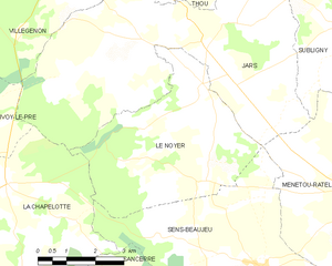
Le Noyer
- commune in Cher, France
- Country:
- Postal Code: 18260
- Coordinates: 47° 23' 3" N, 2° 40' 51" E
- GPS tracks (wikiloc): [Link]
- AboveSeaLevel: 260 м m
- Area: 19.98 sq km
- Population: 220


Assigny
- commune in Cher, France
- Country:
- Postal Code: 18260
- Coordinates: 47° 25' 40" N, 2° 45' 18" E
- GPS tracks (wikiloc): [Link]
- Area: 17.05 sq km
- Population: 161


Sury-ès-Bois
- commune in Cher, France
- Country:
- Postal Code: 18260
- Coordinates: 47° 27' 53" N, 2° 42' 16" E
- GPS tracks (wikiloc): [Link]
- Area: 31.9 sq km
- Population: 259