Janneyrias (Janneyrias)

- commune in Isère, France
- Country:

- Postal Code: 38280
- Coordinates: 45° 45' 8" N, 5° 6' 43" E


- GPS tracks (wikiloc): [Link]
- Area: 10.52 sq km
- Population: 1734
- Web site: http://www.janneyrias.fr
- Wikipedia en: wiki(en)
- Wikipedia: wiki(fr)
- Wikidata storage: Wikidata: Q1155287
- Wikipedia Commons Category: [Link]
- Freebase ID: [/m/03nvjdq]
- GeoNames ID: Alt: [3012508]
- SIREN number: [213801970]
- BnF ID: [15258014v]
- INSEE municipality code: 38197
Shares border with regions:

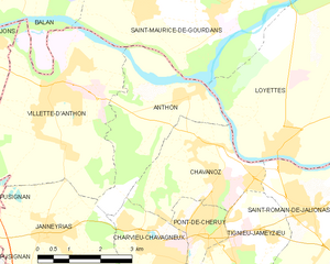
Anthon
- commune in Isère, France
- Country:
- Postal Code: 38280
- Coordinates: 45° 47' 27" N, 5° 10' 11" E
- GPS tracks (wikiloc): [Link]
- Area: 8.82 sq km
- Population: 1037
- Web site: [Link]


Pusignan
- commune in Rhône, France
- Country:
- Postal Code: 69330
- Coordinates: 45° 45' 20" N, 5° 4' 2" E
- GPS tracks (wikiloc): [Link]
- Area: 13.04 sq km
- Population: 4011


Charvieu-Chavagneux
- commune in Isère, France
 Hiking in Charvieu-Chavagneux
Charvieu-Chavagneux is a charming commune located in the Auvergne-Rhône-Alpes region of France, near the city of Lyon. It offers a variety of outdoor activities, including hiking. Here are some points to consider if you’re planning to hike in this area:...
- Country:
- Postal Code: 38230
- Coordinates: 45° 45' 0" N, 5° 9' 0" E
- GPS tracks (wikiloc): [Link]
- AboveSeaLevel: 220 м m
- Area: 8.65 sq km
- Population: 8879
- Web site: [Link]

Villette-d'Anthon
- commune in Isère, France
- Country:
- Postal Code: 38280
- Coordinates: 45° 47' 43" N, 5° 6' 57" E
- GPS tracks (wikiloc): [Link]
- Area: 22.8 sq km
- Population: 4826
- Web site: [Link]


Colombier-Saugnieu
- commune in Rhône, France
Hiking in Colombier-Saugnieu
Colombier-Saugnieu, located in the Auvergne-Rhône-Alps region of France, offers a variety of hiking opportunities that showcase the natural beauty of the surrounding landscape. Here are some key points about hiking in this area:...
- Country:
- Postal Code: 69124
- Coordinates: 45° 42' 41" N, 5° 6' 44" E
- GPS tracks (wikiloc): [Link]
- Area: 27.62 sq km
- Population: 2554