Anthon (Anthon)
- commune in Isère, France
- Country:

- Postal Code: 38280
- Coordinates: 45° 47' 27" N, 5° 10' 11" E


- GPS tracks (wikiloc): [Link]
- Area: 8.82 sq km
- Population: 1037
- Web site: http://www.mairie-anthon.fr
- Wikipedia en: wiki(en)
- Wikipedia: wiki(fr)
- Wikidata storage: Wikidata: Q1154591
- Wikipedia Commons Category: [Link]
- Freebase ID: [/m/0brt4k]
- GeoNames ID: Alt: [6613405]
- SIREN number: [213800113]
- BnF ID: [15257840c]
- GND ID: Alt: [1023360292]
- INSEE municipality code: 38011
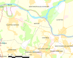
Shares border with regions:


Chavanoz
- commune in Isère, France
Chavanoz is a small town located near the eastern edge of France, close to the city of Lyon. While it may not be as well-known for hiking as some of the larger national parks, the surrounding region offers beautiful landscapes and a variety of trails for outdoor enthusiasts....
- Country:

- Postal Code: 38230
- Coordinates: 45° 46' 38" N, 5° 10' 18" E


- GPS tracks (wikiloc): [Link]
- Area: 8.24 sq km
- Population: 4568
- Web site: [Link]


Janneyrias
- commune in Isère, France
- Country:

- Postal Code: 38280
- Coordinates: 45° 45' 8" N, 5° 6' 43" E


- GPS tracks (wikiloc): [Link]
- Area: 10.52 sq km
- Population: 1734
- Web site: [Link]

Saint-Maurice-de-Gourdans
- commune in Ain, France
- Country:

- Postal Code: 01800
- Coordinates: 45° 49' 17" N, 5° 11' 44" E


- GPS tracks (wikiloc): [Link]
- Area: 25.39 sq km
- Population: 2509
- Web site: [Link]


Charvieu-Chavagneux
- commune in Isère, France
Charvieu-Chavagneux is a charming commune located in the Auvergne-Rhône-Alpes region of France, near the city of Lyon. It offers a variety of outdoor activities, including hiking. Here are some points to consider if you’re planning to hike in this area:...
- Country:

- Postal Code: 38230
- Coordinates: 45° 45' 0" N, 5° 9' 0" E


- GPS tracks (wikiloc): [Link]
- AboveSeaLevel: 220 м m
- Area: 8.65 sq km
- Population: 8879
- Web site: [Link]


Villette-d'Anthon
- commune in Isère, France
- Country:

- Postal Code: 38280
- Coordinates: 45° 47' 43" N, 5° 6' 57" E


- GPS tracks (wikiloc): [Link]
- Area: 22.8 sq km
- Population: 4826
- Web site: [Link]

Loyettes
- commune in Ain, France
Loyettes is a small commune located in the Auvergne-Rhône-Alpes region of France. While it may not be as widely known for hiking as some other areas in the region, there are still opportunities for outdoor activities and enjoying nature nearby....
- Country:

- Postal Code: 01360
- Coordinates: 45° 46' 27" N, 5° 12' 11" E


- GPS tracks (wikiloc): [Link]
- Area: 21.28 sq km
- Population: 3145
- Web site: [Link]

