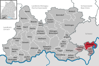
Jestetten (Jestetten)
- municipality in Germany
Jestetten is a charming village located in the Baden-Württemberg region of Germany, close to the Swiss border. It offers a variety of hiking opportunities that cater to different skill levels and interests. Here are some key highlights about hiking in and around Jestetten:
Trails and Routes
-
Local Trails: Jestetten features several marked hiking trails that take you through picturesque landscapes, including vineyards, fields, and forests. The trails vary in difficulty, making it accessible for both casual walkers and more experienced hikers.
-
Black Forest Trail: While Jestetten is not right in the Black Forest, it is located nearby, and many hikers use it as a base to explore some of the scenic routes in the Black Forest region. The trails here offer stunning views, diverse flora and fauna, and a chance to experience the local culture.
-
Rhein River: The nearby Rhine River provides beautiful walking paths and opportunities for relaxation. You can enjoy views of the river, as well as the chance to observe local wildlife.
Scenic Views
Hiking around Jestetten often rewards you with breathtaking views of the surrounding countryside, including rolling hills, vineyards, and, occasionally, vistas that extend into Switzerland.
Tips for Hiking in Jestetten
- Weather: Always check the weather before heading out, as conditions can change quickly, especially in the mountainous areas.
- Appropriate Gear: Wear suitable footwear and carry necessary gear such as water, snacks, a first-aid kit, and a map or GPS device.
- Respect Nature: Follow the "Leave No Trace" principles to help maintain the natural beauty of the area.
- Local Guidance: Consider checking in with local tourist information centers for maps and recommendations on trails and points of interest.
Conclusion
Jestetten serves as a lovely starting point for hiking adventures with its access to nature, scenic views, and a peaceful atmosphere. Whether you are a local or a visitor, the area provides a wonderful opportunity to explore the beauty of the German countryside. Enjoy your hike!
- Country:

- Postal Code: 79798
- Local Dialing Code: 07745
- Licence Plate Code: WT
- Coordinates: 47° 39' 0" N, 8° 34' 0" E


- GPS tracks (wikiloc): [Link]
- AboveSeaLevel: 429 м m
- Area: 20.63 sq km
- Population: 5026
- Web site: http://www.jestetten.de
- Wikipedia en: wiki(en)
- Wikipedia: wiki(de)
- Wikidata storage: Wikidata: Q181389
- Wikipedia Commons Category: [Link]
- Freebase ID: [/m/02q0405]
- GeoNames ID: Alt: [6555915]
- VIAF ID: Alt: [237270099]
- OSM relation ID: [2785957]
- GND ID: Alt: [4096509-0]
- HDS ID: [7075]
- German municipality key: 08337060
Shares border with regions:


Dettighofen
- municipality in Germany
Dettighofen is a charming village located in the district of Waldshut in Baden-Württemberg, Germany. While it might not be one of the most popular hiking destinations in Germany, it offers a variety of hiking opportunities in the picturesque landscapes of the surrounding Black Forest region....
- Country:

- Postal Code: 79802
- Local Dialing Code: 07742
- Licence Plate Code: WT
- Coordinates: 47° 37' 26" N, 8° 29' 1" E


- GPS tracks (wikiloc): [Link]
- AboveSeaLevel: 458 м m
- Area: 14.39 sq km
- Population: 1135
- Web site: [Link]


Lottstetten
- municipality in Germany
Lottstetten, a small municipality located in the southwestern part of Germany near the Swiss border, offers some beautiful hiking opportunities for outdoor enthusiasts. Here are some highlights and tips for hiking in and around Lottstetten:...
- Country:

- Postal Code: 79807
- Local Dialing Code: 07745
- Licence Plate Code: WT
- Coordinates: 47° 37' 44" N, 8° 34' 20" E


- GPS tracks (wikiloc): [Link]
- AboveSeaLevel: 433 м m
- Area: 13.39 sq km
- Population: 2253
- Web site: [Link]

