Jouvençon (Jouvençon)

- commune in Saône-et-Loire, France
- Country:

- Postal Code: 71290
- Coordinates: 46° 34' 27" N, 5° 3' 16" E


- GPS tracks (wikiloc): [Link]
- Area: 6.3 sq km
- Population: 420
- Web site: http://www.jouvencon.fr
- Wikipedia en: wiki(en)
- Wikipedia: wiki(fr)
- Wikidata storage: Wikidata: Q1466874
- Wikipedia Commons Category: [Link]
- Wikipedia Commons Maps Category: [Link]
- Freebase ID: [/m/03qgklr]
- Freebase ID: [/m/03qgklr]
- GeoNames ID: Alt: [6613806]
- GeoNames ID: Alt: [6613806]
- SIREN number: [217102441]
- SIREN number: [217102441]
- PACTOLS thesaurus ID: [pcrtDN31msVA0x]
- PACTOLS thesaurus ID: [pcrtDN31msVA0x]
- INSEE municipality code: 71244
- INSEE municipality code: 71244
Shares border with regions:

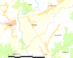
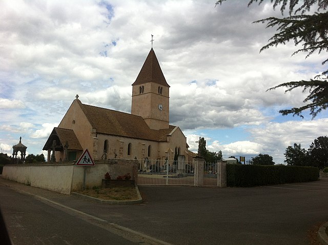
Brienne
- commune in Saône-et-Loire, France
- Country:
- Postal Code: 71290
- Coordinates: 46° 33' 25" N, 5° 1' 18" E
- GPS tracks (wikiloc): [Link]
- Area: 5.65 sq km
- Population: 474
- Web site: [Link]


Ménetreuil
- commune in Saône-et-Loire, France
- Country:
- Postal Code: 71470
- Coordinates: 46° 34' 58" N, 5° 6' 44" E
- GPS tracks (wikiloc): [Link]
- Area: 15.04 sq km
- Population: 406
- Web site: [Link]


Huilly-sur-Seille
- commune in Saône-et-Loire, France
- Country:
- Postal Code: 71290
- Coordinates: 46° 35' 31" N, 5° 3' 7" E
- GPS tracks (wikiloc): [Link]
- AboveSeaLevel: 210 м m
- Area: 12.13 sq km
- Population: 321


Rancy
- commune in Saône-et-Loire, France
- Country:
- Postal Code: 71290
- Coordinates: 46° 35' 52" N, 5° 5' 33" E
- GPS tracks (wikiloc): [Link]
- Area: 5.76 sq km
- Population: 526


Loisy, Saône-et-Loire
- commune in Saône-et-Loire, France
- Country:
- Postal Code: 71290
- Coordinates: 46° 34' 54" N, 5° 1' 40" E
- GPS tracks (wikiloc): [Link]
- Area: 14.64 sq km
- Population: 638

La Genête
- commune in Saône-et-Loire, France
- Country:
- Postal Code: 71290
- Coordinates: 46° 33' 5" N, 5° 2' 42" E
- GPS tracks (wikiloc): [Link]
- Area: 11.57 sq km
- Population: 564


La Chapelle-Thècle
- commune in Saône-et-Loire, France
- Country:
- Postal Code: 71470
- Coordinates: 46° 33' 22" N, 5° 6' 49" E
- GPS tracks (wikiloc): [Link]
- Area: 16.48 sq km
- Population: 443
- Web site: [Link]