Juigné-des-Moutiers (Juigné-des-Moutiers)

- commune in Loire-Atlantique, France
- Country:

- Postal Code: 44670
- Coordinates: 47° 40' 44" N, 1° 11' 7" E


- GPS tracks (wikiloc): [Link]
- Area: 24.65 sq km
- Population: 352
- Web site: http://www.cc-castelbriantais.fr/communaute-de-communes/juigne-les-moutiers/
- Wikipedia en: wiki(en)
- Wikipedia: wiki(fr)
- Wikidata storage: Wikidata: Q673694
- Wikipedia Commons Category: [Link]
- Freebase ID: [/m/03nwccw]
- Freebase ID: [/m/03nwccw]
- GeoNames ID: Alt: [3012121]
- GeoNames ID: Alt: [3012121]
- SIREN number: [214400780]
- SIREN number: [214400780]
- BnF ID: [15260247n]
- BnF ID: [15260247n]
- PACTOLS thesaurus ID: [pcrtQNd0n7H5th]
- PACTOLS thesaurus ID: [pcrtQNd0n7H5th]
- INSEE municipality code: 44078
- INSEE municipality code: 44078
Shares border with regions:


Saint-Julien-de-Vouvantes
- commune in Loire-Atlantique, France
- Country:
- Postal Code: 44670
- Coordinates: 47° 38' 30" N, 1° 14' 20" E
- GPS tracks (wikiloc): [Link]
- Area: 25.6 sq km
- Population: 968
- Web site: [Link]


Carbay
- commune in Maine-et-Loire, France
- Country:
- Postal Code: 49420
- Coordinates: 47° 43' 57" N, 1° 13' 9" E
- GPS tracks (wikiloc): [Link]
- Area: 7.63 sq km
- Population: 249


Soudan
- commune in Loire-Atlantique, France
- Country:
- Postal Code: 44110
- Coordinates: 47° 44' 15" N, 1° 18' 17" E
- GPS tracks (wikiloc): [Link]
- Area: 53.82 sq km
- Population: 1998
- Web site: [Link]

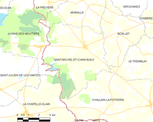
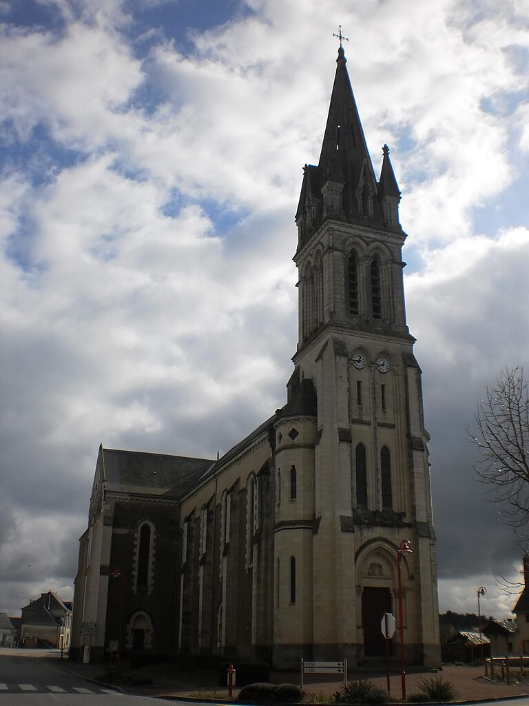
Saint-Michel-et-Chanveaux
- former commune in Maine-et-Loire, France
- Country:
- Postal Code: 49420
- Coordinates: 47° 40' 49" N, 1° 7' 50" E
- GPS tracks (wikiloc): [Link]
- Area: 27.67 sq km
- Population: 409


La Prévière
- former commune in Maine-et-Loire, France
- Country:
- Postal Code: 49420
- Coordinates: 47° 43' 3" N, 1° 10' 40" E
- GPS tracks (wikiloc): [Link]
- Area: 7.24 sq km
- Population: 246
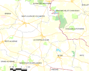
La Chapelle-Glain
- commune in Loire-Atlantique, France
- Country:
- Postal Code: 44670
- Coordinates: 47° 37' 23" N, 1° 11' 49" E
- GPS tracks (wikiloc): [Link]
- Area: 34.5 sq km
- Population: 819
- Web site: [Link]

Armaillé
- commune in Maine-et-Loire, France
- Country:
- Postal Code: 49420
- Coordinates: 47° 42' 51" N, 1° 7' 44" E
- GPS tracks (wikiloc): [Link]
- Area: 16.78 sq km
- Population: 313


Erbray
- commune in Loire-Atlantique, France
- Country:
- Postal Code: 44110
- Coordinates: 47° 39' 21" N, 1° 19' 4" E
- GPS tracks (wikiloc): [Link]
- Area: 58.18 sq km
- Population: 2946
- Web site: [Link]