La Chapelle-Glain (La Chapelle-Glain)

- commune in Loire-Atlantique, France
- Country:

- Postal Code: 44670
- Coordinates: 47° 37' 23" N, 1° 11' 49" E


- GPS tracks (wikiloc): [Link]
- Area: 34.5 sq km
- Population: 819
- Web site: http://www.la-chapelle-glain.fr
- Wikipedia en: wiki(en)
- Wikipedia: wiki(fr)
- Wikidata storage: Wikidata: Q427911
- Wikipedia Commons Category: [Link]
- Freebase ID: [/m/027csrx]
- Freebase ID: [/m/027csrx]
- GeoNames ID: Alt: [3010329]
- GeoNames ID: Alt: [3010329]
- SIREN number: [214400319]
- SIREN number: [214400319]
- BnF ID: [152602000]
- BnF ID: [152602000]
- VIAF ID: Alt: [247850902]
- VIAF ID: Alt: [247850902]
- GND ID: Alt: [4757061-1]
- GND ID: Alt: [4757061-1]
- INSEE municipality code: 44031
- INSEE municipality code: 44031
Shares border with regions:


Petit-Auverné
- commune in Loire-Atlantique, France
- Country:
- Postal Code: 44670
- Coordinates: 47° 36' 36" N, 1° 17' 26" E
- GPS tracks (wikiloc): [Link]
- Area: 22.53 sq km
- Population: 432
- Web site: [Link]


Saint-Julien-de-Vouvantes
- commune in Loire-Atlantique, France
- Country:
- Postal Code: 44670
- Coordinates: 47° 38' 30" N, 1° 14' 20" E
- GPS tracks (wikiloc): [Link]
- Area: 25.6 sq km
- Population: 968
- Web site: [Link]


Saint-Sulpice-des-Landes
- commune in Loire-Atlantique, France
- Country:
- Postal Code: 44540
- Coordinates: 47° 34' 29" N, 1° 12' 22" E
- GPS tracks (wikiloc): [Link]
- Area: 30.78 sq km
- Population: 686
- Web site: [Link]


Challain-la-Potherie
- commune in Maine-et-Loire, France
- Country:
- Postal Code: 49440
- Coordinates: 47° 38' 10" N, 1° 2' 47" E
- GPS tracks (wikiloc): [Link]
- Area: 47.87 sq km
- Population: 824

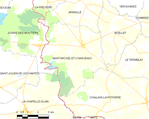
Saint-Michel-et-Chanveaux
- former commune in Maine-et-Loire, France
- Country:
- Postal Code: 49420
- Coordinates: 47° 40' 49" N, 1° 7' 50" E
- GPS tracks (wikiloc): [Link]
- Area: 27.67 sq km
- Population: 409


Le Pin
- commune in Loire-Atlantique, France
- Country:
- Postal Code: 44540
- Coordinates: 47° 35' 21" N, 1° 9' 13" E
- GPS tracks (wikiloc): [Link]
- Area: 24.95 sq km
- Population: 785
- Web site: [Link]


Juigné-des-Moutiers
- commune in Loire-Atlantique, France
- Country:
- Postal Code: 44670
- Coordinates: 47° 40' 44" N, 1° 11' 7" E
- GPS tracks (wikiloc): [Link]
- Area: 24.65 sq km
- Population: 352
- Web site: [Link]