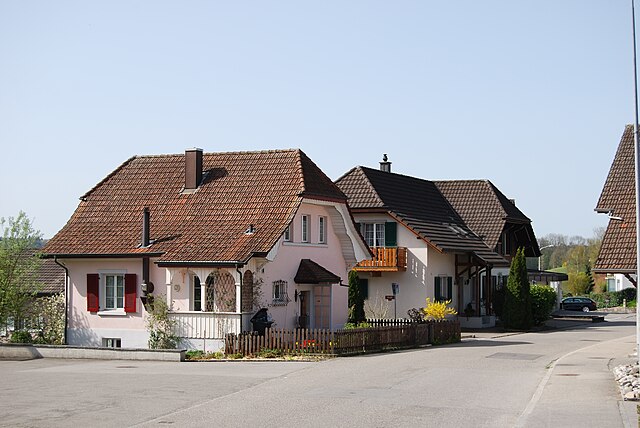
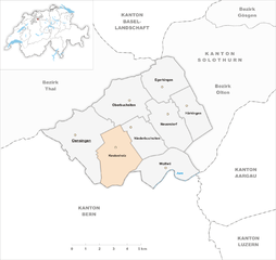
Kestenholz (Kestenholz)
- municipality of Switzerland
Kestenholz is a picturesque village located in the Aargau canton of Switzerland, surrounded by stunning natural landscapes that offer excellent opportunities for hiking. Here are some highlights and tips for hiking in and around Kestenholz:
Scenic Trails
- Local Trails: The region is dotted with well-marked local hiking trails that showcase the beautiful Swiss countryside, including rolling hills, forests, and meadows.
- Nature Reserves: Explore nearby nature reserves that provide a chance to see local flora and fauna.
Key Features
- Panoramic Views: Many trails offer breathtaking views of the Jura Mountains and the Aargau hills.
- Cultural Sites: Along some hiking routes, you may encounter historical sites and charming villages, enriching your hiking experience.
Hiking Recommendations
- Trail Difficulty: Trails vary from easy walks suitable for families to more challenging hikes. Always check the trail difficulty level and your skill set before heading out.
- Seasonal Considerations: Spring and summer offer lush greenery, while autumn showcases vibrant foliage. Winter hiking is possible in certain areas, but ensure you have the proper gear.
Practical Tips
- Gear Up: Wear appropriate hiking boots, dress in layers, and carry a backpack with essentials like water, snacks, a first-aid kit, and a map.
- Weather Awareness: Check the weather forecast before heading out, as conditions can change rapidly in the Swiss Alps.
- Stay Hydrated: Make sure to drink water regularly, especially on longer hikes.
- Respect Nature: Stay on marked paths, and take all your trash with you to preserve the natural beauty of the area.
Kestenholz is a lovely starting point for exploring the diverse trails and stunning landscapes of Switzerland. Enjoy your hiking adventure!
- Country:

- Postal Code: 4703
- Local Dialing Code: 062
- Licence Plate Code: SO
- Coordinates: 47° 17' 0" N, 7° 45' 15" E


- GPS tracks (wikiloc): [Link]
- AboveSeaLevel: 498 м m
- Area: 8.59 sq km
- Population: 1798
- Web site: http://www.kestenholz.ch
- Wikipedia en: wiki(en)
- Wikipedia: wiki(de)
- Wikidata storage: Wikidata: Q66084
- Wikipedia Commons Category: [Link]
- Freebase ID: [/m/0g4qbz]
- GeoNames ID: Alt: [7286190]
- VIAF ID: Alt: [123913041]
- OSM relation ID: [1683533]
- HDS ID: [1059]
- Swiss municipality code: [2403]
Shares border with regions:


Niederbuchsiten
- municipality in Switzerland
Niederbuchsiten, located in the Canton of Solothurn in Switzerland, is a beautiful area for hiking enthusiasts. The region is characterized by its picturesque landscape, combining rolling hills, lush forests, and panoramic views of the surrounding peaks....
- Country:

- Postal Code: 4626
- Local Dialing Code: 062
- Licence Plate Code: SO
- Coordinates: 47° 17' 49" N, 7° 46' 15" E


- GPS tracks (wikiloc): [Link]
- AboveSeaLevel: 480 м m
- Area: 5.49 sq km
- Population: 1169
- Web site: [Link]


Oensingen
- municipality in the Canton of Solothurn, Switzerland
Oensingen, located in the canton of Solothurn in Switzerland, offers a variety of hiking trails that cater to different skill levels and preferences. The region is known for its scenic landscapes, rolling hills, and pleasant weather, making it an excellent destination for outdoor enthusiasts. Here are some highlights to consider when planning a hiking trip in Oensingen:...
- Country:

- Postal Code: 4702
- Local Dialing Code: 062
- Licence Plate Code: SO
- Coordinates: 47° 17' 17" N, 7° 43' 22" E


- GPS tracks (wikiloc): [Link]
- AboveSeaLevel: 457 м m
- Area: 12.03 sq km
- Population: 6299
- Web site: [Link]


Wolfwil
- municipality in Switzerland
Wolfwil is a charming village located in the Canton of Basel-Landschaft in Switzerland, surrounded by beautiful landscapes that are perfect for hiking enthusiasts. The region features a variety of trails that cater to different skill levels, from leisurely walks to more challenging hikes....
- Country:

- Postal Code: 4628
- Local Dialing Code: 062
- Licence Plate Code: SO
- Coordinates: 47° 16' 9" N, 7° 47' 35" E


- GPS tracks (wikiloc): [Link]
- AboveSeaLevel: 426 м m
- Area: 6.86 sq km
- Population: 2200
- Web site: [Link]


Oberbuchsiten
- municipality in Switzerland
Oberbuchsiten is a charming municipality located in the canton of Solothurn, Switzerland. It's a great area for hiking, surrounded by beautiful landscapes, rolling hills, and scenic views of the Swiss countryside. Here are some key points to consider if you're planning a hiking trip in Oberbuchsiten:...
- Country:

- Postal Code: 4625
- Local Dialing Code: 062
- Licence Plate Code: SO
- Coordinates: 47° 18' 39" N, 7° 46' 0" E


- GPS tracks (wikiloc): [Link]
- AboveSeaLevel: 471 м m
- Area: 9.37 sq km
- Population: 2238
- Web site: [Link]


Schwarzhäusern
- municipality in Switzerland
Schwarzhäusern is a picturesque area located in southern Germany, known for its beautiful landscapes and outdoor recreational opportunities. The region is particularly famous for its dense forests, rolling hills, and varied terrain, making it an attractive destination for hikers of all skill levels....
- Country:

- Postal Code: 4911
- Local Dialing Code: 062
- Licence Plate Code: BE
- Coordinates: 47° 15' 14" N, 7° 46' 0" E


- GPS tracks (wikiloc): [Link]
- AboveSeaLevel: 427 м m
- Area: 3.7 sq km
- Population: 517
- Web site: [Link]


Niederbipp
- municipality in Switzerland
Niederbipp is a charming village located in the canton of Bern, Switzerland, and it is surrounded by beautiful landscapes that make it a great area for hiking. Here are some highlights and tips for hiking in and around Niederbipp:...
- Country:

- Postal Code: 4704
- Local Dialing Code: 032
- Licence Plate Code: BE
- Coordinates: 47° 15' 58" N, 7° 42' 14" E


- GPS tracks (wikiloc): [Link]
- AboveSeaLevel: 455 м m
- Area: 17.5 sq km
- Population: 4717
- Web site: [Link]

