Kierspe (Kierspe)
- town in the district Märkischer Kreis, in North Rhine-Westphalia, Germany
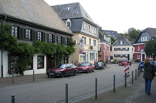
Kierspe is a charming town located in the North Rhine-Westphalia region of Germany, nestled in the beautiful Sauerland area. The region is known for its scenic landscapes, lush forests, and rolling hills, making it an excellent destination for hiking enthusiasts.
Hiking Trails
Kierspe and its surrounding areas offer a variety of hiking trails suitable for different skill levels:
-
Rundwanderweg Kierspe: This is a circular trail that allows you to explore the town and the beautiful countryside. It is well-marked and provides a great opportunity to enjoy the local flora and fauna.
-
Sauerland Höhenflug: A long-distance hiking trail that passes near Kierspe. This trail stretches over 250 kilometers and is known for its stunning views and diverse landscapes, including forests, meadows, and valleys.
-
Local Forest Trails: The forests around Kierspe offer numerous smaller trails that are perfect for short hikes or leisurely walks. These paths often lead to scenic viewpoints and serene natural settings.
Highlights
- Natural Beauty: The Sauerland region is characterized by its natural beauty, with picturesque views, clear streams, and vibrant wildlife.
- Cultural Experiences: While hiking, you can also explore the local culture, including historic sites and traditional architecture in Kierspe and surrounding villages.
Hiking Tips
- Weather: Always check the weather forecast before heading out, as conditions can change quickly in the hills.
- Maps and Guides: Consider bringing a map or using a hiking app to stay on track, especially on longer hikes.
- Safety: Wear appropriate footwear and clothing, stay hydrated, and let someone know your hiking plans.
Accessibility
Kierspe is accessible by public transport, and there are several parking areas if you prefer to drive to the trailheads.
Whether you’re looking for a short walk or an adventurous trek, Kierspe and its surroundings provide a fantastic backdrop for all types of hiking experiences. Enjoy your hike!
- Country:

- Postal Code: 58566
- Local Dialing Code: 02359
- Licence Plate Code: MK
- Coordinates: 51° 8' 0" N, 7° 34' 0" E


- GPS tracks (wikiloc): [Link]
- AboveSeaLevel: 431 м m
- Area: 71.91 sq km
- Population: 16210
- Web site: https://www.kierspe.de/
- Wikipedia en: wiki(en)
- Wikipedia: wiki(de)
- Wikidata storage: Wikidata: Q5569
- Wikipedia Commons Gallery: [Link]
- Wikipedia Commons Category: [Link]
- Wikipedia Commons Maps Category: [Link]
- Freebase ID: [/m/01_q6q]
- GeoNames ID: Alt: [6557681]
- VIAF ID: Alt: [138575572]
- OSM relation ID: [168557]
- GND ID: Alt: [4030501-6]
- archINFORM location ID: [12037]
- Library of Congress authority ID: Alt: [n2003111592]
- MusicBrainz area ID: [9d834934-4d0f-4a7d-b3b7-901808c00f5f]
- Quora topic ID: [Kierspe]
- TGN ID: [1039861]
- National Library of Israel ID: [001067572]
- German municipality key: 05962028
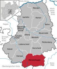
Shares border with regions:


Lüdenscheid
- city in North Rhine-Westphalia, Germany
Lüdenscheid, located in North Rhine-Westphalia, Germany, is surrounded by beautiful landscapes that make it an appealing destination for hiking enthusiasts. The region is part of the Sauerland, known for its rolling hills, forests, and serene lakes. Here are some highlights and considerations for hiking in and around Lüdenscheid:...
- Country:

- Postal Code: 58507–58515
- Local Dialing Code: 02351
- Licence Plate Code: MK
- Coordinates: 51° 13' 11" N, 7° 37' 38" E


- GPS tracks (wikiloc): [Link]
- AboveSeaLevel: 423 м m
- Area: 86.73 sq km
- Population: 72894
- Web site: [Link]


Halver
- town in the Märkischer Kreis district, North Rhine-Westphalia, Germany
Halver, a charming town in North Rhine-Westphalia, Germany, offers a variety of hiking opportunities that showcase the natural beauty of the region. Whether you're an experienced hiker or a beginner, there are trails suited for all levels. Here are some highlights of hiking in Halver:...
- Country:

- Postal Code: 58553
- Local Dialing Code: 02353
- Licence Plate Code: MK
- Coordinates: 51° 11' 0" N, 7° 28' 0" E


- GPS tracks (wikiloc): [Link]
- AboveSeaLevel: 414 м m
- Area: 77.23 sq km
- Population: 16128
- Web site: [Link]


Meinerzhagen
- town in the Märkischer Kreis, North Rhine-Westphalia, Germany
Meinerzhagen, located in North Rhine-Westphalia, Germany, is a charming town surrounded by scenic landscapes, making it a great destination for hiking enthusiasts. The area offers various trails that cater to different skill levels, from easy walks suitable for families to more challenging hikes for experienced trekkers....
- Country:

- Postal Code: 58540
- Local Dialing Code: 02763; 02358; 02357; 02354
- Licence Plate Code: MK
- Coordinates: 51° 7' 0" N, 7° 38' 0" E


- GPS tracks (wikiloc): [Link]
- AboveSeaLevel: 399 м m
- Area: 115.18 sq km
- Population: 20406
- Web site: [Link]

