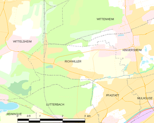
Kingersheim (Kingersheim)

- commune in Haut-Rhin, France
 Hiking in Kingersheim
Kingersheim is located in the Alsace region of northeastern France, near the city of Mulhouse. While the area may not be as famous for hiking as some other regions, it does offer opportunities for outdoor enthusiasts to explore the beautiful landscapes and nature surrounding the town. Here’s what you can expect when hiking in and around Kingersheim:
Local Trails
-
Forest Pathways: The area around Kingersheim has several forested trails where you can enjoy the natural beauty. These pathways are generally well-marked and suitable for various hiking levels.
-
Nearby Parks: Look for parks in or near Kingersheim, which may have designated trails for walking and hiking. The Parc de l'Hotel de Ville is one possible spot for a leisurely stroll.
-
Nearby Vosges Mountains: A short drive from Kingersheim will take you to the Vosges Mountains, which offer more challenging hikes with varied terrains, including beautiful views, lakes, and wooded areas. Popular hikes in the Vosges include trails around Mount Sainte-Odile and the Grand Ballon.
Hiking Tips in Kingersheim
- Gear: Wear appropriate footwear, especially if venturing into hilly or uneven terrain.
- Weather: Check the weather conditions, as they can change quickly in the region. Always be prepared for variable conditions.
- Navigation: Use local maps or hiking apps to stay on the right paths and discover lesser-known trails.
Local Culture
As you hike, take in the picturesque Alsace countryside and be sure to enjoy the local culture, which includes charming villages, vineyards, and unique Alsace cuisine.
Conclusion
While hiking opportunities within Kingersheim itself may be limited compared to larger national parks, nearby forest paths, parks, and the mountainous regions of the Vosges provide wonderful hiking experiences. Whether you’re looking for a leisurely walk or a more strenuous hike, the Kingersheim area and its surroundings have much to offer for outdoor adventurers.
- Country:

- Postal Code: 68260
- Coordinates: 47° 47' 29" N, 7° 20' 17" E


- GPS tracks (wikiloc): [Link]
- Area: 6.69 sq km
- Population: 13143
- Web site: http://www.ville-kingersheim.fr/
- Wikipedia en: wiki(en)
- Wikipedia: wiki(fr)
- Wikidata storage: Wikidata: Q124126
- Wikipedia Commons Category: [Link]
- Freebase ID: [/m/03nst2p]
- Freebase ID: [/m/03nst2p]
- GeoNames ID: Alt: [6441496]
- GeoNames ID: Alt: [6441496]
- SIREN number: [216801662]
- SIREN number: [216801662]
- BnF ID: [15271868q]
- BnF ID: [15271868q]
- VIAF ID: Alt: [235085446]
- VIAF ID: Alt: [235085446]
- GND ID: Alt: [4199855-8]
- GND ID: Alt: [4199855-8]
- WOEID: [596300]
- WOEID: [596300]
- Gran Enciclopèdia Catalana ID: [0265668]
- Gran Enciclopèdia Catalana ID: [0265668]
- INSEE municipality code: 68166
- INSEE municipality code: 68166
Shares border with regions:


Pfastatt
- commune in Haut-Rhin, France
Hiking in Pfastatt
Pfastatt is a commune located in the Grand Est region of northeastern France, specifically in the Haut-Rhin department. While it may not be as widely known as some of the larger hiking destinations in France, it offers some charming outdoor experiences, particularly for those who enjoy exploring the Alsace region's natural beauty....
- Country:
- Postal Code: 68120
- Coordinates: 47° 46' 8" N, 7° 18' 6" E
- GPS tracks (wikiloc): [Link]
- Area: 5.24 sq km
- Population: 9423

Richwiller
- commune in Haut-Rhin, France
Hiking in Richwiller
Richwiller, located in the Alsace region of France, is surrounded by beautiful landscapes and natural areas that offer great hiking opportunities. Here are some key points to consider when hiking in and around Richwiller:...
- Country:
- Postal Code: 68120
- Coordinates: 47° 46' 45" N, 7° 16' 50" E
- GPS tracks (wikiloc): [Link]
- Area: 5.55 sq km
- Population: 3590

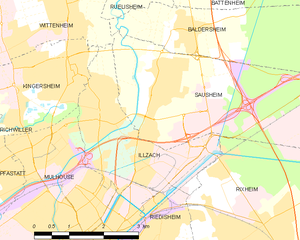
Illzach
- commune in Haut-Rhin, France
Hiking in Illzach
Illzach, located in the Alsace region of France near the city of Mulhouse, offers a blend of urban and natural hiking opportunities. While Illzach itself may not be known for extensive hiking trails, the surrounding areas provide beautiful landscapes and more challenging hikes....
- Country:
- Postal Code: 68110
- Coordinates: 47° 46' 56" N, 7° 20' 53" E
- GPS tracks (wikiloc): [Link]
- Area: 7.5 sq km
- Population: 14626
- Web site: [Link]


Wittenheim
- commune in Haut-Rhin, France
Hiking in Wittenheim
Wittenheim, a small town located in the Alsace region of France, is surrounded by beautiful natural landscapes, making it a great place for hiking enthusiasts. Here are some details about hiking in and around Wittenheim:...
- Country:
- Postal Code: 68270
- Coordinates: 47° 48' 27" N, 7° 20' 13" E
- GPS tracks (wikiloc): [Link]
- Area: 19.01 sq km
- Population: 14512
- Web site: [Link]


Mulhouse
- commune in Haut-Rhin, France
Hiking in Mulhouse
Mulhouse, located in the Alsace region of northeastern France, is surrounded by a varied landscape ideal for hiking enthusiasts. While Mulhouse itself may be more urban, it serves as a convenient base for exploring nearby natural areas, particularly the Vosges Mountains to the west and the Rhine River valley to the east. Here are some highlights and tips for hiking around Mulhouse:...
- Country:
- Postal Code: 68100–68200
- Coordinates: 47° 44' 55" N, 7° 20' 21" E
- GPS tracks (wikiloc): [Link]
- AboveSeaLevel: 240 м m
- Area: 22.18 sq km
- Population: 110370
- Web site: [Link]