Kirchdorf am Inn (Kirchdorf am Inn)
- municipality of Germany
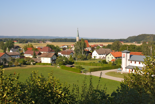
Kirchdorf am Inn is a charming village located in Bavaria, Germany, near the border with Austria. The area is known for its beautiful landscapes, making it a great destination for hiking enthusiasts. Here are some highlights and tips for hiking in and around Kirchdorf am Inn:
Scenic Trails:
-
Inn River Trails: The River Inn offers picturesque paths along its banks. These trails are generally flat and suitable for all skill levels, making them great for family hikes or leisurely strolls.
-
Surrounding Hills: The rolling hills around Kirchdorf provide a variety of trails with panoramic views of the surrounding countryside. Some paths lead to higher elevations, giving hikers a chance to experience breathtaking vistas.
-
Nature Reserves: The region is rich in biodiversity, and several local nature reserves offer marked hiking trails that allow visitors to enjoy the local flora and fauna.
Hiking Tips:
-
Trail Maps: It’s advisable to carry a trail map or use a hiking app to stay on the right path. Local tourist information centers can provide maps and information on trail conditions.
-
Seasonal Considerations: Spring and autumn are ideal for hiking as the weather is usually mild. Summer months can be hot, while winter might lead to snow-covered trails, which could require special gear.
-
Equipment: Wear appropriate footwear and bring plenty of water, snacks, and a first-aid kit. Depending on the trail's difficulty, trekking poles might be helpful.
Local Amenities:
-
Accommodation: There are several guesthouses and hotels in and around Kirchdorf am Inn that cater to hikers. Booking in advance is recommended, especially during peak hiking seasons.
-
Dining Options: After a day of hiking, you can enjoy traditional Bavarian cuisine at local restaurants, making for a perfect way to relax and refuel.
Additional Activities:
If you have time, consider exploring the cultural sites in Kirchdorf am Inn or visiting nearby attractions, including historical towns and castles.
Overall, hiking in Kirchdorf am Inn offers a wonderful experience for nature lovers, with diverse trails and stunning scenery. Be sure to leave no trace and respect the local environment during your visit!
- Country:

- Postal Code: 84375
- Local Dialing Code: 08571
- Licence Plate Code: PAN
- Coordinates: 48° 15' 0" N, 12° 59' 0" E


- GPS tracks (wikiloc): [Link]
- AboveSeaLevel: 359 м m
- Area: 31.64 sq km
- Population: 4064
- Web site: http://www.kirchdorfaminn.de
- Wikipedia en: wiki(en)
- Wikipedia: wiki(de)
- Wikidata storage: Wikidata: Q583404
- Wikipedia Commons Category: [Link]
- Freebase ID: [/m/02q834q]
- GeoNames ID: Alt: [6558941]
- OSM relation ID: [957067]
- GND ID: Alt: [4439721-5]
- Historical Gazetteer (GOV) ID: [KIRINNJN68LG]
- Bavarikon ID: [ODB_A00001623]
- German municipality key: 09277128
Shares border with regions:


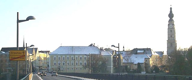
Braunau am Inn
- municipality in Austria
Braunau am Inn, located in Austria near the border with Germany, is surrounded by beautiful landscapes that offer various hiking opportunities. The region features gentle hills, lush forests, and picturesque views of the Inn River and the surrounding countryside....
- Country:

- Postal Code: 5289; 5283; 5280
- Local Dialing Code: 07722
- Licence Plate Code: BR
- Coordinates: 48° 15' 30" N, 13° 2' 0" E


- GPS tracks (wikiloc): [Link]
- AboveSeaLevel: 352 м m
- Area: 24.84 sq km
- Population: 17095
- Web site: [Link]


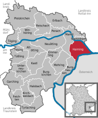
Haiming
- municipality of Germany
Haiming, located in Bavaria, Germany, is an excellent destination for hiking enthusiasts. Nestled close to the Alps, it offers picturesque landscapes, beautiful trails, and a variety of outdoor activities. Here are some highlights about hiking in and around Haiming:...
- Country:

- Postal Code: 84533
- Local Dialing Code: 08678
- Coordinates: 48° 12' 45" N, 12° 53' 16" E


- GPS tracks (wikiloc): [Link]
- AboveSeaLevel: 363 м m
- Area: 28.67 sq km
- Population: 2103
- Web site: [Link]


Simbach am Inn
- municipality of Germany
Simbach am Inn, located on the border between Germany and Austria, offers a variety of hiking opportunities that showcase the natural beauty of the region. Here are some things to consider if you're planning a hiking excursion in or around Simbach am Inn:...
- Country:

- Postal Code: 84359
- Local Dialing Code: 08571
- Licence Plate Code: PAN
- Coordinates: 48° 16' 0" N, 13° 1' 0" E


- GPS tracks (wikiloc): [Link]
- AboveSeaLevel: 350 м m
- Area: 47.33 sq km
- Population: 8697
- Web site: [Link]

Überackern
- municipality in Austria
Überackern is a beautiful location for hiking, nestled in Austria. While the specifics can vary based on the specific trails and areas you choose, here are some general aspects to consider when hiking in and around Überackern:...
- Country:

- Postal Code: 5122
- Local Dialing Code: 07727
- Licence Plate Code: BR
- Coordinates: 48° 11' 35" N, 12° 52' 36" E


- GPS tracks (wikiloc): [Link]
- AboveSeaLevel: 356 м m
- Area: 27.1 sq km
- Population: 685
- Web site: [Link]


Julbach
- municipality of Germany
Julbach, located in Austria, is a charming village nestled in the picturesque landscape of the Mühlviertel region, known for its lush forests, rolling hills, and scenic trails. Hiking in and around Julbach offers a variety of experiences for outdoor enthusiasts, ranging from leisurely walks to more challenging treks....
- Country:

- Postal Code: 84387
- Local Dialing Code: 08571
- Licence Plate Code: PAN
- Coordinates: 48° 15' 18" N, 12° 57' 33" E


- GPS tracks (wikiloc): [Link]
- AboveSeaLevel: 383 м m
- Area: 11.3 sq km
- Population: 1858
- Web site: [Link]


Reut
- municipality of Germany
Reut, located in central Israel near the city of Tel Aviv, is not typically known as a hiking destination compared to other regions in the country like the Galilee, the Golan Heights, or the Negev Desert. However, there are some opportunities for nature walks and outdoor activities in the surrounding areas....
- Country:

- Postal Code: 84367
- Local Dialing Code: 08572
- Licence Plate Code: PAN
- Coordinates: 48° 18' 40" N, 12° 56' 34" E


- GPS tracks (wikiloc): [Link]
- AboveSeaLevel: 460 м m
- Area: 30.75 sq km
- Population: 1599
- Web site: [Link]


Stammham
- human settlement in Germany
Stammham, located in the Altötting district of Bavaria, Germany, offers a variety of scenic hiking opportunities. The region is primarily characterized by its picturesque landscapes, charming villages, and mixed forests, making it ideal for outdoor activities....
- Country:

- Postal Code: 84533
- Local Dialing Code: 08678
- Coordinates: 48° 15' 0" N, 12° 53' 0" E


- GPS tracks (wikiloc): [Link]
- AboveSeaLevel: 369 м m
- Area: 5.67 sq km
- Population: 947
- Web site: [Link]

