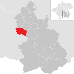
Kirchdorf an der Krems District (Bezirk Kirchdorf an der Krems)

- district of Austria
 Hiking in Kirchdorf an der Krems District
Kirchdorf an der Krems District, located in Upper Austria, offers a variety of hiking opportunities that showcase the region's stunning natural scenery, including rolling hills, lush forests, and breathtaking mountain views. Here are some highlights and tips for hiking in this area:
Hiking Trails
- Trails for All Levels: The district offers a range of trails suitable for different skill levels, from easy walks to challenging hikes.
- Scenic Routes: Popular trails include routes along the Krems River and paths that lead to scenic viewpoints over the valley and surrounding mountains.
Notable Areas
- Krems Valley: This area is known for its beautiful landscapes and is ideal for leisurely hikes. Follow riverside paths or venture into the hills for more elevation.
- Local Nature Reserves: Explore nature reserves within the district, which often feature well-marked trails and information panels about local flora and fauna.
Hiking Tips
- Weather Preparedness: Always check the weather before heading out, as conditions in the mountains can change rapidly.
- Proper Gear: Wear sturdy hiking boots and dress in layers to prepare for varying temperatures.
- Navigation: Use a reliable map or a hiking app, as some trails may not be well marked.
Local Amenities
- Transportation: Kirchdorf an der Krems is accessible by public transport, making it easy to reach trailheads.
- Accommodations: Consider staying in local guesthouses or camping for a complete outdoor experience.
- Restaurants: After a hike, enjoy a meal at local eateries that often serve traditional Austrian cuisine.
Safety Considerations
- Always inform someone about your hiking plans.
- Carry a first aid kit and sufficient water and snacks for your hike.
- Be aware of the wildlife, and follow local guidelines for safe encounters.
Hiking in Kirchdorf an der Krems District provides a fantastic opportunity to connect with nature while exploring the beautiful landscapes of Upper Austria. Whether you're a seasoned hiker or a beginner, you're sure to find paths that inspire and rejuvenate. Enjoy your adventures!
- Country:

- Capital: Kirchdorf an der Krems
- Licence Plate Code: KI
- Coordinates: 47° 53' 2" N, 14° 9' 29" E


- GPS tracks (wikiloc): [Link]
- AboveSeaLevel: 510 м m
- Area: 1239.79 sq km
- Web site: http://www.bh-kirchdorf.gv.at/
- Wikipedia en: wiki(en)
- Wikipedia: wiki(de)
- Wikidata storage: Wikidata: Q660512
- Wikipedia Commons Category: [Link]
- Freebase ID: [/m/0dyccb]
- GeoNames ID: Alt: [2774389]
- VIAF ID: Alt: [241462389]
- GND ID: Alt: [4098421-7]
- archINFORM location ID: [14672]
- Library of Congress authority ID: Alt: [nb2015009698]
Includes regions:
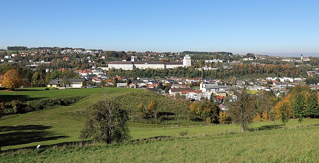

Kremsmünster
- municipality in Austria
Hiking in Kremsmünster
Kremsmünster, located in the Upper Austria region, offers a variety of scenic hiking opportunities. Nestled at the foot of the Alps, this area boasts beautiful landscapes, rich history, and diverse trails suitable for different skill levels. Here’s an overview of what you might experience while hiking in and around Kremsmünster:...
- Country:
- Postal Code: 4550
- Local Dialing Code: 07583
- Licence Plate Code: KI
- Coordinates: 48° 3' 18" N, 14° 7' 51" E
- GPS tracks (wikiloc): [Link]
- AboveSeaLevel: 384 м m
- Area: 42.1 sq km
- Population: 6585
- Web site: [Link]


Rosenau am Hengstpaß
- municipality in Austria
Hiking in Rosenau am Hengstpaß
Rosenau am Hengstpass is a beautiful area in Austria, offering a range of hiking opportunities amidst stunning natural scenery. Nestled in the foothills of the Alps, the region is characterized by lush forests, alpine meadows, and panoramic views. Here are some key points to consider for hiking in this area:...
- Country:
- Postal Code: 4581
- Local Dialing Code: 07566
- Licence Plate Code: KI
- Coordinates: 47° 42' 49" N, 14° 23' 46" E
- GPS tracks (wikiloc): [Link]
- AboveSeaLevel: 700 м m
- Area: 108.3 sq km
- Population: 663
- Web site: [Link]

Micheldorf in Oberösterreich
- municipality in Austria
Hiking in Micheldorf in Oberösterreich
Micheldorf in Oberösterreich is a charming village located in the Upper Austria region, surrounded by beautiful landscapes that are perfect for hiking enthusiasts. Here’s what you can expect when hiking in this area:...
- Country:
- Postal Code: 4563
- Local Dialing Code: 07582
- Licence Plate Code: KI
- Coordinates: 47° 52' 41" N, 14° 8' 0" E
- GPS tracks (wikiloc): [Link]
- AboveSeaLevel: 465 м m
- Area: 50.32 sq km
- Population: 5814
- Web site: [Link]


Klaus an der Pyhrnbahn
- municipality in Austria
Hiking in Klaus an der Pyhrnbahn
Klaus an der Pyhrnbahn is a picturesque village located in the Upper Austria region, surrounded by stunning natural landscapes, making it an excellent destination for hiking enthusiasts. Here are some key points about hiking in this area:...
- Country:
- Postal Code: 4564
- Local Dialing Code: 07585
- Licence Plate Code: KI
- Coordinates: 47° 49' 50" N, 14° 9' 29" E
- GPS tracks (wikiloc): [Link]
- AboveSeaLevel: 466 м m
- Area: 108 sq km
- Population: 1063
- Web site: [Link]


Hinterstoder
- municipality in Upper Austria, Austria
Hiking in Hinterstoder
Hinterstoder, located in the stunning Salzkammergut region of Austria, is a fantastic destination for hikers of all skill levels. This small alpine village is surrounded by the beautiful peaks of the Totes Gebirge mountain range, offering a wide variety of hiking trails that take you through breathtaking landscapes, lush forests, and scenic alpine meadows....
- Country:
- Postal Code: 4573
- Local Dialing Code: 07564
- Licence Plate Code: KI
- Coordinates: 47° 41' 47" N, 14° 8' 58" E
- GPS tracks (wikiloc): [Link]
- AboveSeaLevel: 591 м m
- Area: 149.5 sq km
- Population: 910
- Web site: [Link]

Inzersdorf im Kremstal
- municipality in Austria
Hiking in Inzersdorf im Kremstal
Inzersdorf im Kremstal, located in Austria, offers a variety of picturesque hiking opportunities that cater to different skill levels and preferences. The region is characterized by its beautiful landscapes, rolling hills, and lush forests, making it a perfect destination for nature lovers and outdoor enthusiasts....
- Country:
- Postal Code: 4565
- Local Dialing Code: 07582
- Licence Plate Code: KI
- Coordinates: 47° 55' 47" N, 14° 0' 0" E
- GPS tracks (wikiloc): [Link]
- AboveSeaLevel: 434 м m
- Area: 22.7 sq km
- Population: 1880
- Web site: [Link]

Pettenbach
- municipality in Austria
Hiking in Pettenbach
Pettenbach, located in the scenic Salzkammergut region of Austria, offers a variety of hiking opportunities suitable for different skill levels. The area is known for its stunning landscapes, including lush forests, rolling hills, and impressive mountain views. Here are some key highlights and tips for hiking in Pettenbach:...
- Country:
- Postal Code: 4643
- Local Dialing Code: 07586
- Licence Plate Code: KI
- Coordinates: 47° 57' 42" N, 14° 1' 0" E
- GPS tracks (wikiloc): [Link]
- AboveSeaLevel: 486 м m
- Area: 54.7 sq km
- Population: 5272
- Web site: [Link]

Schlierbach
- municipality in Austria
Hiking in Schlierbach
Schlierbach, located in the picturesque Upper Austria, offers hikers a wonderful mix of natural beauty, cultural heritage, and various trails suitable for different skill levels. Here are some key points to consider when hiking in this charming area:...
- Country:
- Postal Code: 4553
- Local Dialing Code: 07582
- Licence Plate Code: KI
- Coordinates: 47° 56' 1" N, 14° 7' 39" E
- GPS tracks (wikiloc): [Link]
- AboveSeaLevel: 478 м m
- Area: 18.4 sq km
- Population: 2858
- Web site: [Link]
Edlbach
- municipality in Austria
Hiking in Edlbach
Edlbach is a beautiful area located in Upper Austria, nestled in the foothills of the Alps. It's an excellent destination for hiking enthusiasts, offering a variety of trails suitable for different skill levels. Here are some highlights of hiking in Edlbach:...
- Country:
- Postal Code: 4580
- Local Dialing Code: 07562
- Licence Plate Code: KI
- Coordinates: 47° 42' 45" N, 14° 22' 0" E
- GPS tracks (wikiloc): [Link]
- AboveSeaLevel: 770 м m
- Area: 8.3 sq km
- Population: 670
- Web site: [Link]
Grünburg
- municipality in Austria
Hiking in Grünburg
Grünburg, located in the scenic region of Upper Austria, is an excellent destination for hiking enthusiasts. It boasts beautiful natural landscapes, including lush forests, rolling hills, and stunning views of the surrounding mountains....
- Country:
- Licence Plate Code: KI
- Coordinates: 47° 58' 19" N, 14° 16' 40" E
- GPS tracks (wikiloc): [Link]
- AboveSeaLevel: 365 м m
- Area: 43.2 sq km
- Population: 3840
- Web site: [Link]

Ried im Traunkreis
- municipality in Austria
Hiking in Ried im Traunkreis
Ried im Traunkreis is a lovely area in Austria that offers various hiking opportunities. Nestled in the picturesque landscape of Upper Austria, it is surrounded by beautiful nature, rolling hills, and the Traun River, making it a great destination for outdoor enthusiasts....
- Country:
- Postal Code: 4551
- Local Dialing Code: 07588
- Licence Plate Code: KI
- Coordinates: 48° 1' 31" N, 14° 4' 24" E
- GPS tracks (wikiloc): [Link]
- AboveSeaLevel: 469 м m
- Area: 31.1 sq km
- Population: 2739
- Web site: [Link]

Steinbach am Ziehberg
- municipality in Austria
Hiking in Steinbach am Ziehberg
Steinbach am Ziehberg, located in Austria, is a wonderful destination for hiking enthusiasts. Nestled in the stunning Salzkammergut region, it offers beautiful landscape features including mountains, forests, and meadows....
- Country:
- Postal Code: 4562
- Local Dialing Code: 07582
- Licence Plate Code: KI
- Coordinates: 47° 53' 32" N, 14° 2' 0" E
- GPS tracks (wikiloc): [Link]
- AboveSeaLevel: 547 м m
- Area: 34.8 sq km
- Population: 828
- Web site: [Link]
Sankt Pankraz
- municipality in Austria
Hiking in Sankt Pankraz
Sankt Pankraz, located in the heart of Austria, is an excellent destination for hiking enthusiasts. Nestled in the scenic landscape of Lower Austria, the area offers a diverse range of trails that cater to various skill levels, from beginners to seasoned hikers. Here are some highlights and tips for hiking in Sankt Pankraz:...
- Country:
- Postal Code: 4572
- Local Dialing Code: 07565
- Licence Plate Code: KI
- Coordinates: 47° 45' 54" N, 14° 12' 34" E
- GPS tracks (wikiloc): [Link]
- AboveSeaLevel: 531 м m
- Area: 47.1 sq km
- Population: 362
- Web site: [Link]

Wartberg an der Krems
- municipality of Austria
Hiking in Wartberg an der Krems
Wartberg an der Krems is a beautiful village located in Upper Austria, surrounded by stunning landscapes that make it an excellent destination for hiking enthusiasts. The area is characterized by lush forests, rolling hills, and scenic views, making it perfect for various hiking trails suitable for different skill levels....
- Country:
- Postal Code: 4552
- Local Dialing Code: 07587
- Licence Plate Code: KI
- Coordinates: 47° 59' 24" N, 14° 7' 1" E
- GPS tracks (wikiloc): [Link]
- AboveSeaLevel: 385 м m
- Area: 31.6 sq km
- Population: 2993
- Web site: [Link]


Nußbach
- municipality in Austria
Hiking in Nußbach
Nußbach, a small but scenic village in Austria, offers hiking opportunities that allow you to explore the beautiful landscapes of the region. Situated in Upper Austria, near the foothills of the Alps, the area is characterized by rolling hills, lush forests, and breathtaking mountain views....
- Country:
- Postal Code: 4542
- Local Dialing Code: 07587
- Licence Plate Code: KI
- Coordinates: 47° 58' 21" N, 14° 9' 53" E
- GPS tracks (wikiloc): [Link]
- AboveSeaLevel: 464 м m
- Area: 30.4 sq km
- Population: 2286
- Web site: [Link]

Windischgarsten
- town and municipality in Upper Austria, Austria
Hiking in Windischgarsten
Windischgarsten, located in the beautiful Salzkammergut region of Austria, is a fantastic destination for hiking enthusiasts. Set against the stunning backdrop of the Alps, this area offers a range of hiking trails that cater to different skill levels, from leisurely strolls to challenging mountain hikes....
- Country:
- Postal Code: 4580
- Local Dialing Code: 07562
- Licence Plate Code: KI
- Coordinates: 47° 43' 16" N, 14° 19' 51" E
- GPS tracks (wikiloc): [Link]
- AboveSeaLevel: 602 м m
- Area: 4.9 sq km
- Population: 2400
- Web site: [Link]
Vorderstoder
- municipality in Austria
Hiking in Vorderstoder
Vorderstoder is a beautiful village located in the Upper Austria region, nestled in the stunning Ennstal Alps. It’s a fantastic destination for hiking enthusiasts, offering a range of trails suitable for various skill levels, from easy walks to challenging mountain hikes. Here are some key highlights and tips for hiking in Vorderstoder:...
- Country:
- Postal Code: 4574
- Local Dialing Code: 07564
- Licence Plate Code: KI
- Coordinates: 47° 42' 45" N, 14° 13' 31" E
- GPS tracks (wikiloc): [Link]
- AboveSeaLevel: 810 м m
- Area: 37.1 sq km
- Population: 810
- Web site: [Link]

Oberschlierbach
- municipality in Austria
Hiking in Oberschlierbach
Oberschlierbach, located in Bavaria, Germany, is a charming area that offers beautiful landscapes and a variety of hiking opportunities. The region is characterized by lush forests, rolling hills, and picturesque views, making it an excellent destination for both novice and experienced hikers....
- Country:
- Postal Code: 4554
- Local Dialing Code: 07582
- Licence Plate Code: KI
- Coordinates: 47° 55' 31" N, 14° 0' 0" E
- GPS tracks (wikiloc): [Link]
- AboveSeaLevel: 760 м m
- Area: 18.27 sq km
- Population: 484
- Web site: [Link]

Roßleithen
- municipality in Austria
Hiking in Roßleithen
Roßleithen, located in the beautiful Salzkammergut region of Austria, offers a variety of hiking options for outdoor enthusiasts of all levels. The area is characterized by stunning landscapes, rolling hills, and panoramic views of the surrounding mountains, making it a great destination for both leisurely walks and more challenging hikes....
- Country:
- Postal Code: 4575
- Local Dialing Code: 07562
- Licence Plate Code: KI
- Coordinates: 47° 43' 29" N, 14° 18' 36" E
- GPS tracks (wikiloc): [Link]
- AboveSeaLevel: 588 м m
- Area: 67.5 sq km
- Population: 1889
- Web site: [Link]

Spital am Pyhrn
- municipality in Austria
Hiking in Spital am Pyhrn
Spital am Pyhrn, located in the scenic Pyhrn-Priel region of Austria, is a fantastic destination for hiking enthusiasts. Nestled in the foothills of the Alps and surrounded by lush forests, alpine meadows, and striking mountain landscapes, it offers a variety of hiking trails suitable for all levels....
- Country:
- Postal Code: 4582
- Local Dialing Code: 07563
- Licence Plate Code: KI
- Coordinates: 47° 39' 55" N, 14° 20' 27" E
- GPS tracks (wikiloc): [Link]
- AboveSeaLevel: 640 м m
- Area: 108.9 sq km
- Population: 2234
- Web site: [Link]

Molln
- municipality in Austria
Hiking in Molln
Molln, located in the beautiful Salzkammergut region of Austria, is known for its stunning Alpine landscapes and a variety of hiking opportunities. Here’s a guide to hiking in Molln:...
- Country:
- Postal Code: 4591
- Local Dialing Code: 07584
- Licence Plate Code: KI
- Coordinates: 47° 53' 1" N, 14° 15' 32" E
- GPS tracks (wikiloc): [Link]
- AboveSeaLevel: 442 м m
- Area: 191.4 sq km
- Population: 3653
- Web site: [Link]

Steinbach an der Steyr
- municipality in Austria
Hiking in Steinbach an der Steyr
Steinbach an der Steyr is a picturesque village situated in the Upper Austria region, known for its beautiful landscapes and access to outdoor activities, including hiking. The area is characterized by its stunning natural scenery, including rolling hills, the Steyr River, and lush forests, making it an ideal destination for hikers of all levels....
- Country:
- Postal Code: 4596
- Local Dialing Code: 07257
- Licence Plate Code: KI
- Coordinates: 47° 58' 16" N, 14° 16' 1" E
- GPS tracks (wikiloc): [Link]
- AboveSeaLevel: 381 м m
- Area: 28.2 sq km
- Population: 2009
- Web site: [Link]

Kirchdorf an der Krems
- municipality in Austria
Hiking in Kirchdorf an der Krems
Kirchdorf an der Krems is a picturesque town located in Upper Austria, surrounded by beautiful landscapes, making it an excellent destination for hiking enthusiasts. The region features a variety of trails that cater to different skill levels, from easy walks suitable for families to more challenging hikes for seasoned adventurers....
- Country:
- Postal Code: 4560
- Local Dialing Code: 07582
- Licence Plate Code: KI
- Coordinates: 47° 54' 24" N, 14° 0' 0" E
- GPS tracks (wikiloc): [Link]
- AboveSeaLevel: 450 м m
- Area: 2.8 sq km
- Population: 4120
- Web site: [Link]