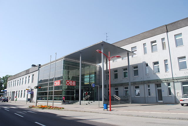
Ernsthofen (Ernsthofen)
- municipality in Austria
Ernsthofen is a small village located in Austria, specifically in the Lower Austria region. While it may not be as well-known as some of the larger hiking destinations in the country, it offers some beautiful surrounding landscapes and can be a peaceful spot for hiking enthusiasts.
Hiking Highlights in and around Ernsthofen:
-
Scenic Trails: The area around Ernsthofen features a mix of flat and rolling terrain, making it suitable for various hiking skill levels. You can find paths that lead through forests, fields, and along rivers.
-
Local Flora and Fauna: Hiking around Ernsthofen can provide opportunities to observe local wildlife and plant species. The region is characterized by rich biodiversity, including various bird species.
-
Historic Sites: Depending on your chosen route, you might encounter small villages, churches, or other cultural landmarks that tell the story of the area’s history.
-
Connecting Trails: Ernsthofen is relatively close to larger hiking areas, such as the Vienna Woods (Wienerwald) or the Mühlviertel region. If you’re looking for a more extensive hiking experience, consider using Ernsthofen as a base to explore these nearby areas.
-
Seasonal Considerations: In spring and summer, the area is lush and green, while fall offers stunning foliage colors. Winter can be colder, and if snow is present, some trails may be more suited for snowshoeing or cross-country skiing.
Practical Tips:
-
Local Maps: Before heading out, it’s advisable to pick up local hiking maps or guides to help navigate the area’s trails.
-
Weather: Always check the weather forecast before your hike, as conditions can change rapidly in the region.
-
Appropriate Gear: Wear sturdy hiking boots, dress in layers, and carry water and snacks. Additionally, a first aid kit is a good idea for longer hikes.
-
Respect Nature: Make sure to follow Leave No Trace principles to preserve the natural beauty of the area.
While Ernsthofen might not be a premier hiking destination on its own, it can offer a serene experience for those looking to explore the natural beauty of Austria in a quieter setting. Enjoy your hiking adventure!
- Country:

- Local Dialing Code: 07435
- Licence Plate Code: AM
- Coordinates: 48° 7' 40" N, 14° 28' 57" E


- GPS tracks (wikiloc): [Link]
- AboveSeaLevel: 284 м m
- Area: 19.20 sq km
- Population: 2230
- Web site: http://www.ernsthofen.gv.at/
- Wikipedia en: wiki(en)
- Wikipedia: wiki(de)
- Wikidata storage: Wikidata: Q673846
- Wikipedia Commons Category: [Link]
- Freebase ID: [/m/02qsny1]
- GeoNames ID: Alt: [2779944]
- VIAF ID: Alt: [242759860]
- GND ID: Alt: [4799037-5]
- WOEID: [541545]
- Austrian municipality key: [30509]
Shares border with regions:
Haag
- municipality in Austria
Haag, located in the Amstetten district of Lower Austria, offers a variety of hiking opportunities that cater to different skill levels and preferences. The area is surrounded by beautiful landscapes, including rolling hills, forests, and rivers, making it a picturesque destination for outdoor enthusiasts....
- Country:

- Postal Code: 3350
- Local Dialing Code: 07434
- Licence Plate Code: AM
- Coordinates: 48° 6' 44" N, 14° 33' 56" E


- GPS tracks (wikiloc): [Link]
- AboveSeaLevel: 346 м m
- Area: 54.96 sq km
- Population: 5548
- Web site: [Link]

St. Valentin
- municipality in Austria
St. Valentin, located in the province of South Tyrol in northern Italy, offers a variety of hiking opportunities that cater to different skill levels and preferences. Nestled in the scenic Val d’Isarco, St. Valentin is surrounded by lush landscapes and beautiful mountain scenery. Here are some key points about hiking in the area:...
- Country:

- Local Dialing Code: 07435
- Licence Plate Code: AM
- Coordinates: 48° 10' 29" N, 14° 32' 0" E


- GPS tracks (wikiloc): [Link]
- AboveSeaLevel: 272 м m
- Area: 45.64 sq km
- Population: 9340
- Web site: [Link]
Haidershofen
- municipality in Austria
Haidershofen, a small village located in Austria, is surrounded by beautiful natural landscapes that make it an excellent destination for hiking enthusiasts. Here are some aspects you might consider when planning a hike in Haidershofen:...
- Country:

- Postal Code: 4431
- Licence Plate Code: AM
- Coordinates: 48° 4' 36" N, 14° 27' 35" E


- GPS tracks (wikiloc): [Link]
- AboveSeaLevel: 285 м m
- Area: 32.04 sq km
- Population: 3670
- Web site: [Link]

Kronstorf
- municipality in Austria
Kronstorf, a charming municipality in Austria's Upper Austria region, offers several picturesque hiking opportunities for outdoor enthusiasts. Nestled near the Danube River and surrounded by lush landscapes, Kronstorf serves as an excellent base for various hiking trails....
- Country:

- Postal Code: 4484
- Local Dialing Code: 07225
- Licence Plate Code: LL
- Coordinates: 48° 8' 34" N, 14° 28' 0" E


- GPS tracks (wikiloc): [Link]
- AboveSeaLevel: 277 м m
- Area: 21 sq km
- Population: 3389
- Web site: [Link]
