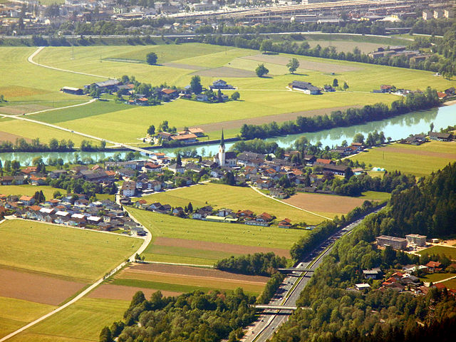
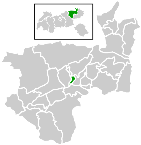
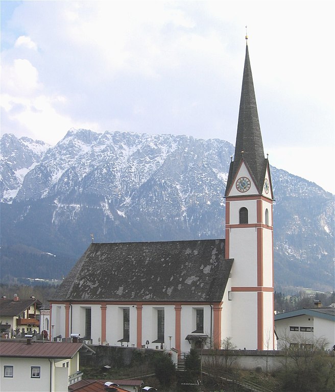
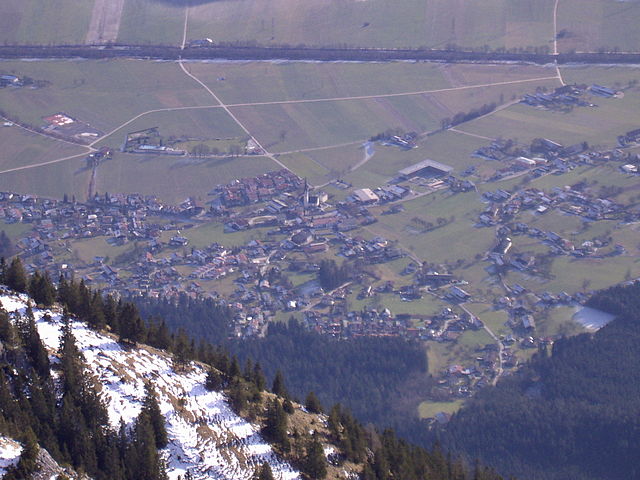
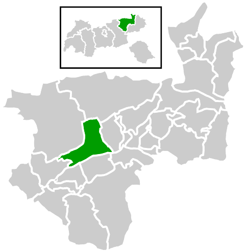
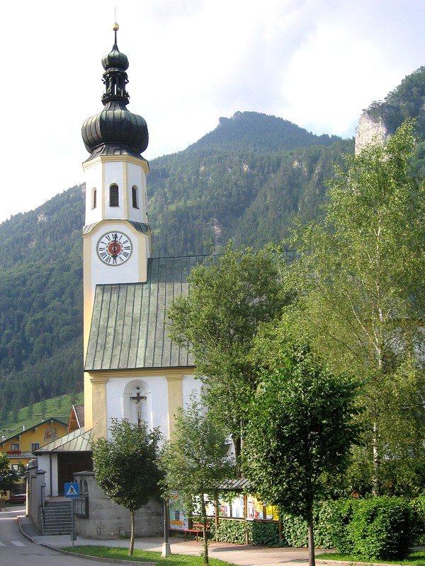
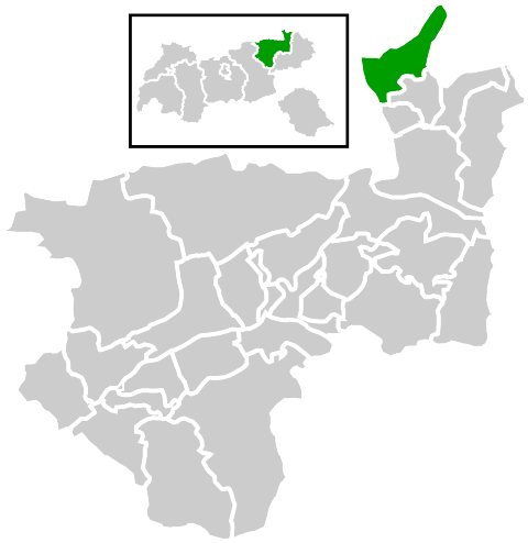
Kufstein District (Bezirk Kufstein)
- district of Austria
 Hiking in Kufstein District
The Kufstein District, located in the federal state of Tyrol, Austria, is a fantastic area for hiking enthusiasts. It features stunning alpine landscapes, charming villages, and well-established trails that cater to various skill levels.
Popular Hiking Areas and Trails
-
Rauriser Hochalpen Nature Park: This natural park offers numerous trails with varying difficulty levels, perfect for both beginners and seasoned hikers. The scenery is breathtaking, with lush meadows, mountain lakes, and impressive peaks.
-
Kaisergebirge: Known for its dramatic limestone formations, the Kaisergebirge mountain range is a highlight for many hikers. The trails here often provide panoramic views and lead to various huts where you can rest and enjoy traditional Tyrolean cuisine.
-
Ski Area Zahmer Kaiser: While primarily known for skiing, this area offers excellent summer hiking trails. The terrain is gentle, making it a great choice for families and casual walkers.
-
Thiersee Region: This area not only has beautiful lake views but also features several hiking trails that meander through forests and meadows. The hike to the "Thiersee Klettersteig" is popular among those seeking a bit of adventure.
Recommendations
-
Trail Levels: Be sure to choose trails that match your fitness and experience level. Many paths are well-marked, but some routes may involve steeper sections or require a bit of climbing.
-
Preparation: Always carry enough water, snacks, and sun protection, as well as wear appropriate hiking gear and sturdy footwear.
-
Respect Nature: Follow the principles of Leave No Trace to help preserve the stunning environment of the Kufstein District.
-
Local Guides: Consider hiring a local guide for more challenging hikes or to gain insights into the area's flora, fauna, and history.
Seasonal Considerations
The best time for hiking in the Kufstein District typically spans from late spring to early autumn (May to October). In winter, many trails may be covered in snow, making them suitable for snowshoeing or skiing, but be aware of avalanche conditions.
Whether you're looking for a leisurely stroll or a challenging ascent, the Kufstein District offers a variety of hiking opportunities that allow you to immerse yourself in the natural beauty of the Tyrolean Alps. Enjoy your hiking adventure!
- Country:

- Capital: Kufstein
- Licence Plate Code: KU
- Coordinates: 47° 30' 0" N, 12° 6' 0" E


- GPS tracks (wikiloc): [Link]
- AboveSeaLevel: 646 м m
- Area: 969.90 sq km
- Population: 105466
- Web site: http://www.tirol.gv.at/bh-kufstein
- Wikipedia en: wiki(en)
- Wikipedia: wiki(de)
- Wikidata storage: Wikidata: Q255141
- Wikipedia Commons Category: [Link]
- Wikipedia Commons Maps Category: [Link]
- Freebase ID: [/m/06n43c]
- GeoNames ID: Alt: [2773299]
- VIAF ID: Alt: [237692093]
- GND ID: Alt: [4033489-2]
- archINFORM location ID: [14618]
- Library of Congress authority ID: Alt: [n88080968]
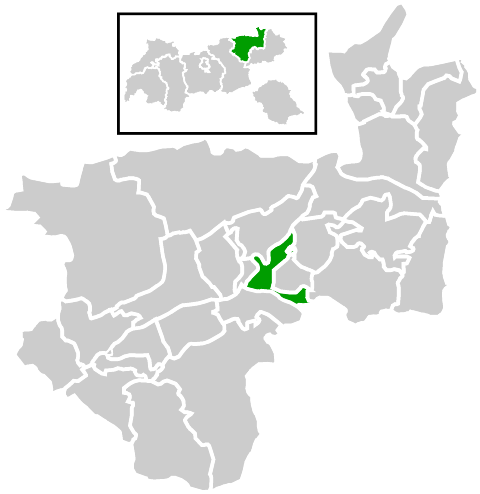
Includes regions:


Brixlegg
- municipality in Austria
Hiking in Brixlegg
Brixlegg, located in the Tyrol region of Austria, is a beautiful destination for hiking enthusiasts. Surrounded by the stunning alpine landscape of the Zillertal and Alpbachtal valleys, Brixlegg offers a variety of trails suitable for all levels of hikers, from leisurely walks to challenging mountain hikes....
- Country:
- Postal Code: 6230
- Local Dialing Code: 05337
- Licence Plate Code: KU
- Coordinates: 47° 25' 45" N, 11° 52' 39" E
- GPS tracks (wikiloc): [Link]
- AboveSeaLevel: 534 м m
- Area: 9.1 sq km
- Population: 2970
- Web site: [Link]

Wörgl
- town in Tyrol, Austria, in the Kufstein district
Hiking in Wörgl
Wörgl, located in the Tyrol region of Austria, offers a variety of hiking opportunities suitable for different skill levels and preferences. Surrounded by the beautiful landscape of the Alps, it is an ideal starting point for numerous hiking trails. Here are some highlights of hiking in and around Wörgl:...
- Country:
- Postal Code: 6300, 6302
- Local Dialing Code: 05332
- Licence Plate Code: KU
- Coordinates: 47° 28' 59" N, 12° 3' 59" E
- GPS tracks (wikiloc): [Link]
- AboveSeaLevel: 511 м m
- Area: 19.73 sq km
- Population: 13811
- Web site: [Link]
Angath
- municipality in Austria
Hiking in Angath
It seems there might be a misunderstanding, as "Angath" does not specifically refer to a well-known hiking destination. However, if you meant "Angath" as a place in India or another region that shares that name, please provide some additional context or details....
- Country:
- Postal Code: 6321
- Local Dialing Code: 05332
- Licence Plate Code: KU
- Coordinates: 47° 30' 0" N, 12° 4' 0" E
- GPS tracks (wikiloc): [Link]
- AboveSeaLevel: 500 м m
- Area: 3.50 sq km
- Population: 1008
- Web site: [Link]


Söll
- municipality in Austria
Hiking in Söll
Söll, a charming village located in the Tyrolean region of Austria, is a fantastic destination for hiking enthusiasts. Nestled in the Wilder Kaiser mountain range, it offers a diverse range of trails for all skill levels, from leisurely walks to challenging hikes. Here are some highlights and tips for hiking in Söll:...
- Country:
- Postal Code: 6306
- Local Dialing Code: 05333
- Licence Plate Code: KU
- Coordinates: 47° 30' 13" N, 12° 11' 31" E
- GPS tracks (wikiloc): [Link]
- AboveSeaLevel: 703 м m
- Area: 45.93 sq km
- Population: 3631
- Web site: [Link]


Brandenberg
- municipality in Austria
Hiking in Brandenberg
The Brandenburg region of Germany offers a variety of hiking opportunities, featuring beautiful landscapes, diverse ecosystems, and historical sites. Here are some key points to consider when hiking in Brandenburg:...
- Country:
- Postal Code: 6234
- Local Dialing Code: 05331
- Licence Plate Code: KU
- Coordinates: 47° 30' 29" N, 11° 53' 27" E
- GPS tracks (wikiloc): [Link]
- AboveSeaLevel: 919 м m
- Area: 130.18 sq km
- Population: 1523
- Web site: [Link]


Kramsach
- municipality in Austria
Hiking in Kramsach
Kramsach, located in the beautiful Tyrol region of Austria, is a fantastic destination for hiking enthusiasts. Nestled in the scenic Inn Valley, this charming village offers a variety of trails suitable for all levels of hikers, from beginners to advanced trekkers....
- Country:
- Postal Code: 6233
- Local Dialing Code: 05337
- Licence Plate Code: KU
- Coordinates: 47° 26' 41" N, 11° 52' 53" E
- GPS tracks (wikiloc): [Link]
- AboveSeaLevel: 520 м m
- Area: 26.9 sq km
- Population: 4891
- Web site: [Link]


Rattenberg
- municipality in Austria
Hiking in Rattenberg
Rattenberg, a picturesque town located in Austria's Tyrol region, is not only known for its beautiful glass-making tradition and medieval architecture but also for its access to some excellent hiking opportunities in the surrounding area. Here are some highlights for hiking enthusiasts:...
- Country:
- Postal Code: 6240
- Local Dialing Code: 05337
- Licence Plate Code: KU
- Coordinates: 47° 26' 20" N, 11° 53' 36" E
- GPS tracks (wikiloc): [Link]
- AboveSeaLevel: 521 м m
- Area: 0.11 sq km
- Population: 411
- Web site: [Link]


Schwoich
- municipality in Austria
Hiking in Schwoich
Schwoich is a charming village located in the Tyrol region of Austria, just a short distance from the picturesque town of Kufstein. The area is renowned for its stunning natural landscapes, making it a fantastic destination for hiking enthusiasts of all levels....
- Country:
- Postal Code: 6334
- Local Dialing Code: 05372
- Licence Plate Code: KU
- Coordinates: 47° 33' 0" N, 12° 8' 0" E
- GPS tracks (wikiloc): [Link]
- AboveSeaLevel: 583 м m
- Area: 18.77 sq km
- Population: 2515
- Web site: [Link]

Kirchbichl
- municipality in Austria
Hiking in Kirchbichl
Kirchbichl is a charming village located in the Tyrol region of Austria, surrounded by stunning alpine landscapes and offering numerous hiking opportunities. Here are some highlights and tips for hiking in and around Kirchbichl:...
- Country:
- Postal Code: 6322
- Local Dialing Code: 05332
- Licence Plate Code: KU
- Coordinates: 47° 31' 0" N, 12° 4' 0" E
- GPS tracks (wikiloc): [Link]
- AboveSeaLevel: 515 м m
- Area: 15.0 sq km
- Population: 5855
- Web site: [Link]


Ebbs
- municipality in Austria
Hiking in Ebbs
Hiking in Ebbs can be a wonderful experience, as this charming village is located in the beautiful region of Tyrol, Austria, near the border with Germany. The surrounding area offers a variety of hiking trails that showcase stunning alpine scenery, lush meadows, and engaging wildlife....
- Country:
- Postal Code: 6341 und 6330
- Local Dialing Code: 05372 für Eichelwang; 05373
- Licence Plate Code: KU
- Coordinates: 47° 37' 48" N, 12° 12' 53" E
- GPS tracks (wikiloc): [Link]
- AboveSeaLevel: 475 м m
- Area: 40 sq km
- Population: 5601
- Web site: [Link]


Radfeld
- municipality in Austria
Hiking in Radfeld
Radfeld, located in the Tyrol region of Austria, is a beautiful destination for hiking enthusiasts. Nestled in the scenic Inn Valley and surrounded by the majestic Alps, Radfeld offers diverse trails catering to all skill levels, from leisurely strolls to more challenging hikes....
- Country:
- Postal Code: 6241
- Local Dialing Code: 05337
- Licence Plate Code: KU
- Coordinates: 47° 26' 46" N, 11° 54' 41" E
- GPS tracks (wikiloc): [Link]
- AboveSeaLevel: 512 м m
- Area: 14.32 sq km
- Population: 2495
- Web site: [Link]
Kundl
- municipality in Austria
Hiking in Kundl
Kundl, located in the Tyrol region of Austria, is a great starting point for various hiking adventures, surrounded by stunning alpine landscapes. The town itself is nestled at the foot of the Alps, providing access to numerous trails suitable for all levels of hikers....
- Country:
- Postal Code: 6250
- Local Dialing Code: 05338
- Licence Plate Code: KU
- Coordinates: 47° 28' 11" N, 11° 59' 5" E
- GPS tracks (wikiloc): [Link]
- AboveSeaLevel: 526 м m
- Area: 21.9 sq km
- Population: 4464
- Web site: [Link]


Walchsee
- municipality in Austria
Hiking in Walchsee
Walchsee, located in Tyrol, Austria, is a beautiful area known for its picturesque lake surrounded by the stunning mountain scenery of the Kaiser Mountains. It's a popular destination for hikers of all levels, offering a variety of trails that capture the essence of the Austrian Alps....
- Country:
- Postal Code: 6344
- Local Dialing Code: 05374
- Licence Plate Code: KU
- Coordinates: 47° 39' 4" N, 12° 19' 7" E
- GPS tracks (wikiloc): [Link]
- AboveSeaLevel: 715 м m
- Area: 39.24 sq km
- Population: 1878
- Web site: [Link]

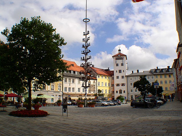
Kufstein
- municipality in Austria
Hiking in Kufstein
Kufstein, a picturesque town located in Tyrol, Austria, is surrounded by stunning mountains and offers a wide range of hiking opportunities for all levels of experience. Here are some key highlights about hiking in and around Kufstein:...
- Country:
- Postal Code: 6330
- Local Dialing Code: 05372
- Licence Plate Code: KU
- Coordinates: 47° 35' 0" N, 12° 10' 0" E
- GPS tracks (wikiloc): [Link]
- AboveSeaLevel: 504 м m
- Area: 39.37 sq km
- Population: 19223
- Web site: [Link]


Reith im Alpbachtal
- municipality in Austria
Hiking in Reith im Alpbachtal
Reith im Alpbachtal, located in the Tyrol region of Austria, is a picturesque destination for hikers, offering stunning alpine scenery and a variety of trails for all skill levels. The area is known for its charming villages, lush meadows, and dramatic mountain vistas....
- Country:
- Postal Code: 6235
- Local Dialing Code: 05337
- Licence Plate Code: KU
- Coordinates: 47° 25' 0" N, 11° 52' 42" E
- GPS tracks (wikiloc): [Link]
- AboveSeaLevel: 637 м m
- Area: 27.41 sq km
- Population: 2722
- Web site: [Link]


Angerberg
- municipality in Austria
Hiking in Angerberg
Angerberg is a picturesque area in Tyrol, Austria, often appreciated for its stunning landscapes and extensive hiking opportunities. Situated in the scenic Inn Valley, it offers a variety of trails suitable for hikers of all levels, from leisurely walks to more challenging mountain treks....
- Country:
- Postal Code: 6320
- Local Dialing Code: 05332
- Licence Plate Code: KU
- Coordinates: 47° 30' 0" N, 12° 1' 0" E
- GPS tracks (wikiloc): [Link]
- AboveSeaLevel: 650 м m
- Area: 19.53 sq km
- Population: 1890
- Web site: [Link]
Wildschönau
- municipality in Austria
Hiking in Wildschönau
Wildschönau is a picturesque valley located in the Tyrol region of Austria, renowned for its stunning landscapes, charming villages, and abundant hiking opportunities. Here’s a detailed overview of what to expect when hiking in Wildschönau:...
- Country:
- Postal Code: 6311, 6313, 6314
- Local Dialing Code: 05339
- Licence Plate Code: KU
- Coordinates: 47° 27' 0" N, 12° 3' 0" E
- GPS tracks (wikiloc): [Link]
- AboveSeaLevel: 936 м m
- Area: 97.42 sq km
- Population: 4242
- Web site: [Link]


Ellmau
- municipality in Austria
Hiking in Ellmau
Ellmau, located in the Tirol region of Austria, is a fantastic destination for hiking enthusiasts, offering a variety of trails that cater to different skill levels and preferences. Here are some highlights and tips for hiking in the Ellmau area:...
- Country:
- Postal Code: 6352
- Local Dialing Code: 05358
- Licence Plate Code: KU
- Coordinates: 47° 30' 50" N, 12° 18' 13" E
- GPS tracks (wikiloc): [Link]
- AboveSeaLevel: 820 м m
- Area: 36.4 sq km
- Population: 2828
- Web site: [Link]


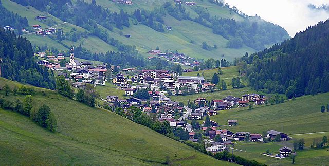
Alpbach
- village in Western Austria in the state of Tyrol
Hiking in Alpbach
Alpbach, located in the Tirol region of Austria, is a picturesque village renowned for its charming wooden architecture and stunning alpine scenery. It's a fantastic destination for hiking enthusiasts, offering a variety of trails suitable for all skill levels, from leisurely walks to more challenging hikes....
- Country:
- Postal Code: 6236
- Local Dialing Code: 05336
- Licence Plate Code: KU
- Coordinates: 47° 23' 55" N, 11° 56' 38" E
- GPS tracks (wikiloc): [Link]
- AboveSeaLevel: 975 м m
- Area: 58.38 sq km
- Population: 2561
- Web site: [Link]

Niederndorf
- municipality in Austria
Hiking in Niederndorf
Niederndorf, located in the Tyrolean region of Austria, offers beautiful hiking opportunities amidst stunning natural landscapes. The area is characterized by its picturesque mountains, lush valleys, and scenic views, making it a great destination for outdoor enthusiasts....
- Country:
- Postal Code: 6342
- Local Dialing Code: 05373
- Licence Plate Code: KU
- Coordinates: 47° 39' 0" N, 12° 12' 56" E
- GPS tracks (wikiloc): [Link]
- AboveSeaLevel: 500 м m
- Area: 7.2 sq km
- Population: 2736
- Web site: [Link]

Münster, Tyrol
- municipality in Austria
Hiking in Münster, Tyrol
Münster in Tyrol is a charming village located in the Austrian Alps, within a stunning natural landscape that offers a variety of hiking opportunities. Here are some key points to consider when hiking in Münster:...
- Country:
- Postal Code: 6232
- Local Dialing Code: 05337
- Licence Plate Code: KU
- Coordinates: 47° 25' 16" N, 11° 50' 2" E
- GPS tracks (wikiloc): [Link]
- AboveSeaLevel: 534 м m
- Area: 27.82 sq km
- Population: 3317
- Web site: [Link]


Bad Häring
- municipality in Austria
Hiking in Bad Häring
Bad Häring is a lovely destination for hiking enthusiasts, nestled in the Tyrolean region of Austria. It is surrounded by stunning alpine scenery, offering various trails suitable for all skill levels. Here are some highlights and tips for hiking in Bad Häring:...
- Country:
- Postal Code: 6323
- Local Dialing Code: 05332
- Licence Plate Code: KU
- Coordinates: 47° 30' 45" N, 12° 7' 25" E
- GPS tracks (wikiloc): [Link]
- AboveSeaLevel: 650 м m
- Area: 9.28 sq km
- Population: 2777
- Web site: [Link]
Rettenschöss
- municipality in Austria
Hiking in Rettenschöss
Rettenschöss is a picturesque area located in Austria, typically known for its beautiful landscapes and outdoor activities, including hiking. Nestled in the Tyrolean region, it's surrounded by stunning mountains, forests, and valleys, which provide a variety of hiking opportunities suitable for all skill levels....
- Country:
- Postal Code: 6342
- Local Dialing Code: 05373
- Licence Plate Code: KU
- Coordinates: 47° 39' 0" N, 12° 16' 0" E
- GPS tracks (wikiloc): [Link]
- AboveSeaLevel: 680 м m
- Area: 16.28 sq km
- Population: 513
- Web site: [Link]
Niederndorferberg
- municipality in Austria
Hiking in Niederndorferberg
Niederndorferberg is a beautiful destination for hiking enthusiasts located in the Tyrolean region of Austria, near the border with Germany. This area is characterized by picturesque landscapes, rolling hills, and stunning mountain views, making it an excellent spot for both casual hikers and more experienced adventurers....
- Country:
- Postal Code: 6346
- Local Dialing Code: 05373
- Licence Plate Code: KU
- Coordinates: 47° 40' 34" N, 12° 15' 24" E
- GPS tracks (wikiloc): [Link]
- AboveSeaLevel: 738 м m
- Area: 12.15 sq km
- Population: 706
- Web site: [Link]

Breitenbach am Inn
- municipality in Austria
Hiking in Breitenbach am Inn
Breitenbach am Inn is a charming village located in Tyrol, Austria, surrounded by stunning alpine scenery, making it an ideal destination for hiking enthusiasts. The area offers a variety of hiking trails suitable for different skill levels, from family-friendly walks to more challenging mountain hikes....
- Country:
- Postal Code: 6252
- Local Dialing Code: 05338
- Licence Plate Code: KU
- Coordinates: 47° 28' 44" N, 11° 58' 24" E
- GPS tracks (wikiloc): [Link]
- AboveSeaLevel: 510 м m
- Area: 37.99 sq km
- Population: 3475
- Web site: [Link]

Mariastein
- municipality in Austria
Hiking in Mariastein
Mariastein is a charming village located in Tyrol, Austria, known for its beautiful landscapes and extensive hiking opportunities. The area is characterized by stunning mountain views, lush green meadows, and picturesque alpine scenery, making it a perfect destination for hikers of all levels....
- Country:
- Postal Code: 6324
- Local Dialing Code: 05332
- Licence Plate Code: KU
- Coordinates: 47° 31' 31" N, 12° 3' 13" E
- GPS tracks (wikiloc): [Link]
- AboveSeaLevel: 575 м m
- Area: 2.4 sq km
- Population: 362
- Web site: [Link]


Scheffau am Wilden Kaiser
- municipality in Austria
Hiking in Scheffau am Wilden Kaiser
Scheffau am Wilden Kaiser is a picturesque village located in the Tyrol region of Austria, known for its stunning alpine scenery and access to numerous hiking trails. It is part of the Wilder Kaiser mountain range, which offers a variety of hiking opportunities for all skill levels, from easy walks to challenging high-altitude treks. Here are some highlights and tips for hiking in this beautiful area:...
- Country:
- Postal Code: 6351
- Local Dialing Code: 05358
- Licence Plate Code: KU
- Coordinates: 47° 31' 0" N, 12° 15' 0" E
- GPS tracks (wikiloc): [Link]
- AboveSeaLevel: 745 м m
- Area: 31.45 sq km
- Population: 1449
- Web site: [Link]
Thiersee
- municipality in Austria
Hiking in Thiersee
Thiersee is a beautiful region located in Tyrol, Austria, known for its stunning natural landscapes, charming villages, and a wide range of outdoor activities, especially hiking. Here are some highlights and tips for hiking in Thiersee:...
- Country:
- Postal Code: 6335
- Local Dialing Code: 05376
- Licence Plate Code: KU
- Coordinates: 47° 34' 0" N, 12° 5' 0" E
- GPS tracks (wikiloc): [Link]
- AboveSeaLevel: 678 м m
- Area: 108.61 sq km
- Population: 2990
- Web site: [Link]
Erl
- municipality in Austria
Hiking in Erl
Erl, a picturesque village in Austria located in the Tyrol region near the border with Germany, is known for its stunning natural landscapes and numerous hiking opportunities. The surrounding area features beautiful mountains, lakes, and forests, making it an ideal destination for outdoor enthusiasts....
- Country:
- Postal Code: 6343
- Local Dialing Code: 05373
- Licence Plate Code: KU
- Coordinates: 47° 40' 54" N, 12° 10' 51" E
- GPS tracks (wikiloc): [Link]
- AboveSeaLevel: 476 м m
- Area: 27.0 sq km
- Population: 1540
- Web site: [Link]


Langkampfen
- municipality in Austria
Hiking in Langkampfen
Langkampfen is a picturesque village in Tyrol, Austria, situated close to the scenic mountain ranges of the region. Hiking in this area offers a combination of breathtaking landscapes, diverse trails, and the opportunity to experience the charm of the Austrian Alps....
- Country:
- Postal Code: 6336
- Local Dialing Code: 05332
- Licence Plate Code: KU
- Coordinates: 47° 33' 7" N, 12° 6' 14" E
- GPS tracks (wikiloc): [Link]
- AboveSeaLevel: 504 м m
- Area: 26.5 sq km
- Population: 4108
- Web site: [Link]
Shares border with regions:

Miesbach
- district of Bavaria, Germany
Hiking in Miesbach
Miesbach is a scenic district located in Bavaria, Germany, known for its stunning landscapes, rolling hills, and proximity to the Alps. It offers a wealth of hiking opportunities for both beginners and experienced hikers. Here are some highlights about hiking in the Miesbach district:...
- Country:

- Capital: Miesbach
- Licence Plate Code: MB
- Coordinates: 47° 44' 24" N, 11° 48' 36" E
- GPS tracks (wikiloc): [Link]
- AboveSeaLevel: 741 м m
- Area: 864.00 sq km
- Population: 93630
- Web site: [Link]

Rosenheim
- district of Bavaria, Germany
Hiking in Rosenheim
Rosenheim district, located in Bavaria, Germany, offers a diverse range of hiking opportunities amidst beautiful landscapes, charming villages, and stunning natural scenery. Here are some highlights for hiking in the region:...
- Country:
- Capital: Rosenheim
- Licence Plate Code: WS; RO; AIB
- Coordinates: 47° 55' 12" N, 12° 10' 12" E
- GPS tracks (wikiloc): [Link]
- AboveSeaLevel: 512 м m
- Area: 1439.40 sq km
- Population: 190104
- Web site: [Link]
Traunstein
- district of Bavaria, Germany
Hiking in Traunstein
Traunstein, located in Bavaria, Germany, is a beautiful area known for its picturesque landscapes, charming villages, and a variety of hiking opportunities. The region is characterized by its rolling hills, mountains, and lakes, making it ideal for outdoor enthusiasts. Here are some highlights for hiking in Traunstein:...
- Country:
- Capital: Traunstein
- Licence Plate Code: TS
- Coordinates: 47° 53' 24" N, 12° 34' 48" E
- GPS tracks (wikiloc): [Link]
- AboveSeaLevel: 560 м m
- Area: 1533.92 sq km
- Population: 145408
- Web site: [Link]