Lécousse (Lécousse)

- commune in Ille-et-Vilaine, France
- Country:

- Postal Code: 35133
- Coordinates: 48° 22' 3" N, 1° 13' 4" E


- GPS tracks (wikiloc): [Link]
- Area: 11.07 sq km
- Population: 3178
- Web site: http://www.lecousse.fr
- Wikipedia en: wiki(en)
- Wikipedia: wiki(fr)
- Wikidata storage: Wikidata: Q1074702
- Wikipedia Commons Category: [Link]
- Freebase ID: [/m/03m9xc4]
- Freebase ID: [/m/03m9xc4]
- GeoNames ID: Alt: [6432730]
- GeoNames ID: Alt: [6432730]
- SIREN number: [213501505]
- SIREN number: [213501505]
- OSM relation ID: [123372]
- OSM relation ID: [123372]
- INSEE municipality code: 35150
- INSEE municipality code: 35150
Shares border with regions:


Laignelet
- commune in Ille-et-Vilaine, France
- Country:
- Postal Code: 35133
- Coordinates: 48° 22' 15" N, 1° 9' 1" E
- GPS tracks (wikiloc): [Link]
- Area: 14.83 sq km
- Population: 1158
- Web site: [Link]


Parigné
- commune in Ille-et-Vilaine, France
- Country:
- Postal Code: 35133
- Coordinates: 48° 25' 41" N, 1° 11' 30" E
- GPS tracks (wikiloc): [Link]
- Area: 20.72 sq km
- Population: 1322
- Web site: [Link]

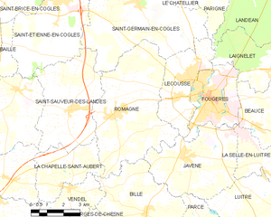
Romagné
- commune in Ille-et-Vilaine, France
- Country:
- Postal Code: 35133
- Coordinates: 48° 20' 32" N, 1° 16' 38" E
- GPS tracks (wikiloc): [Link]
- Area: 26.93 sq km
- Population: 2351
- Web site: [Link]


Landéan
- commune in Ille-et-Vilaine, France
- Country:
- Postal Code: 35133
- Coordinates: 48° 24' 47" N, 1° 9' 9" E
- GPS tracks (wikiloc): [Link]
- Area: 27.31 sq km
- Population: 1247
- Web site: [Link]
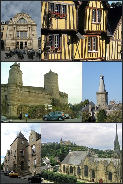

Fougères
- commune in Ille-et-Vilaine, France
- Country:
- Postal Code: 35300
- Coordinates: 48° 21' 6" N, 1° 12' 0" E
- GPS tracks (wikiloc): [Link]
- AboveSeaLevel: 171 м m
- Area: 10.46 sq km
- Population: 20235
- Web site: [Link]


Javené
- commune in Ille-et-Vilaine, France
- Country:
- Postal Code: 35133
- Coordinates: 48° 19' 9" N, 1° 12' 57" E
- GPS tracks (wikiloc): [Link]
- Area: 18.45 sq km
- Population: 2055
- Web site: [Link]


Saint-Germain-en-Coglès
- commune in Ille-et-Vilaine, France
- Country:
- Postal Code: 35133
- Coordinates: 48° 24' 21" N, 1° 15' 48" E
- GPS tracks (wikiloc): [Link]
- Area: 32.09 sq km
- Population: 2044
- Web site: [Link]