Léogeats (Léogeats)

- commune in Gironde, France
- Country:

- Postal Code: 33210
- Coordinates: 44° 30' 43" N, 0° 22' 0" E


- GPS tracks (wikiloc): [Link]
- Area: 19.61 sq km
- Population: 800
- Web site: http://www.leogeats.fr
- Wikipedia en: wiki(en)
- Wikipedia: wiki(fr)
- Wikidata storage: Wikidata: Q192944
- Wikipedia Commons Category: [Link]
- Freebase ID: [/m/03nr_4b]
- GeoNames ID: Alt: [3003068]
- SIREN number: [213302375]
- INSEE municipality code: 33237
Shares border with regions:


Noaillan
- commune in Gironde, France
- Country:
- Postal Code: 33730
- Coordinates: 44° 28' 50" N, 0° 21' 59" E
- GPS tracks (wikiloc): [Link]
- Area: 31.8 sq km
- Population: 1674
- Web site: [Link]


Fargues
- commune in Gironde, France
- Country:
- Postal Code: 33210
- Coordinates: 44° 32' 9" N, 0° 17' 48" E
- GPS tracks (wikiloc): [Link]
- Area: 15.41 sq km
- Population: 1592
- Web site: [Link]

Budos
- commune in Gironde, France
- Country:
- Postal Code: 33720
- Coordinates: 44° 32' 0" N, 0° 23' 8" E
- GPS tracks (wikiloc): [Link]
- Area: 21.1 sq km
- Population: 775
- Web site: [Link]

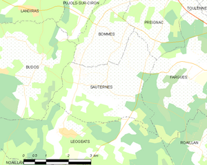
Sauternes
- commune in Gironde, France
- Country:
- Postal Code: 33210
- Coordinates: 44° 31' 54" N, 0° 20' 34" E
- GPS tracks (wikiloc): [Link]
- Area: 11.32 sq km
- Population: 777
- Web site: [Link]


Balizac
- commune in Gironde, France
- Country:
- Postal Code: 33730
- Coordinates: 44° 29' 15" N, 0° 26' 39" E
- GPS tracks (wikiloc): [Link]
- Area: 41.78 sq km
- Population: 493


Roaillan
- commune in Gironde, France
- Country:
- Postal Code: 33210
- Coordinates: 44° 29' 56" N, 0° 16' 55" E
- GPS tracks (wikiloc): [Link]
- Area: 11.48 sq km
- Population: 1633
- Web site: [Link]