
Lüneburg (Lüneburg)

- town in the German state of Lower Saxony
 Hiking in Lüneburg
Lüneburg, located in Lower Saxony, Germany, offers a variety of hiking opportunities that showcase its beautiful landscapes, historical sites, and unique natural features. Here are some key points about hiking in the region:
1. :
- This is one of the most popular hiking areas near Lüneburg. The heath is renowned for its picturesque heather fields, especially in late summer when they bloom.
- There are numerous marked trails suitable for different levels of hikers. A popular route is the Heidschnuckenweg, a long-distance trail that runs through the heath.
2. :
- Lüneburg has a rich history, and hiking through the town you can explore medieval buildings, old salt works, and the historic city center, which features beautiful architecture.
- Consider hiking the "Salt Road" (Salzstraße), which follows routes traditionally used for salt trading.
3. :
- Explore the various nature reserves in the area, including the Lüneburg Heath Nature Reserve. These spots offer well-maintained trails with opportunities for birdwatching and experiencing local flora and fauna.
4. :
- Trail Maps: Make sure to grab a map or download route apps. Local tourist information centers are good sources for trail maps and additional information.
- Best Time to Visit: Late summer (August-September) is ideal for visiting the heath in full bloom, but spring and early autumn also offer pleasant hiking conditions.
- Gear: Wear sturdy hiking boots, and consider the weather, as it can change rapidly. Bring water, snacks, and appropriate weather gear.
5. :
- Many of the trails around Lüneburg are easily accessible, with suitable parking options and public transportation links.
- Trails range from leisurely walks to more challenging hikes, catering to families and experienced hikers alike.
6. :
- After a day of hiking, enjoy local cuisine in Lüneburg's restaurants. Try regional specialties such as "Rinderroulade" and local craft beers.
With its unique blend of natural beauty and historical significance, Lüneburg is a fantastic destination for hiking enthusiasts looking to explore the German countryside.
- Country:

- Postal Code: 21339; 21337; 21335
- Local Dialing Code: 04131
- Licence Plate Code: LG
- Coordinates: 53° 15' 9" N, 10° 24' 52" E


- GPS tracks (wikiloc): [Link]
- AboveSeaLevel: 17 м m
- Area: 70.34 sq km
- Population: 74494
- Web site: https://www.hansestadtlueneburg.de/
- Wikipedia en: wiki(en)
- Wikipedia: wiki(de)
- Wikidata storage: Wikidata: Q3920
- Wikipedia Commons Gallery: [Link]
- Wikipedia Commons Category: [Link]
- Wikipedia Commons Maps Category: [Link]
- Freebase ID: [/m/0135kl]
- Freebase ID: [/m/0135kl]
- Freebase ID: [/m/0135kl]
- GeoNames ID: Alt: [2875115]
- GeoNames ID: Alt: [2875115]
- GeoNames ID: Alt: [2875115]
- BnF ID: [12385730p]
- BnF ID: [12385730p]
- BnF ID: [12385730p]
- VIAF ID: Alt: [136029148]
- VIAF ID: Alt: [136029148]
- VIAF ID: Alt: [136029148]
- OSM relation ID: [2420744]
- OSM relation ID: [2420744]
- OSM relation ID: [2420744]
- GND ID: Alt: [4036512-8]
- GND ID: Alt: [4036512-8]
- GND ID: Alt: [4036512-8]
- archINFORM location ID: [8965]
- archINFORM location ID: [8965]
- archINFORM location ID: [8965]
- Library of Congress authority ID: Alt: [n79065823]
- Library of Congress authority ID: Alt: [n79065823]
- Library of Congress authority ID: Alt: [n79065823]
- PACTOLS thesaurus ID: [pcrtx9Z5MKSOT7]
- PACTOLS thesaurus ID: [pcrtx9Z5MKSOT7]
- PACTOLS thesaurus ID: [pcrtx9Z5MKSOT7]
- MusicBrainz area ID: [d5f0f45c-e826-4e9b-92f9-9d6acc9c4150]
- MusicBrainz area ID: [d5f0f45c-e826-4e9b-92f9-9d6acc9c4150]
- MusicBrainz area ID: [d5f0f45c-e826-4e9b-92f9-9d6acc9c4150]
- Quora topic ID: [Lüneburg]
- Quora topic ID: [Lüneburg]
- Quora topic ID: [Lüneburg]
- Encyclopædia Britannica Online ID: [place/Luneburg-Germany]
- Encyclopædia Britannica Online ID: [place/Luneburg-Germany]
- Encyclopædia Britannica Online ID: [place/Luneburg-Germany]
- Gran Enciclopèdia Catalana ID: [0038764]
- Gran Enciclopèdia Catalana ID: [0038764]
- Gran Enciclopèdia Catalana ID: [0038764]
- EMLO location ID: [d33be792-7a51-4711-92fa-9a2803f86c44]
- EMLO location ID: [d33be792-7a51-4711-92fa-9a2803f86c44]
- EMLO location ID: [d33be792-7a51-4711-92fa-9a2803f86c44]
- Facebook Places ID: [108577182506991]
- Facebook Places ID: [108577182506991]
- Facebook Places ID: [108577182506991]
- ISNI: Alt: [0000 0004 0394 5042]
- ISNI: Alt: [0000 0004 0394 5042]
- ISNI: Alt: [0000 0004 0394 5042]
- National Library of Israel ID: [000975745]
- National Library of Israel ID: [000975745]
- National Library of Israel ID: [000975745]
- Nomisma ID: [lueneburg]
- Nomisma ID: [lueneburg]
- Nomisma ID: [lueneburg]
- Global Anabaptist Mennonite Encyclopedia Online ID: [Lüneburg (Niedersachsen, Germany)]
- Global Anabaptist Mennonite Encyclopedia Online ID: [Lüneburg (Niedersachsen, Germany)]
- Global Anabaptist Mennonite Encyclopedia Online ID: [Lüneburg (Niedersachsen, Germany)]
- German municipality key: 03355022
- German municipality key: 03355022
- German municipality key: 03355022
- US National Archives Identifier: 10044956
- US National Archives Identifier: 10044956
- US National Archives Identifier: 10044956
Shares border with regions:
Barendorf
- municipality of Germany
Hiking in Barendorf
Barendorf is a small village in Germany, located in the northern part of the country, not far from Hamburg. While Barendorf itself may not be a widely recognized hiking destination, the surrounding areas offer opportunities for varied outdoor activities, including hiking....
- Country:
- Postal Code: 21397
- Local Dialing Code: 04137
- Licence Plate Code: LG
- Coordinates: 53° 13' 44" N, 10° 31' 18" E
- GPS tracks (wikiloc): [Link]
- AboveSeaLevel: 75 м m
- Area: 9.24 sq km
- Population: 2473
- Web site: [Link]
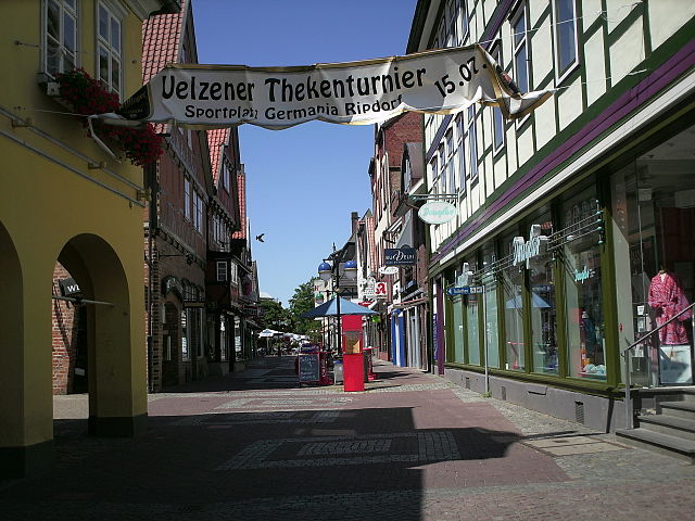

Uelzen
- town in northwest Germany
Hiking in Uelzen
Uelzen, located in Lower Saxony, Germany, is a charming town known for its picturesque landscapes and opportunities for hiking. The region surrounding Uelzen offers a variety of trails that cater to different skill levels, making it a great destination for both novice and experienced hikers....
- Country:
- Postal Code: 29525
- Local Dialing Code: 0581
- Licence Plate Code: UE
- Coordinates: 52° 57' 53" N, 10° 33' 57" E
- GPS tracks (wikiloc): [Link]
- AboveSeaLevel: 43 м m
- Area: 136.84 sq km
- Population: 33633
- Web site: [Link]


Adendorf
- municipality of Germany
Hiking in Adendorf
Adendorf, a small town in Lower Saxony, Germany, is typically known for its picturesque landscapes and proximity to various natural attractions. While it may not be as widely recognized as some larger hiking destinations, it offers several opportunities for hiking enthusiasts to explore the region's beautiful countryside....
- Country:
- Postal Code: 21365
- Local Dialing Code: 04131
- Licence Plate Code: LG
- Coordinates: 53° 17' 0" N, 10° 27' 0" E
- GPS tracks (wikiloc): [Link]
- AboveSeaLevel: 23 м m
- Area: 16.08 sq km
- Population: 10783
- Web site: [Link]


Kirchgellersen
- municipality of Germany
Hiking in Kirchgellersen
Kirchgellersen is a quaint village located in Lower Saxony, Germany, near the historic city of Lüneburg. While it may not be world-renowned for hiking, the surrounding areas offer some pleasant opportunities for walking and enjoying nature....
- Country:
- Postal Code: 21394
- Local Dialing Code: 04135
- Licence Plate Code: LG
- Coordinates: 53° 14' 0" N, 10° 18' 0" E
- GPS tracks (wikiloc): [Link]
- AboveSeaLevel: 34 м m
- Area: 19.99 sq km
- Population: 2467
- Web site: [Link]


Bispingen
- municipality of Germany
Hiking in Bispingen
Bispingen is a charming small town located in Lower Saxony, Germany, and is part of the German Lüneburg Heath region. This area is known for its beautiful landscapes, extensive hiking trails, and unique heathland scenery, making it a great destination for outdoor enthusiasts....
- Country:
- Postal Code: 29646
- Local Dialing Code: 05194
- Licence Plate Code: SFA
- Coordinates: 53° 4' 58" N, 9° 59' 54" E
- GPS tracks (wikiloc): [Link]
- AboveSeaLevel: 78 м m
- Area: 128.55 sq km
- Population: 6486
- Web site: [Link]


Südergellersen
- municipality of Germany
Hiking in Südergellersen
Südergellersen is a quaint village located in Lower Saxony, Germany, and while it may not be widely known as a hiking destination, its surrounding area offers some lovely walking and hiking opportunities. The region's landscape features a mix of idyllic countryside, fields, and forested areas....
- Country:
- Postal Code: 21394
- Local Dialing Code: 04135
- Licence Plate Code: LG
- Coordinates: 53° 13' 0" N, 10° 18' 0" E
- GPS tracks (wikiloc): [Link]
- AboveSeaLevel: 56 м m
- Area: 18.46 sq km
- Population: 1675
- Web site: [Link]


Bardowick
- municipality of Germany
Hiking in Bardowick
Bardowick, a small town located near Lüneburg in Lower Saxony, Germany, offers a unique blend of historical charm and natural beauty, making it a great destination for hiking enthusiasts. Here are some insights about hiking in and around Bardowick:...
- Country:
- Postal Code: 21357
- Local Dialing Code: 04131
- Licence Plate Code: LG
- Coordinates: 53° 17' 37" N, 10° 23' 17" E
- GPS tracks (wikiloc): [Link]
- AboveSeaLevel: 10 м m
- Area: 23.25 sq km
- Population: 6993
- Web site: [Link]
Reppenstedt
- municipality of Germany
Hiking in Reppenstedt
Reppenstedt is a charming village located near Lüneburg in Lower Saxony, Germany. While it may not be widely known as a hiking destination, the surrounding area offers several opportunities for outdoor enthusiasts to explore nature through hiking....
- Country:
- Postal Code: 21391
- Local Dialing Code: 04131
- Licence Plate Code: LG
- Coordinates: 53° 15' 0" N, 10° 21' 11" E
- GPS tracks (wikiloc): [Link]
- AboveSeaLevel: 36 м m
- Area: 14.78 sq km
- Population: 7370
- Web site: [Link]


Scharnebeck
- municipality of Germany
Hiking in Scharnebeck
Scharnebeck is a small town located in Lower Saxony, Germany, known for its charming landscapes and proximity to lush green parks and nature reserves. While it might not be as famous as some hiking destinations in larger national parks, it offers several opportunities for outdoor activities and hiking enthusiasts....
- Country:
- Postal Code: 21379
- Local Dialing Code: 04136
- Licence Plate Code: LG
- Coordinates: 53° 18' 0" N, 10° 31' 0" E
- GPS tracks (wikiloc): [Link]
- AboveSeaLevel: 8 м m
- Area: 26.88 sq km
- Population: 3535
- Web site: [Link]
Vögelsen
- municipality of Germany
Hiking in Vögelsen
Vögelsen is a small community located near Lüneburg in Lower Saxony, Germany. While it may not be as well-known for hiking as some larger national parks or mountain regions, there are still opportunities for outdoor enthusiasts to explore the beautiful landscapes of the area....
- Country:
- Postal Code: 21360
- Local Dialing Code: 04131
- Licence Plate Code: LG
- Coordinates: 53° 17' 0" N, 10° 21' 0" E
- GPS tracks (wikiloc): [Link]
- AboveSeaLevel: 23 м m
- Area: 8.26 sq km
- Population: 2339
- Web site: [Link]
Reinstorf
- municipality of Germany
Hiking in Reinstorf
Reinstorf is a small village located in Lower Saxony, Germany, and while it may not be widely known as a major hiking destination, it offers opportunities for outdoor activities and exploration in the surrounding areas. Here's what you can typically expect when hiking near Reinstorf:...
- Country:
- Postal Code: 21400
- Local Dialing Code: 04137
- Licence Plate Code: LG
- Coordinates: 53° 14' 4" N, 10° 34' 24" E
- GPS tracks (wikiloc): [Link]
- AboveSeaLevel: 51 м m
- Area: 30.29 sq km
- Population: 1304
- Web site: [Link]

Wendisch Evern
- municipality of Germany
Hiking in Wendisch Evern
Wendisch Evern is a small village in Lower Saxony, Germany, located near the city of Lüneburg. While it may not be a traditionally recognized hiking destination, the region around Wendisch Evern offers some beautiful landscapes and opportunities for exploring nature....
- Country:
- Postal Code: 21403
- Local Dialing Code: 04131
- Licence Plate Code: LG
- Coordinates: 53° 13' 0" N, 10° 28' 0" E
- GPS tracks (wikiloc): [Link]
- AboveSeaLevel: 59 м m
- Area: 14.9 sq km
- Population: 1772
- Web site: [Link]