Lüneburg (Landkreis Lüneburg)

- German district of Lower Saxony
 Hiking in Lüneburg
Lüneburg district, located in Lower Saxony, Germany, is a wonderful area for hiking enthusiasts. The region is known for its scenic landscapes, featuring rolling hills, forests, rivers, and charming villages. Here are some highlights for hiking in Lüneburg:
Trails and Nature Reserves
-
Lüneburg Heath (Lüneburger Heide): This UNESCO Biosphere Reserve is famous for its vast heathlands, which bloom with beautiful purple heather in late summer. The heath is crisscrossed with a network of well-maintained hiking trails, allowing you to explore the unique flora and fauna.
-
Elbe River Trails: The Elbe is a major river that runs close to Lüneburg. There are several scenic walking paths along the riverbanks, offering tranquil views and the opportunity for birdwatching and observing wildlife.
-
Harburger Mountains: To the south of Lüneburg, the Harburg Mountains provide a more rugged hiking experience. The trails here offer varied terrain, including hills and deep forests, perfect for those looking for a challenge.
-
Nature Parks and Reserves: In addition to the heathland, several nature parks offer hiking opportunities, such as the Lüneburg Heath Nature Park. These areas are rich in biodiversity and provide serene environments for walking and hiking.
Hiking Recommendations
-
Route Planning: It’s advisable to check local trail maps or online resources for up-to-date information on trails and difficulty levels. Websites and apps like Komoot or AllTrails can be useful for route planning.
-
Seasonal Considerations: The best time for hiking in Lüneburg is typically late spring to early autumn, with warm temperatures and blooming landscapes. The heathland reaches its peak beauty in late summer.
-
Equipment: Make sure to wear sturdy hiking boots, carry enough water, and pack some snacks. Depending on the trail, trekking poles might be beneficial, especially in more rugged areas.
-
Wildlife and Nature: Keep an eye out for various birds and wildlife, and respect the natural environment. Stick to marked paths to minimize your impact.
Local Attractions
After a day of hiking, consider visiting Lüneburg, a historic town with beautiful medieval architecture, quaint cafes, and inviting restaurants. The saltworks and the old town are especially worth a visit.
Enjoy your hiking adventures in Lüneburg district! Whether you're looking for serene forest walks or expansive heathlands, there's something for every hiking enthusiast in this beautiful region.
- Country:

- Capital: Lüneburg
- Licence Plate Code: LG
- Coordinates: 53° 15' 0" N, 10° 30' 0" E


- GPS tracks (wikiloc): [Link]
- AboveSeaLevel: 8 м m
- Area: 1323.10 sq km
- Population: 181605
- Web site: http://www.landkreis-lueneburg.de
- Wikipedia en: wiki(en)
- Wikipedia: wiki(de)
- Wikidata storage: Wikidata: Q5910
- Wikipedia Commons Category: [Link]
- Freebase ID: [/m/0135jq]
- Freebase ID: [/m/0135jq]
- GeoNames ID: Alt: [3221040]
- GeoNames ID: Alt: [3221040]
- VIAF ID: Alt: [125507629]
- VIAF ID: Alt: [125507629]
- OSM relation ID: [2084746]
- OSM relation ID: [2084746]
- GND ID: Alt: [4036516-5]
- GND ID: Alt: [4036516-5]
- archINFORM location ID: [8966]
- archINFORM location ID: [8966]
- Library of Congress authority ID: Alt: [n82032235]
- Library of Congress authority ID: Alt: [n82032235]
- TGN ID: [7076853]
- TGN ID: [7076853]
- National Library of Israel ID: [000991338]
- National Library of Israel ID: [000991338]
- NUTS code: [DE935]
- NUTS code: [DE935]
- BabelNet ID: [00708432n]
- BabelNet ID: [00708432n]
- German district key: 03355
- German district key: 03355
Includes regions:

Gellersen
- Samtgemeinde in Lower Saxony
Hiking in Gellersen
Gellersen, located in Lower Saxony, Germany, offers a variety of hiking opportunities amidst picturesque landscapes, charming villages, and serene natural settings. While it may not be as widely known for hiking as some other regions in Germany, there are still plenty of trails and outdoor activities to explore. Here are some highlights about hiking in and around Gellersen:...
- Country:
- Coordinates: 53° 14' 52" N, 10° 21' 10" E
- GPS tracks (wikiloc): [Link]
- Population: 13167
- Web site: [Link]

Scharnebeck
- Samtgemeinde in Lower Saxony
Hiking in Scharnebeck
Scharnebeck, located in the district of Lüneburg in Lower Saxony, Germany, is not primarily known as a hiking destination, but it offers serene landscapes and opportunities for walking and exploring nature. Here are some insights on hiking in and around Scharnebeck:...
- Country:
- Coordinates: 53° 18' 0" N, 10° 31' 0" E
- GPS tracks (wikiloc): [Link]
- Area: 26.88 sq km
- Population: 15580

Dahlenburg
- Samtgemeinde in Lower Saxony
Hiking in Dahlenburg
Dahlenburg, located in the Samtgemeinde area of Lower Saxony, Germany, offers some opportunities for hiking and enjoying nature. The region is characterized by scenic landscapes, agricultural land, and forests. Here are some points of interest regarding hiking in Dahlenburg:...
- Country:
- Coordinates: 53° 11' 0" N, 10° 45' 0" E
- GPS tracks (wikiloc): [Link]
- Population: 6110


Adendorf
- municipality of Germany
Hiking in Adendorf
Adendorf, a small town in Lower Saxony, Germany, is typically known for its picturesque landscapes and proximity to various natural attractions. While it may not be as widely recognized as some larger hiking destinations, it offers several opportunities for hiking enthusiasts to explore the region's beautiful countryside....
- Country:
- Postal Code: 21365
- Local Dialing Code: 04131
- Licence Plate Code: LG
- Coordinates: 53° 17' 0" N, 10° 27' 0" E
- GPS tracks (wikiloc): [Link]
- AboveSeaLevel: 23 м m
- Area: 16.08 sq km
- Population: 10783
- Web site: [Link]


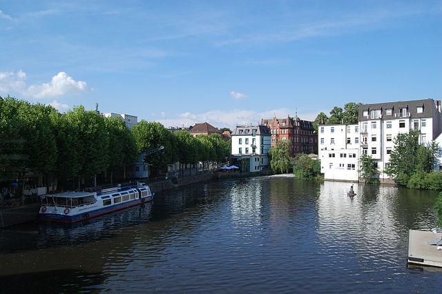
Lüneburg
- town in the German state of Lower Saxony
Hiking in Lüneburg
Lüneburg, located in Lower Saxony, Germany, offers a variety of hiking opportunities that showcase its beautiful landscapes, historical sites, and unique natural features. Here are some key points about hiking in the region:...
- Country:
- Postal Code: 21339; 21337; 21335
- Local Dialing Code: 04131
- Licence Plate Code: LG
- Coordinates: 53° 15' 9" N, 10° 24' 52" E
- GPS tracks (wikiloc): [Link]
- AboveSeaLevel: 17 м m
- Area: 70.34 sq km
- Population: 74494
- Web site: [Link]

Bardowick
- Samtgemeinde in Lower Saxony
Hiking in Bardowick
Bardowick, located in Lower Saxony, Germany, is a charming village that offers a unique blend of history and nature, making it an interesting destination for hiking enthusiasts. Here's what you might want to know about hiking in and around Bardowick:...
- Country:
- Coordinates: 53° 18' 2" N, 10° 23' 25" E
- GPS tracks (wikiloc): [Link]
- Area: 100.16 sq km
- Population: 17553
- Web site: [Link]

Amelinghausen
- Samtgemeinde in Lower Saxony
Hiking in Amelinghausen
Amelinghausen, located in Lower Saxony, Germany, is surrounded by picturesque nature, making it an appealing destination for hiking enthusiasts. The region boasts a mix of forests, fields, and scenic landscapes, offering a variety of trails suitable for different skill levels....
- Country:
- Coordinates: 53° 7' 31" N, 10° 12' 47" E
- GPS tracks (wikiloc): [Link]
- Area: 194.48 sq km
- Population: 8340
- Web site: [Link]
Ostheide
- Samtgemeinde in Lower Saxony
Hiking in Ostheide
Ostheide is a picturesque region in Lower Saxony, Germany, known for its beautiful landscapes, dense forests, and serene lakes. It's an excellent destination for hiking enthusiasts looking for a peaceful experience in nature....
- Country:
- Coordinates: 53° 14' 0" N, 10° 31' 0" E
- GPS tracks (wikiloc): [Link]
- Area: 129.78 sq km
- Population: 10428
- Web site: [Link]


Amt Neuhaus
- municipality of Germany
Hiking in Amt Neuhaus
Amt Neuhaus, located in Lower Saxony, Germany, is a charming area for hiking enthusiasts. The region is known for its natural beauty, including lush forests, serene rivers, and picturesque landscapes. Here are some highlights and tips for hiking in Amt Neuhaus:...
- Country:
- Postal Code: 19273
- Local Dialing Code: 038845; 038841
- Licence Plate Code: LG
- Coordinates: 53° 17' 7" N, 10° 55' 56" E
- GPS tracks (wikiloc): [Link]
- AboveSeaLevel: 6 м m
- Area: 237.16 sq km
- Population: 5204
- Web site: [Link]

Bleckede
- human settlement in Germany
Hiking in Bleckede
Bleckede is a charming town in Lower Saxony, Germany, located by the Elbe River. While it might not be as well-known as some major hiking destinations, it offers a variety of hiking opportunities in a picturesque natural setting....
- Country:
- Postal Code: 19273; 21354
- Local Dialing Code: 05852; 05853; 05854; 05857; 038844
- Licence Plate Code: LG
- Coordinates: 53° 18' 0" N, 10° 44' 0" E
- GPS tracks (wikiloc): [Link]
- AboveSeaLevel: 6 м m
- Area: 139.9 sq km
- Population: 9439
- Web site: [Link]
Shares border with regions:

Bergedorf
- borough of the city of Hamburg, Germany
Hiking in Bergedorf
Bergedorf, a district in Hamburg, Germany, is known for its picturesque landscapes and outdoor opportunities. While it may not be a traditional hiking destination, there are several routes and natural parks in and around the area that provide great walking and hiking experiences. Here are some highlights:...
- Country:
- Coordinates: 53° 29' 14" N, 10° 12' 37" E
- GPS tracks (wikiloc): [Link]
- AboveSeaLevel: 17 м m
- Area: 154.8 sq km
- Population: 129111
- Web site: [Link]
Herzogtum Lauenburg
- district of Germany
Hiking in Herzogtum Lauenburg
Herzogtum Lauenburg is a picturesque region in northern Germany, known for its scenic landscapes, rich history, and charming towns. If you're considering hiking in this area, you'll find a variety of trails and natural attractions that cater to different skill levels. Here are some highlights and tips for hiking in Herzogtum Lauenburg:...
- Country:
- Licence Plate Code: RZ
- Coordinates: 53° 35' 0" N, 10° 40' 0" E
- GPS tracks (wikiloc): [Link]
- AboveSeaLevel: 35 м m
- Area: 1262.97 sq km
- Population: 192999
- Web site: [Link]
Parchim
- former rural district of Germany
Hiking in Parchim
Parchim is located in the state of Mecklenburg-Western Pomerania in Germany. This district offers a mix of natural beauty, historical landmarks, and a peaceful rural landscape, making it a great place for hiking enthusiasts. Here’s what you can expect while hiking in and around Parchim:...
- Country:
- Coordinates: 53° 30' 0" N, 11° 55' 12" E
- GPS tracks (wikiloc): [Link]
- Area: 2233 sq km
- Web site: [Link]


Harburg
- German district in Lower Saxony
Hiking in Harburg
Harburg, a district in the southern part of Hamburg, Germany, offers various hiking opportunities that allow you to explore the beautiful natural landscapes and scenic views of the region. Here are some key points about hiking in Harburg:...
- Country:
- Capital: Winsen
- Licence Plate Code: WL
- Coordinates: 53° 19' 43" N, 9° 58' 11" E
- GPS tracks (wikiloc): [Link]
- AboveSeaLevel: 49 м m
- Population: 250326
- Web site: [Link]

Lüchow-Dannenberg District
- German district in Lower Saxony
Hiking in Lüchow-Dannenberg District
Lüchow-Dannenberg, located in lower Saxony, Germany, offers a distinctive blend of natural beauty, cultural heritage, and a variety of outdoor activities, making it an excellent region for hiking enthusiasts....
- Country:
- Capital: Lüchow
- Licence Plate Code: DAN
- Coordinates: 53° 0' 0" N, 11° 10' 12" E
- GPS tracks (wikiloc): [Link]
- AboveSeaLevel: 13 м m
- Area: 1220.00 sq km
- Population: 48825
- Web site: [Link]
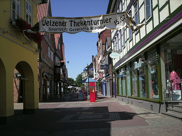

Uelzen District
- German district in Lower Saxony
Hiking in Uelzen District
Uelzen District in Lower Saxony, Germany, offers a variety of hiking opportunities for outdoor enthusiasts. While it might not be as widely known for hiking as some other regions, it provides beautiful natural scenery, charming villages, and historical sites to explore. Here are some aspects to consider for hiking in Uelzen:...
- Country:
- Licence Plate Code: UE
- Coordinates: 53° 0' 0" N, 10° 34' 48" E
- GPS tracks (wikiloc): [Link]
- AboveSeaLevel: 32 м m
- Area: 1454.00 sq km
- Population: 92961
- Web site: [Link]


Heidekreis
- district in Lower Saxony, Germany
Hiking in Heidekreis
Heidekreis, located in Lower Saxony, Germany, offers a variety of hiking opportunities amidst beautiful natural landscapes. The region is characterized by its mix of heathlands, forests, and moorlands, making it an attractive destination for outdoor enthusiasts....
- Country:
- Capital: Bad Fallingbostel
- Licence Plate Code: HK
- Coordinates: 52° 55' 12" N, 9° 45' 0" E
- GPS tracks (wikiloc): [Link]
- AboveSeaLevel: 64 м m
- Area: 1873.50 sq km
- Population: 139641
- Web site: [Link]