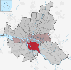
Lüneburg Government Region (Regierungsbezirk Lüneburg)

- former district of Pussia and Lower Saxony, Germany
 Hiking in Lüneburg Government Region
Lüneburg, located in Lower Saxony, Germany, is an excellent destination for hiking enthusiasts. The region is known for its picturesque landscapes, historical towns, and a variety of hiking trails suitable for all skill levels.
Key Highlights of Hiking in Lüneburg:
-
Lüneburg Heath (Lüneburger Heide):
- This vast heathland is famous for its purple heather in late summer, creating a stunning natural spectacle. The area offers numerous trails winding through the heath, showcasing its diverse flora and fauna.
- Popular hiking routes include the "Heidschnuckenweg," a long-distance trail that spans approximately 223 kilometers (about 139 miles), connecting the towns of Hamburg and Celle.
-
Historical Town of Lüneburg:
- Before or after a hike, exploring the charming medieval town of Lüneburg is a must. The town's half-timbered houses, cobbled streets, and the historic salt market (Salzmarkt) are worth a visit.
- Several shorter trails can be found around the town, allowing you to enjoy the scenery while learning about its rich history.
-
Wilseder Berg:
- This is the highest point in the Lüneburg Heath, offering panoramic views of the surrounding landscape. The walks leading up to Wilseder Berg can be challenging but are rewarded with breathtaking vistas.
-
Nature Reserves:
- The region is dotted with nature reserves that offer a variety of habitats and ecosystems. The "Naturpark Lüneburger Heide" features trails through forests, wetlands, and heathlands, providing opportunities to spot wildlife such as deer and various bird species.
-
Well-Marked Trails:
- The hiking trails in Lüneburg are well-marked and maintained, making navigation relatively easy even for beginners. Information boards at various points provide insights about the area’s ecology and history.
-
Accessibility:
- Lüneburg is conveniently accessible by train and road, making it an excellent day trip or weekend getaway for hiking enthusiasts coming from larger cities like Hamburg.
Tips for Hiking in Lüneburg:
- Weather: Always check the weather before setting out, as conditions can change quickly.
- Footwear: Wear sturdy hiking boots to ensure comfort and support on varied terrain.
- Hydration and Snacks: Bring enough water and snacks, especially if you plan on hiking longer distances.
- Respect Nature: Follow Leave No Trace principles, stay on marked trails, and respect wildlife.
Whether you’re looking for a leisurely walk through picturesque landscapes or an adventurous hike through the heath, Lüneburg offers a variety of options that can cater to all preferences!
- Capital: Lüneburg
- Coordinates: 53° 14' 45" N, 10° 24' 34" E


- GPS tracks (wikiloc): [Link]
- Wikipedia en: wiki(en)
- Wikipedia: wiki(de)
- Wikidata storage: Wikidata: Q314251
- Freebase ID: [/m/01b36n]
- VIAF ID: Alt: [166427123]
- GND ID: Alt: [4036517-7]
- NUTS code: [DE93]
Includes regions:

Wilhelmsburg
- quarter of the German city of Hamburg
Hiking in Wilhelmsburg
Wilhelmsburg, a district in Hamburg, Germany, is known for its unique blend of nature and urban life. While it may not be a traditional hiking destination like the Alps or national parks, there are still several opportunities for outdoor adventures and exploring scenic routes....
- Country:

- Coordinates: 53° 29' 42" N, 10° 0' 40" E
- GPS tracks (wikiloc): [Link]
- AboveSeaLevel: -2 м m
- Area: 35.3 sq km


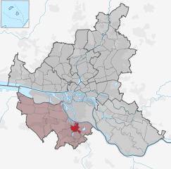
Winsen District
- former district of Prussia
Hiking in Winsen District
Kreis Winsen, located in Lower Saxony, Germany, is an excellent destination for hiking enthusiasts. Known for its picturesque landscapes and diverse terrain, the area offers a range of hiking trails suitable for all skill levels, from leisurely walks to more challenging hikes....
Burgdorf
- rural district of Germany
Hiking in Burgdorf
Burgdorf is a district located in the canton of Bern in Switzerland, known for its picturesque landscapes and rich history. When it comes to hiking in the Burgdorf district, there are several trails and opportunities that cater to hikers of all levels....
- Country:
- Coordinates: 52° 27' 0" N, 10° 0' 0" E
- GPS tracks (wikiloc): [Link]
Kreis Isenhagen
Hiking in Kreis Isenhagen
Kreis Isenhagen, located in Lower Saxony, Germany, provides a picturesque environment for hiking, although it is not as widely recognized as some more famous hiking regions in Germany. The area is characterized by its lush landscapes, forests, and wetlands, making it suitable for various outdoor activities, including hiking....
Kreis Dannenberg
Hiking in Kreis Dannenberg
Kreis Dannenberg, located in Lower Saxony, Germany, offers a scenic and tranquil environment for hiking enthusiasts. This area is characterized by its rolling hills, lush forests, meandering rivers, and picturesque villages, making it an appealing destination for nature lovers....
Kreis Bleckede
Hiking in Kreis Bleckede
Kreis Bleckede, located in Lower Saxony, Germany, offers a great experience for hiking enthusiasts. This region is characterized by its lush landscapes, rivers, and diverse natural habitats, making it an excellent destination for those looking to explore the outdoors....
Kreis Lüchow
Hiking in Kreis Lüchow
Kreis Lüchow-Dannenberg, located in Lower Saxony, Germany, is a unique and beautiful destination for hiking enthusiasts. The region is characterized by its scenic landscapes, lush forests, rivers, and a rich cultural heritage. Here are some key features to consider when hiking in this area:...
Landkreis Fallingbostel
Hiking in Landkreis Fallingbostel
Landkreis Fallingbostel, located in Lower Saxony, Germany, offers a variety of hiking opportunities amidst picturesque landscapes. The region is characterized by a mix of forests, heathlands, and agricultural areas, making it a charming destination for nature enthusiasts and hikers....
- Coordinates: 52° 52' 3" N, 9° 41' 48" E
- GPS tracks (wikiloc): [Link]
Landkreis Soltau
Hiking in Landkreis Soltau
Landkreis Soltau, located in Lower Saxony, Germany, is known for its beautiful landscapes, lush forests, and charming towns, making it an excellent destination for hiking enthusiasts. Here are some highlights and tips for hiking in the region:...
- Coordinates: 52° 59' 9" N, 9° 50' 36" E
- GPS tracks (wikiloc): [Link]
Harburg District
- former District of Prussia
Hiking in Harburg District
Kreis Harburg, located in Lower Saxony, Germany, offers a diverse range of hiking opportunities, featuring beautiful landscapes, forests, and charming villages. Here are some highlights for hikers in the region:...
Harburg
- quarter in Hamburg, Germany
Hiking in Harburg
Harburg, a district in the southern part of Hamburg, Germany, offers several recreational opportunities for hiking enthusiasts, especially with its proximity to nature reserves and parks. Here are some highlights about hiking in the Harburg area:...
- Country:
- Postal Code: 21079; 21075; 21073
- Local Dialing Code: 040
- Coordinates: 53° 27' 33" N, 9° 58' 58" E
- GPS tracks (wikiloc): [Link]
- AboveSeaLevel: 79 м m
- Area: 3.9 sq km


Celle
- town in Lower Saxony, Germany
Hiking in Celle
Celle, a charming town in Lower Saxony, Germany, offers several opportunities for hiking enthusiasts. Known for its historic half-timbered houses and beautiful natural surroundings, Celle is a great starting point for outdoor adventures. Here are some highlights for hiking in and around Celle:...
- Country:
- Postal Code: 29221–29229
- Local Dialing Code: 5086; 5145; 5141
- Licence Plate Code: CE
- Coordinates: 52° 37' 32" N, 10° 4' 57" E
- GPS tracks (wikiloc): [Link]
- AboveSeaLevel: 40 м m
- Area: 176010000 sq km
- Population: 69748
- Web site: [Link]
Harburg-Wilhelmsburg
- former city in Prussia
Hiking in Harburg-Wilhelmsburg
Harburg-Wilhelmsburg, located in Hamburg, Germany, offers a unique blend of urban and natural environments that can make for an interesting hiking experience. While not typically known as a major hiking destination, the area has some pleasant trails that allow you to explore its natural beauty and waterfronts....
- Coordinates: 53° 28' 0" N, 9° 59' 0" E
- GPS tracks (wikiloc): [Link]