
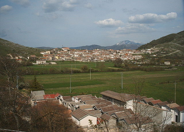
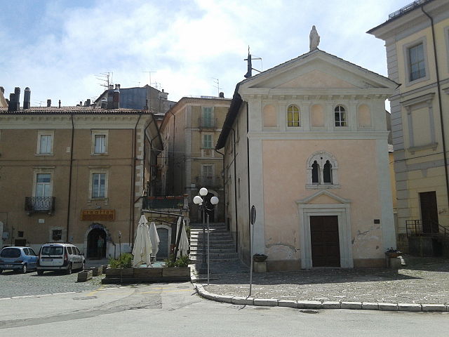
L'Aquila (L'Aquila)
.svg)
- Italian city, capital of the Abruzzo region and of the Province of L'Aquila
 Hiking in L'Aquila
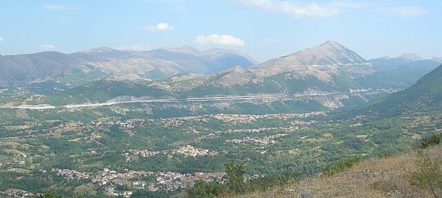
L'Aquila, located in the Abruzzo region of Italy, is surrounded by stunning landscapes, making it a great destination for hiking enthusiasts. The area is characterized by the Gran Sasso and Monti della Laga National Park, which offers a variety of trails suited for all skill levels, from casual walkers to experienced hikers. Here are some highlights of hiking in L'Aquila:
Trails and Areas
-
Gran Sasso: This is the most prominent mountain range in the area and offers numerous trails. Highlights include the ascent to Corno Grande, the highest peak in the Apennines. The trail offers breathtaking views and the chance to see unique flora and fauna.
-
Campo Imperatore: Often referred to as "Little Tibet," this plateau offers easy hikes with spectacular views. It’s also a great starting point for more demanding hikes in the surrounding mountains.
-
Fossa and the Val di fImgoso: This area is known for its natural beauty, with lush forests, rivers, and charming villages. You can find several trails that allow you to experience both nature and local culture.
-
The Laga Mountains: These mountains feature well-marked trails that weave through forests, offering a more secluded hiking experience compared to the more popular Gran Sasso.
What to See
- Wildlife: The national park is home to diverse wildlife, including wolves, deer, and various bird species.
- Flora: The area boasts a rich variety of plant species due to its diverse ecosystems, from alpine meadows to dense forests.
- Historical Sites: Along the trails, you can find remnants of ancient settlements, churches, and shepherding paths that showcase the region’s history and culture.
Tips for Hiking in L'Aquila
- Weather: The weather can change rapidly in the mountains, so be prepared with appropriate clothing and gear.
- Footwear: Sturdy hiking boots are essential, especially on rocky and uneven terrain.
- Maps and Guides: It’s advisable to carry a detailed map and, if possible, hike with a guide if you are unfamiliar with the area.
- Safety: Always inform someone of your hiking plans, and consider the difficulty of the trails relative to your experience.
Local Cuisine
After a day of hiking, enjoy some of the local cuisine. Try traditional dishes such as arrosticini (skewered lamb), pasta alla chitarra, and local cheeses, which can be found in the many trattorias and restaurants around L'Aquila.
Overall, hiking in L'Aquila offers a blend of natural beauty, outdoor adventure, and cultural experiences. Whether you're trekking to high peaks or enjoying leisurely walks through the countryside, L'Aquila has something for every hiker.
- Country:

- Postal Code: 67100
- Local Dialing Code: 0862
- Coordinates: 42° 21' 14" N, 13° 23' 31" E


- GPS tracks (wikiloc): [Link]
- AboveSeaLevel: 714 м m
- Area: 466.87 sq km
- Population: 69627
- Web site: http://www.comune.laquila.it
- Wikipedia en: wiki(en)
- Wikipedia: wiki(it)
- Wikidata storage: Wikidata: Q3476
- Wikipedia Commons Gallery: [Link]
- Wikipedia Commons Category: [Link]
- Wikipedia Commons Maps Category: [Link]
- Freebase ID: [/m/02jjy1]
- GeoNames ID: Alt: [6541999]
- VIAF ID: Alt: [123156197]
- OSM relation ID: [41842]
- GND ID: Alt: [4099061-8]
- archINFORM location ID: [868]
- Library of Congress authority ID: Alt: [n80113659]
- MusicBrainz area ID: [16b33cac-4288-4359-ba53-ed4444486707]
- UN/LOCODE: [ITLAQ]
- Encyclopædia Britannica Online ID: [place/LAquila-Italy]
- Gran Enciclopèdia Catalana ID: [0004595]
- Facebook Places ID: [110784538949135]
- Great Russian Encyclopedia Online ID: [2641686]
- DMOZ ID: Alt: [Regional/Europe/Italy/Abruzzo/Localities/L'Aquila/]
- National Library of Israel ID: [000981019]
- BabelNet ID: [00005232n]
- Google Maps Customer ID: [5732692740326498189]
- ISTAT ID: 066049
- Italian cadastre code: A345
- US National Archives Identifier: 10044801
Shares border with regions:


Antrodoco
- Italian comune
Hiking in Antrodoco
Antrodoco, a town located in the province of Rieti in central Italy, is situated in the Apennine mountain range and offers beautiful hiking opportunities. This area is characterized by its stunning natural landscapes, charming villages, and rich cultural heritage....
- Country:
- Postal Code: 02013
- Local Dialing Code: 0746
- Licence Plate Code: RI
- Coordinates: 42° 25' 0" N, 13° 5' 0" E
- GPS tracks (wikiloc): [Link]
- AboveSeaLevel: 525 м m
- Area: 63.9 sq km
- Population: 2498
- Web site: [Link]
Borgorose
- Italian comune
Hiking in Borgorose
Borgorose is a beautiful destination for hiking enthusiasts, located in the Abruzzo region of Italy. It's surrounded by stunning natural landscapes, including mountains, forests, and rivers, making it an appealing spot for outdoor activities....
- Country:
- Postal Code: 02021
- Local Dialing Code: 0746
- Licence Plate Code: RI
- Coordinates: 42° 12' 0" N, 13° 14' 0" E
- GPS tracks (wikiloc): [Link]
- AboveSeaLevel: 732 м m
- Area: 145.82 sq km
- Population: 4486
- Web site: [Link]
Barete
- Italian comune
Hiking in Barete
Barete is an interesting destination for hiking, located in the Abruzzo region of Italy. The area is known for its beautiful landscapes, diverse wildlife, and a variety of trails suitable for different skill levels. Here are some key points to consider when planning a hike in Barete:...
- Country:
- Postal Code: 67010
- Local Dialing Code: 0862
- Licence Plate Code: AQ
- Coordinates: 42° 27' 5" N, 13° 16' 59" E
- GPS tracks (wikiloc): [Link]
- AboveSeaLevel: 800 м m
- Area: 24.59 sq km
- Population: 683
- Web site: [Link]


Barisciano
- Italian comune
Hiking in Barisciano
Barisciano is a charming village located in the Province of L'Aquila, in the Abruzzo region of Italy. The area is known for its stunning landscapes, historical architecture, and proximity to the Gran Sasso e Monti della Laga National Park, making it a fantastic destination for hikers and outdoor enthusiasts....
- Country:
- Postal Code: 67021
- Local Dialing Code: 0862
- Licence Plate Code: AQ
- Coordinates: 42° 19' 31" N, 13° 35' 36" E
- GPS tracks (wikiloc): [Link]
- AboveSeaLevel: 940 м m
- Area: 78.49 sq km
- Population: 1764
- Web site: [Link]

Cagnano Amiterno
- Italian comune
Hiking in Cagnano Amiterno
Cagnano Amiterno is a small village located in the province of L'Aquila in the Abruzzo region of Italy, nestled in the beautiful Apennine mountains. The area is a fantastic destination for hiking enthusiasts, offering a mix of stunning landscapes, rugged terrain, and a rich natural environment....
- Country:
- Postal Code: 67012
- Local Dialing Code: 0862
- Licence Plate Code: AQ
- Coordinates: 42° 27' 30" N, 13° 13' 44" E
- GPS tracks (wikiloc): [Link]
- AboveSeaLevel: 841 м m
- Area: 61.32 sq km
- Population: 1262
- Web site: [Link]


Campotosto
- Italian comune
Hiking in Campotosto
Campotosto is a beautiful area located in the province of Teramo in the Abruzzo region of Italy. It is known for its stunning landscapes, rich biodiversity, and numerous hiking trails that cater to various skill levels. Here are some highlights and information about hiking in Campotosto:...
- Country:
- Postal Code: 67013
- Local Dialing Code: 0862
- Licence Plate Code: AQ
- Coordinates: 42° 33' 32" N, 13° 22' 5" E
- GPS tracks (wikiloc): [Link]
- AboveSeaLevel: 1420 м m
- Area: 51.73 sq km
- Population: 524
- Web site: [Link]


Capitignano
- Italian comune
Hiking in Capitignano
Capitignano is located in the province of L'Aquila in the region of Abruzzo, Italy. It's a less commercialized area compared to some other hiking destinations, making it ideal for those looking to explore nature in a quieter setting. Here are some highlights about hiking in and around Capitignano:...
- Country:
- Postal Code: 67014
- Local Dialing Code: 0862
- Licence Plate Code: AQ
- Coordinates: 42° 31' 13" N, 13° 18' 4" E
- GPS tracks (wikiloc): [Link]
- AboveSeaLevel: 916 м m
- Area: 30.64 sq km
- Population: 662
- Web site: [Link]
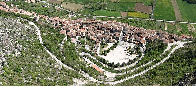

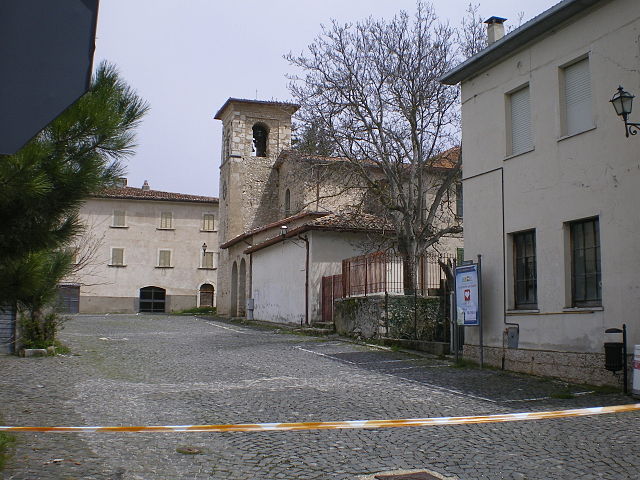
Fossa, Abruzzo
- Italian comune
Hiking in Fossa, Abruzzo
Fossa is a charming village located in the Abruzzo region of Italy, surrounded by stunning natural landscapes that make it an excellent destination for hiking enthusiasts. The area boasts a rich variety of trails that cater to different skill levels, from easy walks to more challenging hikes. Here are some highlights about hiking in and around Fossa:...
- Country:
- Postal Code: 67020
- Local Dialing Code: 0862
- Licence Plate Code: AQ
- Coordinates: 42° 17' 34" N, 13° 29' 16" E
- GPS tracks (wikiloc): [Link]
- AboveSeaLevel: 644 м m
- Area: 8.71 sq km
- Population: 705
- Web site: [Link]


Lucoli
- Italian comune
Hiking in Lucoli
Lucoli, a charming town located in the province of L’Aquila in the Abruzzo region of Italy, offers a stunning backdrop for hiking enthusiasts. Nestled in the Apennine Mountains, Lucoli is surrounded by beautiful landscapes, rich wildlife, and a variety of trails suitable for different skill levels....
- Country:
- Postal Code: 67045
- Local Dialing Code: 0862
- Licence Plate Code: AQ
- Coordinates: 42° 17' 31" N, 13° 20' 20" E
- GPS tracks (wikiloc): [Link]
- AboveSeaLevel: 956 м m
- Area: 103.44 sq km
- Population: 967
- Web site: [Link]


Magliano de' Marsi
- Italian comune
Hiking in Magliano de' Marsi
Magliano de' Marsi is a charming town located in the Abruzzo region of Italy, surrounded by the breathtaking landscapes of the Apennine Mountains. It's an excellent destination for hiking enthusiasts as it offers a variety of trails that cater to different skill levels, with stunning views of the surrounding countryside and the majestic mountains....
- Country:
- Postal Code: 67062
- Local Dialing Code: 0863
- Licence Plate Code: AQ
- Coordinates: 42° 5' 30" N, 13° 21' 50" E
- GPS tracks (wikiloc): [Link]
- AboveSeaLevel: 728 м m
- Area: 70.93 sq km
- Population: 3650
- Web site: [Link]

Ocre
- Italian comune
Hiking in Ocre
Ocre is a beautiful region in Italy, known for its stunning landscapes, charming villages, and outdoor activities, including hiking. While there may not be extensive information specifically about hiking in Ocre, I can provide general insights about hiking opportunities in the surrounding Abruzzo region....
- Country:
- Postal Code: 67040
- Local Dialing Code: 0862
- Licence Plate Code: AQ
- Coordinates: 42° 17' 10" N, 13° 28' 31" E
- GPS tracks (wikiloc): [Link]
- AboveSeaLevel: 850 м m
- Area: 23.6 sq km
- Population: 1159
- Web site: [Link]


Pizzoli
- Italian comune
Hiking in Pizzoli
Pizzoli is a picturesque village located in the Abruzzo region of Italy, surrounded by beautiful landscapes and rich natural heritage. While it may not be as widely known as some other hiking destinations in Italy, it offers several opportunities for outdoor enthusiasts....
- Country:
- Postal Code: 67017
- Local Dialing Code: 0862
- Licence Plate Code: AQ
- Coordinates: 42° 26' 10" N, 13° 17' 56" E
- GPS tracks (wikiloc): [Link]
- AboveSeaLevel: 740 м m
- Area: 56.44 sq km
- Population: 4611
- Web site: [Link]

Rocca di Cambio
- Italian comune
Hiking in Rocca di Cambio
Rocca di Cambio, located in the Apennine Mountains of Italy, is an excellent destination for hiking enthusiasts. Situated in the Abruzzo region, it boasts stunning landscapes, rich biodiversity, and a variety of trails that cater to different skill levels. Here are some highlights and tips for hiking in Rocca di Cambio:...
- Country:
- Postal Code: 67047
- Local Dialing Code: 0862
- Licence Plate Code: AQ
- Coordinates: 42° 14' 14" N, 13° 29' 24" E
- GPS tracks (wikiloc): [Link]
- AboveSeaLevel: 1434 м m
- Area: 27.62 sq km
- Population: 512
- Web site: [Link]

Rocca di Mezzo
- Italian comune
Hiking in Rocca di Mezzo
Rocca di Mezzo, located in the Apennine Mountains of central Italy, is a beautiful destination for hiking enthusiasts. Known for its stunning landscapes, rich biodiversity, and charming medieval villages, it offers a variety of trails suitable for different skill levels. Here are some key points about hiking in Rocca di Mezzo:...
- Country:
- Postal Code: 67048
- Local Dialing Code: 0862
- Licence Plate Code: AQ
- Coordinates: 42° 12' 21" N, 13° 31' 13" E
- GPS tracks (wikiloc): [Link]
- AboveSeaLevel: 1329 м m
- Area: 90.55 sq km
- Population: 1474
- Web site: [Link]


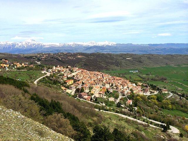
Santo Stefano di Sessanio
- Italian comune
Hiking in Santo Stefano di Sessanio
Santo Stefano di Sessanio is a picturesque medieval village located in the Abruzzo region of Italy, known for its stunning natural landscapes and rich cultural heritage. Hiking in this area offers a mix of scenic views, historical sites, and diverse trails suitable for various skill levels....
- Country:
- Postal Code: 67020
- Local Dialing Code: 0862
- Licence Plate Code: AQ
- Coordinates: 42° 20' 34" N, 13° 38' 45" E
- GPS tracks (wikiloc): [Link]
- AboveSeaLevel: 1250 м m
- Area: 33.7 sq km
- Population: 110
- Web site: [Link]
Scoppito
- Italian comune
Hiking in Scoppito
Scoppito is a charming village located in the province of L'Aquila in Abruzzo, Italy. Surrounded by the natural beauty of the Apennine Mountains, it offers a variety of hiking opportunities for both novice and experienced hikers. The area's diverse terrain includes mountainous landscapes, woodlands, and beautiful valleys, providing a range of trails suitable for exploration....
- Country:
- Postal Code: 67019
- Local Dialing Code: 0862
- Licence Plate Code: AQ
- Coordinates: 42° 22' 26" N, 13° 15' 21" E
- GPS tracks (wikiloc): [Link]
- AboveSeaLevel: 820 м m
- Area: 53 sq km
- Population: 3805
- Web site: [Link]

Tornimparte
- Italian comune
Hiking in Tornimparte
Tornimparte is a picturesque village located in the province of Ávila, in the autonomous community of Castilla y León, Spain. Nestled in the Sierra de Villafranca, it provides access to beautiful natural landscapes and several hiking opportunities....
- Country:
- Postal Code: 67049
- Local Dialing Code: 0862
- Licence Plate Code: AQ
- Coordinates: 42° 17' 24" N, 13° 18' 3" E
- GPS tracks (wikiloc): [Link]
- AboveSeaLevel: 830 м m
- Area: 65.96 sq km
- Population: 3152
- Web site: [Link]

Crognaleto
- Italian comune
Hiking in Crognaleto
Crognaleto is a picturesque area located in the Abruzzo region of Italy, known for its stunning natural landscapes, beautiful mountains, and a variety of hiking trails that cater to different skill levels. The region is part of the Gran Sasso e Monti della Laga National Park, which provides a rich environment of biodiversity, including picturesque valleys, rugged peaks, and diverse flora and fauna....
- Country:
- Postal Code: 64043
- Local Dialing Code: 0861
- Licence Plate Code: TE
- Coordinates: 42° 35' 0" N, 13° 29' 0" E
- GPS tracks (wikiloc): [Link]
- AboveSeaLevel: 835 м m
- Area: 124.3 sq km
- Population: 1245
- Web site: [Link]

Fano Adriano
- Italian comune
Hiking in Fano Adriano
Fano Adriano, a small town in the Abruzzo region of Italy, offers a picturesque setting for hikers seeking to explore the natural beauty of the area. Nestled in the Gran Sasso and Monti della Laga National Park, this region boasts a variety of hiking trails suited for different skill levels, from leisurely walks to more challenging treks....
- Country:
- Postal Code: 64044
- Local Dialing Code: 0861
- Licence Plate Code: TE
- Coordinates: 42° 33' 14" N, 13° 32' 12" E
- GPS tracks (wikiloc): [Link]
- AboveSeaLevel: 745 м m
- Area: 35.77 sq km
- Population: 278
- Web site: [Link]

Isola del Gran Sasso d'Italia
- Italian comune
Hiking in Isola del Gran Sasso d'Italia
Isola del Gran Sasso d'Italia is a beautiful area in the Abruzzo region of Italy, known for its stunning mountainous landscapes, rich biodiversity, and a variety of hiking trails suitable for different skill levels. It’s part of the Gran Sasso e Monti della Laga National Park, the largest protected area in the Apennines....
- Country:
- Postal Code: 64045
- Local Dialing Code: 0861
- Licence Plate Code: TE
- Coordinates: 42° 30' 27" N, 13° 39' 28" E
- GPS tracks (wikiloc): [Link]
- AboveSeaLevel: 498 м m
- Area: 84.05 sq km
- Population: 4684
- Web site: [Link]

Pietracamela
- Italian comune
Hiking in Pietracamela
Pietracamela is a beautiful village located in the Abruzzo region of Italy, nestled at the foot of the Gran Sasso massif. This area is renowned for its stunning landscapes, diverse flora and fauna, and rich history, making it a great destination for hikers of all levels. Here are some key points to consider when hiking in Pietracamela:...
- Country:
- Postal Code: 64047
- Local Dialing Code: 0861
- Licence Plate Code: TE
- Coordinates: 42° 31' 23" N, 13° 33' 12" E
- GPS tracks (wikiloc): [Link]
- AboveSeaLevel: 1005 м m
- Area: 44.49 sq km
- Population: 251
- Web site: [Link]