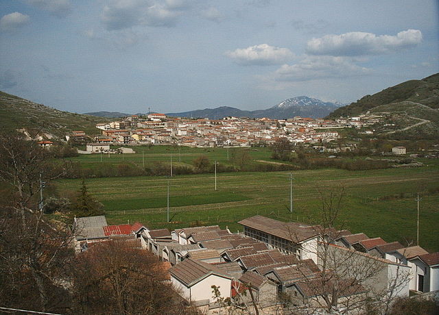
Antrodoco (Antrodoco)
.svg)
- Italian comune
 Hiking in Antrodoco
Antrodoco, a town located in the province of Rieti in central Italy, is situated in the Apennine mountain range and offers beautiful hiking opportunities. This area is characterized by its stunning natural landscapes, charming villages, and rich cultural heritage.
Hiking Trails and Routes
-
Mount Terminillo: This is one of the most popular hiking destinations near Antrodoco. It features several trails of varying difficulty, allowing hikers to enjoy breathtaking views of the surrounding mountains and valleys. The summit can also be accessed via a challenging trek.
-
Cascate di Rascino: The waterfalls of Rascino are a fantastic spot for nature lovers. You can find trails that lead to these cascading waters, making for a picturesque hiking experience, especially in the spring when the water flow is abundant.
-
Parco Regionale dei Monti Sirente-Velino: A bit further from Antrodoco, this regional park offers numerous hiking trails. The park is known for its rich biodiversity, including various flora and fauna, and provides hikers with the chance to see wildlife in its natural habitat.
-
Historical Paths: There are trails that connect Antrodoco to historical sites and old villages in the region, such as the ancient ruins and local churches. These paths not only provide a physical challenge but also a cultural experience.
Tips for Hiking in Antrodoco
- Weather Conditions: Always check the weather before heading out as conditions in the mountains can change rapidly.
- Proper Gear: Ensure you wear sturdy hiking boots and carry essential gear like a map, compass, or a GPS device. A first-aid kit and sufficient water are also crucial.
- Local Guidance: If you're unfamiliar with the area, consider hiring a local guide or joining a hiking group to enhance your experience and safety.
- Respect Nature: Follow Leave No Trace principles to preserve the beauty of the environment.
- Timing: Start your hikes early to avoid the heat, especially during the summer months, and allocate enough time to return before dark.
Cultural Aspects
Don't miss the chance to experience local culture while hiking. Antrodoco is known for its traditional cuisine, so consider stopping by local eateries or participating in food festivals if your hiking trip coincides with one.
Hiking in Antrodoco offers a mix of adventure and immersion in the stunning Italian landscape. It’s ideal for both novice and experienced hikers looking to explore the natural beauty and cultural richness of the region.
- Country:

- Postal Code: 02013
- Local Dialing Code: 0746
- Licence Plate Code: RI
- Coordinates: 42° 25' 0" N, 13° 5' 0" E


- GPS tracks (wikiloc): [Link]
- AboveSeaLevel: 525 м m
- Area: 63.9 sq km
- Population: 2498
- Web site: http://www.comunediantrodoco.it
- Wikipedia en: wiki(en)
- Wikipedia: wiki(it)
- Wikidata storage: Wikidata: Q223434
- Wikipedia Commons Category: [Link]
- Freebase ID: [/m/0f8pjj]
- GeoNames ID: Alt: [6538643]
- VIAF ID: Alt: [246285755]
- OSM relation ID: [41989]
- GND ID: Alt: [4582939-1]
- TGN ID: [7006737]
- Digital Atlas of the Roman Empire ID: [17239]
- ISTAT ID: 057003
- Italian cadastre code: A315
Shares border with regions:
Fiamignano
- Italian comune
Hiking in Fiamignano
Fiamignano, a picturesque village in the province of Rieti in Italy, is surrounded by beautiful landscapes and offers numerous hiking opportunities. Situated in the heart of the Apennines, hiking in this region provides stunning views, diverse flora and fauna, and a chance to explore local culture and history....
- Country:
- Postal Code: 02023
- Local Dialing Code: 0746
- Licence Plate Code: RI
- Coordinates: 42° 16' 0" N, 13° 8' 0" E
- GPS tracks (wikiloc): [Link]
- AboveSeaLevel: 988 м m
- Area: 100.62 sq km
- Population: 1337
- Web site: [Link]
Borbona
- Italian comune
Hiking in Borbona
Borbona, located in the Lazio region of Italy, is a charming area that offers potential for hiking enthusiasts. Nestled within the beautiful landscape of the Apennines, Borbona is surrounded by lush forests, rolling hills, and picturesque mountain views, making it an ideal destination for outdoor activities....
- Country:
- Postal Code: 02010
- Local Dialing Code: 0746
- Licence Plate Code: RI
- Coordinates: 42° 31' 0" N, 13° 8' 0" E
- GPS tracks (wikiloc): [Link]
- AboveSeaLevel: 760 м m
- Area: 47.96 sq km
- Population: 596
- Web site: [Link]
Borgo Velino
- Italian comune
Hiking in Borgo Velino
Borgo Velino is a charming village located in the province of Rieti in the Lazio region of Italy. Nestled among the foothills of the Apennines, it offers stunning landscapes and diverse hiking opportunities. Here are some highlights for hiking in and around Borgo Velino:...
- Country:
- Postal Code: 02010
- Local Dialing Code: 0746
- Licence Plate Code: RI
- Coordinates: 42° 24' 0" N, 13° 4' 0" E
- GPS tracks (wikiloc): [Link]
- AboveSeaLevel: 460 м m
- Area: 18.29 sq km
- Population: 941
- Web site: [Link]
Micigliano
- Italian comune
Hiking in Micigliano
Micigliano is a charming village located in the province of Rieti in the Lazio region of Italy. Nestled in the Sabina hills, it offers picturesque landscapes and a tranquil environment, making it a great destination for hiking enthusiasts....
- Country:
- Postal Code: 02010
- Local Dialing Code: 0746
- Licence Plate Code: RI
- Coordinates: 42° 27' 0" N, 13° 3' 0" E
- GPS tracks (wikiloc): [Link]
- AboveSeaLevel: 925 м m
- Area: 36.85 sq km
- Population: 133
- Web site: [Link]


Petrella Salto
- Italian comune
Hiking in Petrella Salto
Petrella Salto is a charming village nestled in the Lazio region of Italy, surrounded by beautiful landscapes and rich natural beauty, making it an excellent destination for hiking enthusiasts. Here are some aspects to consider if you're thinking about hiking in this area:...
- Country:
- Postal Code: 02025
- Local Dialing Code: 0746
- Licence Plate Code: RI
- Coordinates: 42° 18' 0" N, 13° 4' 0" E
- GPS tracks (wikiloc): [Link]
- AboveSeaLevel: 786 м m
- Area: 102.93 sq km
- Population: 1146
- Web site: [Link]


L'Aquila
- Italian city, capital of the Abruzzo region and of the Province of L'Aquila
Hiking in L'Aquila
L'Aquila, located in the Abruzzo region of Italy, is surrounded by stunning landscapes, making it a great destination for hiking enthusiasts. The area is characterized by the Gran Sasso and Monti della Laga National Park, which offers a variety of trails suited for all skill levels, from casual walkers to experienced hikers. Here are some highlights of hiking in L'Aquila:...
- Country:
- Postal Code: 67100
- Local Dialing Code: 0862
- Coordinates: 42° 21' 14" N, 13° 23' 31" E
- GPS tracks (wikiloc): [Link]
- AboveSeaLevel: 714 м m
- Area: 466.87 sq km
- Population: 69627
- Web site: [Link]

Cagnano Amiterno
- Italian comune
Hiking in Cagnano Amiterno
Cagnano Amiterno is a small village located in the province of L'Aquila in the Abruzzo region of Italy, nestled in the beautiful Apennine mountains. The area is a fantastic destination for hiking enthusiasts, offering a mix of stunning landscapes, rugged terrain, and a rich natural environment....
- Country:
- Postal Code: 67012
- Local Dialing Code: 0862
- Licence Plate Code: AQ
- Coordinates: 42° 27' 30" N, 13° 13' 44" E
- GPS tracks (wikiloc): [Link]
- AboveSeaLevel: 841 м m
- Area: 61.32 sq km
- Population: 1262
- Web site: [Link]
Scoppito
- Italian comune
Hiking in Scoppito
Scoppito is a charming village located in the province of L'Aquila in Abruzzo, Italy. Surrounded by the natural beauty of the Apennine Mountains, it offers a variety of hiking opportunities for both novice and experienced hikers. The area's diverse terrain includes mountainous landscapes, woodlands, and beautiful valleys, providing a range of trails suitable for exploration....
- Country:
- Postal Code: 67019
- Local Dialing Code: 0862
- Licence Plate Code: AQ
- Coordinates: 42° 22' 26" N, 13° 15' 21" E
- GPS tracks (wikiloc): [Link]
- AboveSeaLevel: 820 м m
- Area: 53 sq km
- Population: 3805
- Web site: [Link]