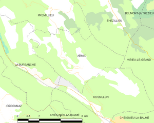
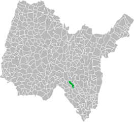
La Burbanche (La Burbanche)
- commune in Ain, France
La Burbanche is a picturesque mountainous region located in the Rhône-Alpes area of France, known for its beautiful landscapes, scenic views, and hiking opportunities. It is situated near the Chartreuse Mountains and offers a variety of trails suitable for different skill levels, making it an excellent destination for hikers.
Hiking Opportunities:
-
Trail Diversity: The area features a range of trails from easy walks to challenging hikes, with varying lengths and elevations. There are trails that weave through forests, meander along rivers, and ascend to panoramic viewpoints.
-
Scenic Views: Many trails provide stunning views of the surrounding mountains and valleys, particularly during the autumn months when foliage changes color.
-
Wildlife and Flora: Hikers will have the opportunity to see diverse wildlife and a variety of plant species native to the region, especially in protected areas.
-
Local Culture: Hiking in La Burbanche allows you to experience local culture, including traditional alpine villages and cuisine. After a hike, you might enjoy local specialties at a nearby restaurant or café.
Tips for Hiking in La Burbanche:
- Season Considerations: The best time for hiking is typically late spring to early autumn (May to September). Snow can affect trails in winter.
- Prepare Adequately: Wear appropriate hiking gear, including sturdy boots and layers for changing weather. Bringing a map or GPS can help, as cell service may be limited in remote areas.
- Stay Hydrated: Carry enough water, especially on longer hikes, and consider packing snacks for energy.
- Respect Nature: Follow Leave No Trace principles to protect the environment and local wildlife.
Popular Trails:
While specific trail names can vary, you might find popular routes that connect to points of interest or offer unique vistas. Consider visiting local tourism offices for updated trail maps, suggested routes, and advice on accessibility.
Overall, hiking in La Burbanche is a fantastic way to immerse yourself in nature and enjoy the serenity of the French Alps. Whether you're looking for a leisurely stroll or an adventurous climb, this region has something to offer every hiker.
- Country:

- Postal Code: 01510
- Coordinates: 45° 50' 48" N, 5° 33' 38" E


- GPS tracks (wikiloc): [Link]
- Area: 10.82 sq km
- Population: 71
- Wikipedia en: wiki(en)
- Wikipedia: wiki(fr)
- Wikidata storage: Wikidata: Q616098
- Wikipedia Commons Category: [Link]
- Wikipedia Commons Maps Category: [Link]
- Freebase ID: [/m/08130d]
- Freebase ID: [/m/08130d]
- Freebase ID: [/m/08130d]
- GeoNames ID: Alt: [6456643]
- GeoNames ID: Alt: [6456643]
- GeoNames ID: Alt: [6456643]
- SIREN number: [210100665]
- SIREN number: [210100665]
- SIREN number: [210100665]
- INSEE municipality code: 01066
- INSEE municipality code: 01066
- INSEE municipality code: 01066
Shares border with regions:


Armix
- commune in Ain, France
It seems there may be a misunderstanding, as "Armix" is not widely recognized as a specific hiking destination or region in most hiking literature or databases. However, it's possible that you may be referring to a local area, park, or a lesser-known trail....
- Country:

- Postal Code: 01510
- Coordinates: 45° 50' 57" N, 5° 35' 8" E


- GPS tracks (wikiloc): [Link]
- Area: 6.82 sq km
- Population: 24


Arandas
- commune in Ain, France
Arandas, located in the Ain department in the Auvergne-Rhône-Alpes region of France, offers some stunning hiking opportunities with a mix of beautiful landscapes and diverse terrain. The area is characterized by rolling hills, valleys, and a variety of flora and fauna, making it ideal for both casual walkers and more experienced hikers....
- Country:

- Postal Code: 01230
- Coordinates: 45° 53' 42" N, 5° 29' 11" E


- GPS tracks (wikiloc): [Link]
- Area: 14.1 sq km
- Population: 153

Hostiaz
- commune in Ain, France
Hostiaz is a charming village located in the Savoie region of France, known for its beautiful mountain landscapes and tranquil surroundings, making it a great destination for hiking enthusiasts. Here are some aspects of hiking in and around Hostiaz:...
- Country:

- Postal Code: 01110
- Coordinates: 45° 54' 6" N, 5° 32' 4" E


- GPS tracks (wikiloc): [Link]
- Area: 10.6 sq km
- Population: 87


Prémillieu
- commune in Ain, France
Prémillieu is a small commune situated in the Department of Isère in the Auvergne-Rhône-Alpes region of southeastern France. While it might not be as well-known as some larger hiking destinations in the region, it offers beautiful landscapes and a peaceful environment, making it suitable for hiking enthusiasts looking for less crowded trails....
- Country:

- Postal Code: 01110
- Coordinates: 45° 52' 27" N, 5° 34' 17" E


- GPS tracks (wikiloc): [Link]
- Area: 8.51 sq km
- Population: 47

Cheignieu-la-Balme
- commune in Ain, France
Cheignieu-la-Balme is a charming commune located in the Ain department of the Auvergne-Rhône-Alpes region in southeastern France. The area is known for its picturesque landscapes, rolling hills, forests, and proximity to the Rhône River, making it a wonderful place for hiking enthusiasts....
- Country:

- Postal Code: 01510
- Coordinates: 45° 49' 38" N, 5° 36' 28" E


- GPS tracks (wikiloc): [Link]
- Area: 6.26 sq km
- Population: 139

Tenay
- commune in Ain, France
Hiking in Tenaya, often associated with Tenaya Lake and the Tioga Pass area in Yosemite National Park, offers some spectacular opportunities for outdoor enthusiasts. Here are some highlights and tips for hiking in this beautiful region:...
- Country:

- Postal Code: 01230
- Coordinates: 45° 55' 12" N, 5° 30' 30" E


- GPS tracks (wikiloc): [Link]
- Area: 13.12 sq km
- Population: 1053
- Web site: [Link]

Rossillon
- commune in Ain, France
Rossillon is a charming village located in the region of Provence in southeastern France. While it’s not as well-known as some of the more prominent hiking destinations in the region, it offers beautiful landscapes and a more tranquil hiking experience. Here’s what you can expect when hiking in and around Rossillon:...
- Country:

- Postal Code: 01510
- Coordinates: 45° 49' 55" N, 5° 35' 37" E


- GPS tracks (wikiloc): [Link]
- Area: 8.07 sq km
- Population: 150

Ordonnaz
- commune in Ain, France
Ordonnaz is a small commune located in the Auvergne-Rhône-Alpes region of southeastern France, nestled at the foot of the Alps. This area offers picturesque landscapes, making it a delightful destination for hiking enthusiasts....
- Country:

- Postal Code: 01510
- Coordinates: 45° 50' 14" N, 5° 32' 18" E


- GPS tracks (wikiloc): [Link]
- Area: 14.88 sq km
- Population: 152
