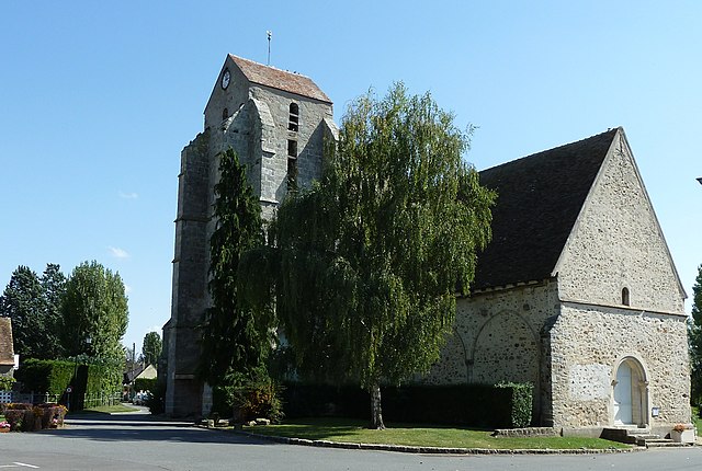
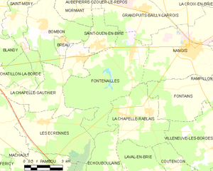
La Chapelle-Gauthier (La Chapelle-Gauthier)

- commune in Seine-et-Marne, France
- Country:

- Postal Code: 77720
- Coordinates: 48° 32' 59" N, 2° 53' 57" E


- GPS tracks (wikiloc): [Link]
- Area: 17.36 sq km
- Population: 1460
- Web site: http://www.lachapellegauthier77.fr
- Wikipedia en: wiki(en)
- Wikipedia: wiki(fr)
- Wikidata storage: Wikidata: Q837608
- Wikipedia Commons Category: [Link]
- Freebase ID: [/m/02q25q_]
- Freebase ID: [/m/02q25q_]
- GeoNames ID: Alt: [6457084]
- GeoNames ID: Alt: [6457084]
- SIREN number: [217700863]
- SIREN number: [217700863]
- BnF ID: [152754270]
- BnF ID: [152754270]
- INSEE municipality code: 77086
- INSEE municipality code: 77086
Shares border with regions:


Le Châtelet-en-Brie
- commune in Seine-et-Marne, France
- Country:
- Postal Code: 77820
- Coordinates: 48° 30' 11" N, 2° 47' 22" E
- GPS tracks (wikiloc): [Link]
- Area: 22.71 sq km
- Population: 4455
- Web site: [Link]


Châtillon-la-Borde
- commune in Seine-et-Marne, France
- Country:
- Postal Code: 77820
- Coordinates: 48° 31' 49" N, 2° 50' 7" E
- GPS tracks (wikiloc): [Link]
- Area: 7.25 sq km
- Population: 218

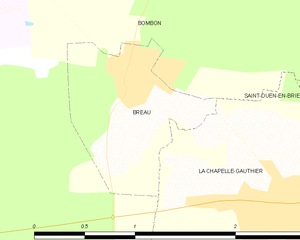
Bréau
- commune in Seine-et-Marne, France
- Country:
- Postal Code: 77720
- Coordinates: 48° 33' 42" N, 2° 52' 41" E
- GPS tracks (wikiloc): [Link]
- Area: 1.35 sq km
- Population: 325
- Web site: [Link]


Saint-Ouen-en-Brie
- commune in Seine-et-Marne, France
- Country:
- Postal Code: 77720
- Coordinates: 48° 33' 28" N, 2° 55' 5" E
- GPS tracks (wikiloc): [Link]
- Area: 5.69 sq km
- Population: 848
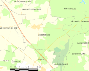
Les Écrennes
- commune in Seine-et-Marne, France
- Country:
- Postal Code: 77820
- Coordinates: 48° 30' 12" N, 2° 51' 32" E
- GPS tracks (wikiloc): [Link]
- Area: 18.54 sq km
- Population: 596
- Web site: [Link]


Sivry-Courtry
- commune in Seine-et-Marne, France
- Country:
- Postal Code: 77115
- Coordinates: 48° 31' 41" N, 2° 45' 17" E
- GPS tracks (wikiloc): [Link]
- Area: 22.47 sq km
- Population: 1235
- Web site: [Link]

Saint-Méry
- commune in Seine-et-Marne, France
- Country:
- Postal Code: 77720
- Coordinates: 48° 34' 39" N, 2° 49' 34" E
- GPS tracks (wikiloc): [Link]
- Area: 9.94 sq km
- Population: 363

Fontenailles
- commune in Seine-et-Marne, France
- Country:
- Postal Code: 77370
- Coordinates: 48° 33' 12" N, 2° 57' 6" E
- GPS tracks (wikiloc): [Link]
- Area: 27.44 sq km
- Population: 1075
- Web site: [Link]


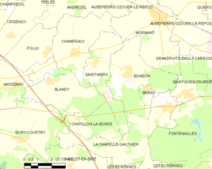
Bombon
- commune in Seine-et-Marne, France
- Country:
- Postal Code: 77720
- Coordinates: 48° 34' 18" N, 2° 51' 33" E
- GPS tracks (wikiloc): [Link]
- Area: 15 sq km
- Population: 926