La Chapelle-la-Reine (La Chapelle-la-Reine)

- commune in Seine-et-Marne, France
- Country:

- Postal Code: 77760
- Coordinates: 48° 19' 6" N, 2° 34' 18" E


- GPS tracks (wikiloc): [Link]
- Area: 15.91 sq km
- Population: 2475
- Web site: http://www.lachapellelareine.fr
- Wikipedia en: wiki(en)
- Wikipedia: wiki(fr)
- Wikidata storage: Wikidata: Q243363
- Wikipedia Commons Category: [Link]
- Wikipedia Commons Maps Category: [Link]
- Freebase ID: [/m/02q25vs]
- Freebase ID: [/m/02q25vs]
- GeoNames ID: Alt: [3010315]
- GeoNames ID: Alt: [3010315]
- SIREN number: [217700889]
- SIREN number: [217700889]
- BnF ID: [15275429p]
- BnF ID: [15275429p]
- VIAF ID: Alt: [168447285]
- VIAF ID: Alt: [168447285]
- PACTOLS thesaurus ID: [pcrtNJluppiLVR]
- PACTOLS thesaurus ID: [pcrtNJluppiLVR]
- INSEE municipality code: 77088
- INSEE municipality code: 77088
Shares border with regions:


Boissy-aux-Cailles
- commune in Seine-et-Marne, France
- Country:
- Postal Code: 77760
- Coordinates: 48° 19' 10" N, 2° 30' 12" E
- GPS tracks (wikiloc): [Link]
- Area: 16.4 sq km
- Population: 300

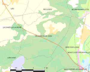
Villiers-sous-Grez
- commune in Seine-et-Marne, France
- Country:
- Postal Code: 77760
- Coordinates: 48° 19' 10" N, 2° 38' 53" E
- GPS tracks (wikiloc): [Link]
- Area: 12.25 sq km
- Population: 740
- Web site: [Link]


Ury
- commune in Seine-et-Marne, France
- Country:
- Postal Code: 77760
- Coordinates: 48° 20' 36" N, 2° 36' 13" E
- GPS tracks (wikiloc): [Link]
- Area: 8.21 sq km
- Population: 836
- Web site: [Link]


Recloses
- commune in Seine-et-Marne, France
- Country:
- Postal Code: 77760
- Coordinates: 48° 20' 52" N, 2° 38' 30" E
- GPS tracks (wikiloc): [Link]
- Area: 9.35 sq km
- Population: 685
- Web site: [Link]


Amponville
- commune in Seine-et-Marne, France
- Country:
- Postal Code: 77760
- Coordinates: 48° 16' 44" N, 2° 31' 47" E
- GPS tracks (wikiloc): [Link]
- Area: 12.3 sq km
- Population: 363


Le Vaudoué
- commune in Seine-et-Marne, France
- Country:
- Postal Code: 77123
- Coordinates: 48° 21' 25" N, 2° 31' 8" E
- GPS tracks (wikiloc): [Link]
- Area: 17.16 sq km
- Population: 759
- Web site: [Link]

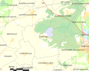
Larchant
- commune in Seine-et-Marne, France
- Country:
- Postal Code: 77760
- Coordinates: 48° 17' 5" N, 2° 35' 48" E
- GPS tracks (wikiloc): [Link]
- Area: 29.24 sq km
- Population: 723
- Web site: [Link]


Achères-la-Forêt
- commune in Seine-et-Marne, France
- Country:
- Postal Code: 77760
- Coordinates: 48° 20' 44" N, 2° 33' 54" E
- GPS tracks (wikiloc): [Link]
- Area: 12.6 sq km
- Population: 1154
- Web site: [Link]