La Ferté-Vidame (La Ferté-Vidame)

- commune in Eure-et-Loir, France
- Country:

- Postal Code: 28340
- Coordinates: 48° 36' 42" N, 0° 54' 3" E


- GPS tracks (wikiloc): [Link]
- Area: 39.81 sq km
- Population: 708
- Wikipedia en: wiki(en)
- Wikipedia: wiki(fr)
- Wikidata storage: Wikidata: Q696861
- Wikipedia Commons Category: [Link]
- Freebase ID: [/m/03nqtfl]
- GeoNames ID: Alt: [6455819]
- SIREN number: [212801492]
- BnF ID: [15254080p]
- VIAF ID: Alt: [122615313]
- Library of Congress authority ID: Alt: [no2002047676]
- PACTOLS thesaurus ID: [pcrt9gqxuEYPsY]
- INSEE municipality code: 28149
Shares border with regions:


La Lande-sur-Eure
- former commune in Orne, France
- Country:
- Postal Code: 61290
- Coordinates: 48° 33' 27" N, 0° 51' 51" E
- GPS tracks (wikiloc): [Link]
- Area: 15.78 sq km
- Population: 173


Neuilly-sur-Eure
- former commune in Orne, France
- Country:
- Postal Code: 61290
- Coordinates: 48° 32' 31" N, 0° 54' 12" E
- GPS tracks (wikiloc): [Link]
- Area: 21.47 sq km
- Population: 601

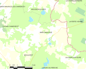
Marchainville
- former commune in Orne, France
- Country:
- Postal Code: 61290
- Coordinates: 48° 35' 4" N, 0° 48' 54" E
- GPS tracks (wikiloc): [Link]
- Area: 21.61 sq km
- Population: 237
Moussonvilliers
- commune in Orne, France
- Country:
- Postal Code: 61190
- Coordinates: 48° 38' 14" N, 0° 47' 33" E
- GPS tracks (wikiloc): [Link]
- Area: 21.94 sq km
- Population: 227