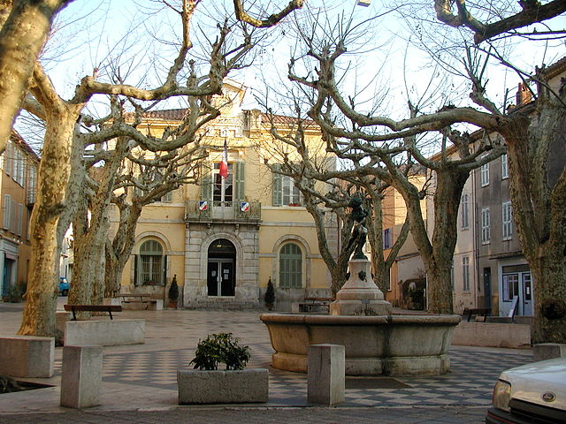
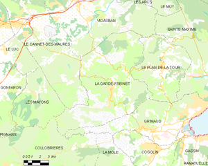
La Garde-Freinet (La Garde-Freinet)
- commune in Var, France
- Country:

- Postal Code: 83680
- Coordinates: 43° 19' 1" N, 6° 28' 9" E


- GPS tracks (wikiloc): [Link]
- Area: 76.64 sq km
- Population: 1878
- Web site: http://www.lagarde-freinet.fr/
- Wikipedia en: wiki(en)
- Wikipedia: wiki(fr)
- Wikidata storage: Wikidata: Q696791
- Wikipedia Commons Category: [Link]
- Freebase ID: [/m/02vkphn]
- GeoNames ID: Alt: [3009193]
- SIREN number: [218300630]
- BnF ID: [15277890b]
- VIAF ID: Alt: [124506158]
- Library of Congress authority ID: Alt: [n97007601]
- PACTOLS thesaurus ID: [pcrtTSl9guOSof]
- INSEE municipality code: 83063
Shares border with regions:


Vidauban
- commune in Var, France
Vidauban is a charming village located in the Var department of the Provence-Alpes-Côte d'Azur region in southeastern France. Surrounded by beautiful landscapes, it offers a variety of hiking opportunities that cater to different skill levels. Here are some highlights and tips for hiking in Vidauban:...
- Country:

- Postal Code: 83550
- Coordinates: 43° 25' 38" N, 6° 25' 55" E


- GPS tracks (wikiloc): [Link]
- Area: 73.93 sq km
- Population: 11391


Collobrières
- commune in Var, France
- Country:

- Postal Code: 83610
- Coordinates: 43° 14' 14" N, 6° 18' 32" E


- GPS tracks (wikiloc): [Link]
- Area: 112.68 sq km
- Population: 1919
- Web site: [Link]


Les Mayons
- commune in Var, France
- Country:

- Postal Code: 83340
- Coordinates: 43° 18' 46" N, 6° 21' 29" E


- GPS tracks (wikiloc): [Link]
- Area: 28.86 sq km
- Population: 636


Le Cannet-des-Maures
- commune in Var, France
 Hiking in Le Cannet-des-Maures
Le Cannet-des-Maures, located in the Var department of the Provence-Alpes-Côte d'Azur region in southeastern France, offers a variety of hiking opportunities that showcase the beautiful landscapes of the area. The town is situated near the lush hills of the Maures Massif, which is known for its dense forests, Mediterranean scrub, and stunning views of the surrounding countryside....
- Country:

- Postal Code: 83340
- Coordinates: 43° 23' 30" N, 6° 20' 27" E


- GPS tracks (wikiloc): [Link]
- Area: 73.64 sq km
- Population: 4356


Grimaud
- commune in Var, France
- Country:

- Postal Code: 83310
- Coordinates: 43° 16' 24" N, 6° 31' 18" E


- GPS tracks (wikiloc): [Link]
- Area: 44.58 sq km
- Population: 4300


Le Plan-de-la-Tour
- commune in Var, France
- Country:

- Postal Code: 83120
- Coordinates: 43° 20' 26" N, 6° 32' 47" E


- GPS tracks (wikiloc): [Link]
- Area: 36.8 sq km
- Population: 2695
- Web site: [Link]
