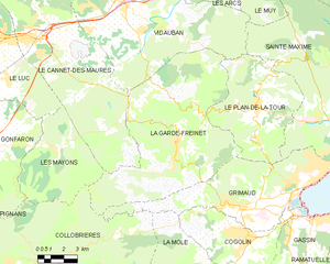
Le Plan-de-la-Tour (Le Plan-de-la-Tour)

- commune in Var, France
- Country:

- Postal Code: 83120
- Coordinates: 43° 20' 26" N, 6° 32' 47" E


- GPS tracks (wikiloc): [Link]
- Area: 36.8 sq km
- Population: 2695
- Web site: http://www.leplandelatour.net
- Wikipedia en: wiki(en)
- Wikipedia: wiki(fr)
- Wikidata storage: Wikidata: Q816108
- Wikipedia Commons Category: [Link]
- Freebase ID: [/m/03w9krt]
- GeoNames ID: Alt: [2986886]
- SIREN number: [218300945]
- BnF ID: [15277921s]
- VIAF ID: Alt: [152543397]
- PACTOLS thesaurus ID: [pcrtL95hZklMSI]
- Pleiades ID: [148159]
- INSEE municipality code: 83094
Shares border with regions:


Vidauban
- commune in Var, France
 Hiking in Vidauban
Vidauban is a charming village located in the Var department of the Provence-Alpes-Côte d'Azur region in southeastern France. Surrounded by beautiful landscapes, it offers a variety of hiking opportunities that cater to different skill levels. Here are some highlights and tips for hiking in Vidauban:...
- Country:
- Postal Code: 83550
- Coordinates: 43° 25' 38" N, 6° 25' 55" E
- GPS tracks (wikiloc): [Link]
- Area: 73.93 sq km
- Population: 11391


Sainte-Maxime
- commune in Var, France
- Country:
- Postal Code: 83120
- Coordinates: 43° 18' 32" N, 6° 38' 16" E
- GPS tracks (wikiloc): [Link]
- Area: 81.61 sq km
- Population: 14289
- Web site: [Link]

La Garde-Freinet
- commune in Var, France
- Country:
- Postal Code: 83680
- Coordinates: 43° 19' 1" N, 6° 28' 9" E
- GPS tracks (wikiloc): [Link]
- Area: 76.64 sq km
- Population: 1878
- Web site: [Link]


Grimaud
- commune in Var, France
- Country:
- Postal Code: 83310
- Coordinates: 43° 16' 24" N, 6° 31' 18" E
- GPS tracks (wikiloc): [Link]
- Area: 44.58 sq km
- Population: 4300