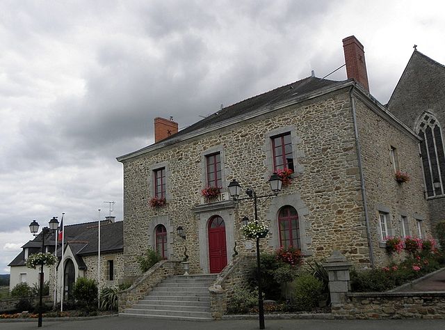
La Gravelle (La Gravelle)

- commune in Mayenne, France
- Country:

- Postal Code: 53410
- Coordinates: 48° 4' 22" N, 1° 0' 57" E


- GPS tracks (wikiloc): [Link]
- Area: 6.23 sq km
- Population: 519
- Wikipedia en: wiki(en)
- Wikipedia: wiki(fr)
- Wikidata storage: Wikidata: Q609098
- Wikipedia Commons Category: [Link]
- Freebase ID: [/m/03qdddx]
- GeoNames ID: Alt: [6613204]
- SIREN number: [215301086]
- BnF ID: [152639010]
- INSEE municipality code: 53108
Shares border with regions:


Bréal-sous-Vitré
- commune in Ille-et-Vilaine, France
- Country:
- Postal Code: 35370
- Coordinates: 48° 6' 11" N, 1° 3' 40" E
- GPS tracks (wikiloc): [Link]
- Area: 5.75 sq km
- Population: 655


Saint-Cyr-le-Gravelais
- commune in Mayenne, France
- Country:
- Postal Code: 53320
- Coordinates: 48° 2' 6" N, 1° 1' 38" E
- GPS tracks (wikiloc): [Link]
- Area: 19.82 sq km
- Population: 538

Le Pertre
- commune in Ille-et-Vilaine, France
- Country:
- Postal Code: 35370
- Coordinates: 48° 2' 5" N, 1° 2' 14" E
- GPS tracks (wikiloc): [Link]
- Area: 43.63 sq km
- Population: 1390
- Web site: [Link]


Saint-Pierre-la-Cour
- commune in Mayenne, France
- Country:
- Postal Code: 53410
- Coordinates: 48° 6' 54" N, 1° 1' 35" E
- GPS tracks (wikiloc): [Link]
- Area: 15.69 sq km
- Population: 2136
- Web site: [Link]


La Brûlatte
- commune in Mayenne, France
- Country:
- Postal Code: 53410
- Coordinates: 48° 5' 7" N, 0° 57' 12" E
- GPS tracks (wikiloc): [Link]
- Area: 15.24 sq km
- Population: 701
- Web site: [Link]

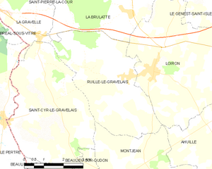
Ruillé-le-Gravelais
- former commune in Mayenne, France
- Country:
- Postal Code: 53320
- Coordinates: 48° 3' 21" N, 0° 57' 19" E
- GPS tracks (wikiloc): [Link]
- Area: 16.94 sq km
- Population: 951
- Web site: [Link]