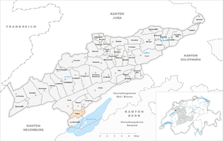
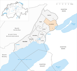
La Neuveville (La Neuveville)
- municipality in Switzerland
La Neuveville, located on the shores of Lake Biel in Switzerland, is a charming town known for its picturesque landscapes and rich history. Hiking in this region offers stunning views of the lake, the Jura Mountains, and the surrounding vineyards. Here are some highlights and tips for hiking in La Neuveville:
Hiking Trails
-
Sentier des Vignes (Vineyard Trail): This popular trail winds through the vineyards around La Neuveville, providing breathtaking views of Lake Biel and the Alps. It's a relatively easy hike, perfect for a leisurely day.
-
Jura Crest Trail: A bit more challenging, this trail runs along the ridge of the Jura Mountains, offering panoramic views. You can access parts of this trail from La Neuveville, and it's suitable for more experienced hikers looking for a full-day adventure.
-
Nearby Nature Reserves: Explore the nearby nature reserves such as the "Natural Reserve of Niesens," which offers well-marked trails through dense forests and along the cliffs, ideal for observing local wildlife.
Recommendations
-
Season: The best time for hiking in La Neuveville is late spring to early autumn (May to October), when the weather is generally mild and the trails are well-maintained.
-
Trail Conditions: Always check trail conditions before you head out, especially after heavy rain or snow.
-
Equipment: Wear sturdy hiking boots and carry essential gear, including water, snacks, a first-aid kit, and a map or GPS device.
-
Local Attractions: After hiking, take time to explore the historical town center of La Neuveville, with its old buildings and charming streets. Don’t miss the chance to enjoy local wines!
-
Respect Nature: Always follow Leave No Trace principles to protect the natural environment. Stick to marked trails and avoid disturbing wildlife.
Whether you’re a beginner or an experienced hiker, La Neuveville offers a variety of beautiful trails that showcase the best of Swiss nature and culture. Enjoy your hike!
- Country:

- Postal Code: 2520
- Local Dialing Code: 032
- Licence Plate Code: BE
- Coordinates: 47° 3' 55" N, 7° 5' 40" E


- GPS tracks (wikiloc): [Link]
- AboveSeaLevel: 723 м m
- Area: 6.8 sq km
- Population: 3444
- Web site: http://www.neuveville.ch
- Wikipedia en: wiki(en)
- Wikipedia: wiki(de)
- Wikidata storage: Wikidata: Q69476
- Wikipedia Commons Category: [Link]
- Freebase ID: [/m/03122g]
- GeoNames ID: Alt: [7286256]
- OSM relation ID: [1682521]
- GND ID: Alt: [4306478-4]
- archINFORM location ID: [11097]
- Library of Congress authority ID: Alt: [n81012240]
- Quora topic ID: [La-Neuveville]
- HDS ID: [431]
- Swiss municipality code: [0723]
Shares border with regions:


Gals
- municipality in Switzerland
It seems there might be a typo in your request, as "Gals" doesn't specifically refer to a known hiking destination. If you meant "gals" informally to refer to women who hike, I can certainly provide tips or information about hiking communities focused on women....
- Country:

- Postal Code: 3238
- Local Dialing Code: 032
- Licence Plate Code: BE
- Coordinates: 47° 1' 38" N, 7° 2' 56" E


- GPS tracks (wikiloc): [Link]
- AboveSeaLevel: 430 м m
- Area: 7.83 sq km
- Population: 800
- Web site: [Link]


Lignières
- municipality in the canton of Neuchâtel, Switzerland
Lignières is a picturesque village located in the Neuchâtel region of Switzerland. It's a great starting point for hiking enthusiasts due to its scenic views, diverse terrain, and proximity to the Jura Mountains. Here are some highlights and suggestions for hiking in and around Lignières:...
- Country:

- Postal Code: 2523
- Local Dialing Code: 032
- Licence Plate Code: NE
- Coordinates: 47° 5' 0" N, 7° 4' 0" E


- GPS tracks (wikiloc): [Link]
- AboveSeaLevel: 802 м m
- Area: 12.51 sq km
- Population: 952
- Web site: [Link]


Erlach
- municipality in the canton of Bern, Switzerland
Erlach, a picturesque village located near the shores of Lake Biel in Switzerland, is surrounded by beautiful landscapes that are perfect for hiking enthusiasts. The region offers a variety of trails that cater to different skill levels, making it a great destination for both beginners and experienced hikers....
- Country:

- Postal Code: 3235
- Local Dialing Code: 032
- Licence Plate Code: BE
- Coordinates: 47° 2' 33" N, 7° 5' 51" E


- GPS tracks (wikiloc): [Link]
- AboveSeaLevel: 454 м m
- Area: 3.5 sq km
- Population: 1427
- Web site: [Link]


Ligerz
- municipality in Switzerland
Ligerz is a charming village located in the Canton of Bern, Switzerland, alongside the stunning Lake Biel. It’s a great destination for hiking enthusiasts, offering beautiful scenery, diverse trails, and a peaceful atmosphere. Here are some highlights about hiking in Ligerz:...
- Country:

- Postal Code: 2514
- Local Dialing Code: 032
- Licence Plate Code: BE
- Coordinates: 47° 5' 0" N, 7° 8' 0" E


- GPS tracks (wikiloc): [Link]
- AboveSeaLevel: 643 м m
- Area: 1.8 sq km
- Population: 566
- Web site: [Link]


Prêles
- former municipality of Switzerland
Prêles is a charming village located in the beautiful region of the Bernese Jura in Switzerland. It offers fantastic opportunities for hiking enthusiasts, with its stunning landscapes, rich flora and fauna, and panoramic views of the surrounding mountains and valleys....
- Country:

- Postal Code: 2515
- Local Dialing Code: 032
- Licence Plate Code: BE
- Coordinates: 47° 6' 0" N, 7° 8' 0" E


- GPS tracks (wikiloc): [Link]
- AboveSeaLevel: 822 м m
- Area: 6.98 sq km
- Web site: [Link]


Le Landeron
- municipality of Switzerland
Le Landeron is a picturesque village located in the Neuchâtel region of Switzerland, nestled along the shores of Lake Neuchâtel. It offers a variety of hiking opportunities, characterized by beautiful landscapes, charming vineyards, and serene lakeside views. Here are some key points to consider if you're planning to hike in Le Landeron:...
- Country:

- Postal Code: 2525
- Local Dialing Code: 032
- Licence Plate Code: NE
- Coordinates: 47° 3' 19" N, 7° 4' 9" E


- GPS tracks (wikiloc): [Link]
- AboveSeaLevel: 575 м m
- Area: 10.31 sq km
- Population: 4647
- Web site: [Link]

