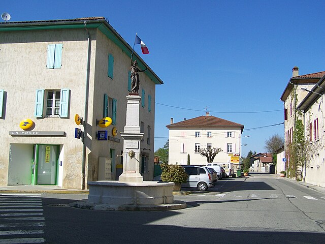
La Sône (La Sône)
- commune in Isère, France
La Sône is a charming commune located in the Auvergne-Rhône-Alpes region of France, surrounded by beautiful natural landscapes. While it may not be as widely known as some of the larger hiking destinations in the Alps, it offers a variety of scenic trails that cater to different skill levels.
Hiking Trails
-
Local Hiking Paths: La Sône features numerous marked hiking trails that showcase the enchanting countryside, including lush forests, rolling hills, and beautiful views of the surrounding mountains. The trails are generally well-maintained and offer options for both short walks and longer hikes.
-
Vercors Regional Natural Park: Nearby, the Vercors region provides more extensive hiking opportunities. The park boasts spectacular limestone cliffs, deep gorges, and diverse flora and fauna. You can embark on a variety of hikes, from easy strolls to challenging ascents.
-
Cascades de la Druise: This is a popular hiking destination near La Sône. The trail leading to the cascades is relatively easy and suitable for families. You can enjoy the stunning waterfalls and the surrounding natural beauty.
Hiking Tips
- Seasonal Considerations: Spring and fall are ideal times for hiking in this region, as the weather is generally mild and the scenery is particularly beautiful with changing foliage or blooming wildflowers.
- Stay Hydrated: Always carry sufficient water, especially during warmer months. Many trails might not have water sources nearby.
- Pick the Right Gear: Depending on the difficulty of the trail, wear appropriate footwear and clothing. Good hiking boots will provide the necessary grip and support.
- Navigation: While trails are usually marked, it’s wise to carry a map or use a GPS device to stay oriented.
Local Amenities
La Sône is small, but you will likely find local accommodations such as guesthouses or bed and breakfasts. It’s a good idea to check local eateries or shops for supplies, especially if you plan to spend a day out on the trails.
Conclusion
Hiking in La Sône offers a peaceful and picturesque experience for outdoor enthusiasts. With its proximity to the Vercors and a range of trails to explore, it's an excellent option for those looking to enjoy the stunning landscapes of this beautiful region in France. Whether you are a seasoned hiker or a beginner, you will find trails that inspire and invigorate!
- Country:

- Postal Code: 38840
- Coordinates: 45° 6' 41" N, 5° 16' 41" E


- GPS tracks (wikiloc): [Link]
- Area: 2.95 sq km
- Population: 579
- Web site: http://www.la-sone.fr
- Wikipedia en: wiki(en)
- Wikipedia: wiki(fr)
- Wikidata storage: Wikidata: Q1060544
- Wikipedia Commons Category: [Link]
- Freebase ID: [/m/03nvksq]
- GeoNames ID: Alt: [6455955]
- SIREN number: [213804958]
- BnF ID: [15258297x]
- INSEE municipality code: 38495
Shares border with regions:


Saint-Just-de-Claix
- commune in Isère, France
Saint-Just-de-Claix is a charming village located in the Drôme department of the Auvergne-Rhône-Alpes region of southeastern France. It sits at the foothills of the Vercors Massif, a stunning area known for its dramatic landscapes, limestone cliffs, and extensive hiking trails. Here are some highlights of hiking in and around Saint-Just-de-Claix:...
- Country:

- Postal Code: 38680
- Coordinates: 45° 4' 29" N, 5° 17' 2" E


- GPS tracks (wikiloc): [Link]
- Area: 11.59 sq km
- Population: 1178


Saint-Hilaire-du-Rosier
- commune in Isère, France
 Hiking in Saint-Hilaire-du-Rosier
Saint-Hilaire-du-Rosier is a small commune located in the Drôme department of southeastern France. It is situated in a picturesque region that features a mix of natural beauty, charming rural landscapes, and proximity to various hiking opportunities....
- Country:

- Postal Code: 38840
- Coordinates: 45° 6' 3" N, 5° 14' 53" E


- GPS tracks (wikiloc): [Link]
- Area: 16.42 sq km
- Population: 1921
- Web site: [Link]


Chatte
- commune in Isère, France
It seems like you might be referring to a location that could be spelled differently or may not be widely recognized as a hiking destination. If you meant "Chattahoochee" or other known areas, please clarify. However, if you are referring to a lesser-known area, here's a general guide on how to approach hiking in any location:...
- Country:

- Postal Code: 38160
- Coordinates: 45° 8' 37" N, 5° 16' 59" E


- GPS tracks (wikiloc): [Link]
- Area: 22.81 sq km
- Population: 2496
- Web site: [Link]


Saint-Romans
- commune in Isère, France
Saint-Romans is a picturesque village located in the Isère department of the Auvergne-Rhône-Alpes region in southeastern France. This location offers various hiking opportunities for both novice and experienced hikers. Here are some highlights to consider when hiking in and around Saint-Romans:...
- Country:

- Postal Code: 38160
- Coordinates: 45° 6' 57" N, 5° 19' 37" E


- GPS tracks (wikiloc): [Link]
- Area: 17.04 sq km
- Population: 1786
- Web site: [Link]
