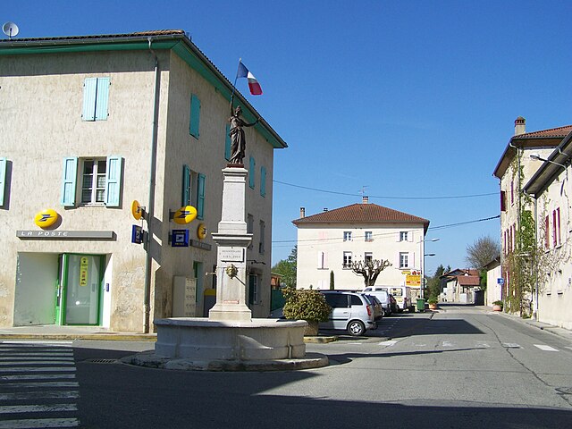
Saint-Romans (Saint-Romans)

- commune in Isère, France
 Hiking in Saint-Romans
Saint-Romans is a picturesque village located in the Isère department of the Auvergne-Rhône-Alpes region in southeastern France. This location offers various hiking opportunities for both novice and experienced hikers. Here are some highlights to consider when hiking in and around Saint-Romans:
Hiking Trails
-
Local Paths: The area around Saint-Romans has many paths winding through lovely landscapes, including forests, meadows, and rolling hills. These trails often provide stunning views of the Vercors mountains and are suitable for leisurely walks.
-
The Vercors Regional Natural Park: Just a short distance from Saint-Romans, this park offers numerous hiking trails that cater to different skill levels. The park's diverse flora and fauna make it a fantastic destination for nature lovers.
-
The Gorges de la Bourne: A bit further afield, this famous gorge is located in the Vercors massif and features breathtaking scenery. This area has well-marked trails that offer both easy and more challenging hikes, providing options for all levels.
Hiking Tips
-
Maps and Guides: Make sure to carry a detailed hiking map or download GPS apps that feature the trails in the region. Local tourist offices can provide useful information and maps.
-
Weather Considerations: Be mindful of the weather predictions before heading out. The mountainous terrain can experience rapid weather changes, especially in spring and autumn.
-
Duration and Difficulty: Choose trails that suit your fitness level and the time you have available. Allow extra time for breaks, and make sure to stay hydrated.
-
Safety Gear: Wear proper hiking footwear and consider carrying a basic first-aid kit, snacks, and sufficient water, especially on longer hikes.
Local Attractions
-
Cultural Sites: If you have time after your hike, explore local sites such as historical churches and traditional French architecture in Saint-Romans.
-
Wildlife Watching: The area offers excellent opportunities for birdwatching and spotting local wildlife, particularly in the Vercors Regional Natural Park.
Best Time to Hike
The best times for hiking in this region are spring (April to June) and autumn (September to October), when the weather is generally mild, and the landscapes are vibrant with color. Summer can be hot, while winter brings snow, transforming the area into a winter sports destination.
Hiking in Saint-Romans allows for a delightful blend of nature, culture, and adventure, making it a rewarding experience for outdoor enthusiasts.
- Country:

- Postal Code: 38160
- Coordinates: 45° 6' 57" N, 5° 19' 37" E


- GPS tracks (wikiloc): [Link]
- Area: 17.04 sq km
- Population: 1786
- Web site: http://www.saint-romans.fr
- Wikipedia en: wiki(en)
- Wikipedia: wiki(fr)
- Wikidata storage: Wikidata: Q667975
- Wikipedia Commons Category: [Link]
- Freebase ID: [/m/03g_5s_]
- GeoNames ID: Alt: [6433395]
- SIREN number: [213804537]
- BnF ID: [15258260k]
- INSEE municipality code: 38453
Shares border with regions:


La Sône
- commune in Isère, France
Hiking in La Sône
La Sône is a charming commune located in the Auvergne-Rhône-Alpes region of France, surrounded by beautiful natural landscapes. While it may not be as widely known as some of the larger hiking destinations in the Alps, it offers a variety of scenic trails that cater to different skill levels....
- Country:
- Postal Code: 38840
- Coordinates: 45° 6' 41" N, 5° 16' 41" E
- GPS tracks (wikiloc): [Link]
- Area: 2.95 sq km
- Population: 579
- Web site: [Link]
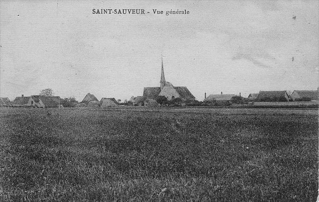
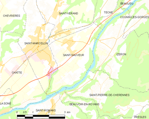
Saint-Sauveur
- commune in Isère, France
Hiking in Saint-Sauveur
Saint-Sauveur is a charming village located in the Isère department of the Auvergne-Rhône-Alpes region in southeastern France. It's known for its beautiful natural landscapes, making it a great destination for hiking enthusiasts....
- Country:
- Postal Code: 38160
- Coordinates: 45° 9' 9" N, 5° 20' 31" E
- GPS tracks (wikiloc): [Link]
- Area: 9.42 sq km
- Population: 2100
- Web site: [Link]


Saint-Just-de-Claix
- commune in Isère, France
Hiking in Saint-Just-de-Claix
Saint-Just-de-Claix is a charming village located in the Drôme department of the Auvergne-Rhône-Alpes region of southeastern France. It sits at the foothills of the Vercors Massif, a stunning area known for its dramatic landscapes, limestone cliffs, and extensive hiking trails. Here are some highlights of hiking in and around Saint-Just-de-Claix:...
- Country:
- Postal Code: 38680
- Coordinates: 45° 4' 29" N, 5° 17' 2" E
- GPS tracks (wikiloc): [Link]
- Area: 11.59 sq km
- Population: 1178


Saint-André-en-Royans
- commune in Isère, France
Hiking in Saint-André-en-Royans
Saint-André-en-Royans is a picturesque village located in the Drôme department of southeastern France, within the stunning Vercors Regional Natural Park. The area is known for its spectacular landscapes, rugged cliffs, lush forests, and unique geological formations, making it a great location for hiking enthusiasts of all levels....
- Country:
- Postal Code: 38680
- Coordinates: 45° 5' 9" N, 5° 20' 19" E
- GPS tracks (wikiloc): [Link]
- Area: 10.42 sq km
- Population: 319
- Web site: [Link]


Presles
- commune in Isère, France
Hiking in Presles
Presles is a charming village located in the Grand Chartreuse mountain range in the Isère department of the Auvergne-Rhône-Alpes region of France. It's known for its stunning natural beauty, making it a great destination for hiking enthusiasts. Here are some key points about hiking in and around Presles:...
- Country:
- Postal Code: 38680
- Coordinates: 45° 5' 28" N, 5° 22' 59" E
- GPS tracks (wikiloc): [Link]
- Area: 25.68 sq km
- Population: 89

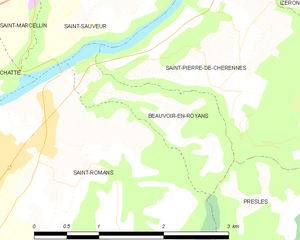
Beauvoir-en-Royans
- commune in Isère, France
Hiking in Beauvoir-en-Royans
Beauvoir-en-Royans is a charming village located in the Drôme department in southeastern France, nestled in the picturesque landscapes of the Vercors Regional Natural Park. This area is known for its stunning natural beauty, making it an excellent destination for hiking enthusiasts....
- Country:
- Postal Code: 38160
- Coordinates: 45° 7' 15" N, 5° 20' 17" E
- GPS tracks (wikiloc): [Link]
- AboveSeaLevel: 281 м m
- Area: 2.1 sq km
- Population: 89

Chatte
- commune in Isère, France
Hiking in Chatte
It seems like you might be referring to a location that could be spelled differently or may not be widely recognized as a hiking destination. If you meant "Chattahoochee" or other known areas, please clarify. However, if you are referring to a lesser-known area, here's a general guide on how to approach hiking in any location:...
- Country:
- Postal Code: 38160
- Coordinates: 45° 8' 37" N, 5° 16' 59" E
- GPS tracks (wikiloc): [Link]
- Area: 22.81 sq km
- Population: 2496
- Web site: [Link]