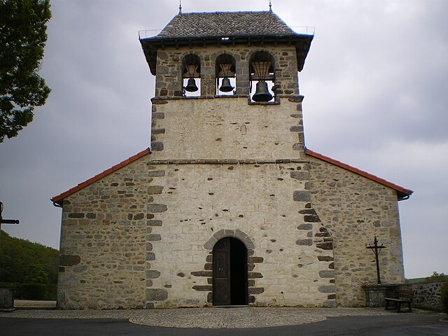
Labastide-du-Haut-Mont (Labastide-du-Haut-Mont)

- commune in Lot, France
- Country:

- Postal Code: 46210
- Coordinates: 44° 50' 5" N, 2° 7' 15" E


- GPS tracks (wikiloc): [Link]
- Area: 9.85 sq km
- Population: 48
- Wikipedia en: wiki(en)
- Wikipedia: wiki(fr)
- Wikidata storage: Wikidata: Q1322324
- Wikipedia Commons Category: [Link]
- Freebase ID: [/m/03mgnmh]
- GeoNames ID: Alt: [6616841]
- SIREN number: [214601353]
- BnF ID: [15260876w]
- INSEE municipality code: 46135
Shares border with regions:


Latronquière
- commune in Lot, France
- Country:
- Postal Code: 46210
- Coordinates: 44° 47' 59" N, 2° 4' 41" E
- GPS tracks (wikiloc): [Link]
- Area: 10.37 sq km
- Population: 460


Bessonies
- commune in Lot, France
- Country:
- Postal Code: 46210
- Coordinates: 44° 48' 37" N, 2° 9' 3" E
- GPS tracks (wikiloc): [Link]
- Area: 7.41 sq km
- Population: 82


Sénaillac-Latronquière
- commune in Lot, France
- Country:
- Postal Code: 46210
- Coordinates: 44° 49' 30" N, 2° 3' 36" E
- GPS tracks (wikiloc): [Link]
- Area: 11.26 sq km
- Population: 137


Saint-Hilaire
- commune in Lot, France
- Country:
- Postal Code: 46210
- Coordinates: 44° 46' 30" N, 2° 9' 19" E
- GPS tracks (wikiloc): [Link]
- AboveSeaLevel: 520 м m
- Area: 7.93 sq km
- Population: 71

Saint-Saury
- commune in Cantal, France
- Country:
- Postal Code: 15290
- Coordinates: 44° 52' 5" N, 2° 8' 23" E
- GPS tracks (wikiloc): [Link]
- Area: 30.11 sq km
- Population: 194
Lauresses
- commune in Lot, France
- Country:
- Postal Code: 46210
- Coordinates: 44° 46' 3" N, 2° 7' 23" E
- GPS tracks (wikiloc): [Link]
- Area: 23.73 sq km
- Population: 268

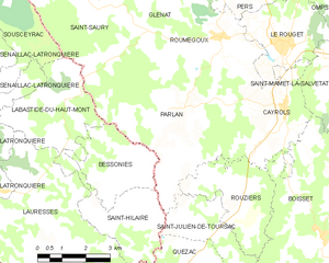
Parlan
- commune in Cantal, France
- Country:
- Postal Code: 15290
- Coordinates: 44° 49' 45" N, 2° 10' 21" E
- GPS tracks (wikiloc): [Link]
- Area: 24.12 sq km
- Population: 418