
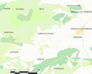
Lagrasse (Lagrasse)

- commune in Aude, France
- Country:

- Postal Code: 11220
- Coordinates: 43° 5' 27" N, 2° 37' 14" E


- GPS tracks (wikiloc): [Link]
- Area: 32.2 sq km
- Population: 547
- Web site: http://www.lagrasse.fr
- Wikipedia en: wiki(en)
- Wikipedia: wiki(fr)
- Wikidata storage: Wikidata: Q181605
- Wikipedia Commons Category: [Link]
- Freebase ID: [/m/03gzlrt]
- GeoNames ID: Alt: [3008923]
- SIREN number: [211101852]
- BnF ID: [15246722q]
- VIAF ID: Alt: [123285521]
- GND ID: Alt: [4272930-0]
- Library of Congress authority ID: Alt: [n90691956]
- Quora topic ID: [Lagrasse]
- INSEE municipality code: 11185
Shares border with regions:

Montlaur
- commune in Aude, France
- Country:
- Postal Code: 11220
- Coordinates: 43° 7' 46" N, 2° 33' 28" E
- GPS tracks (wikiloc): [Link]
- Area: 33.92 sq km
- Population: 530


Saint-Pierre-des-Champs
- commune in Aude, France
- Country:
- Postal Code: 11220
- Coordinates: 43° 3' 31" N, 2° 36' 17" E
- GPS tracks (wikiloc): [Link]
- Area: 15.89 sq km
- Population: 181
- Web site: [Link]


Ribaute
- commune in Aude, France
- Country:
- Postal Code: 11220
- Coordinates: 43° 6' 28" N, 2° 38' 6" E
- GPS tracks (wikiloc): [Link]
- Area: 9.41 sq km
- Population: 280


Serviès-en-Val
- commune in Aude, France
- Country:
- Postal Code: 11220
- Coordinates: 43° 5' 21" N, 2° 31' 12" E
- GPS tracks (wikiloc): [Link]
- Area: 6.5 sq km
- Population: 229

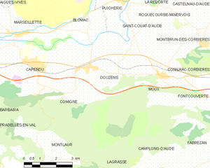
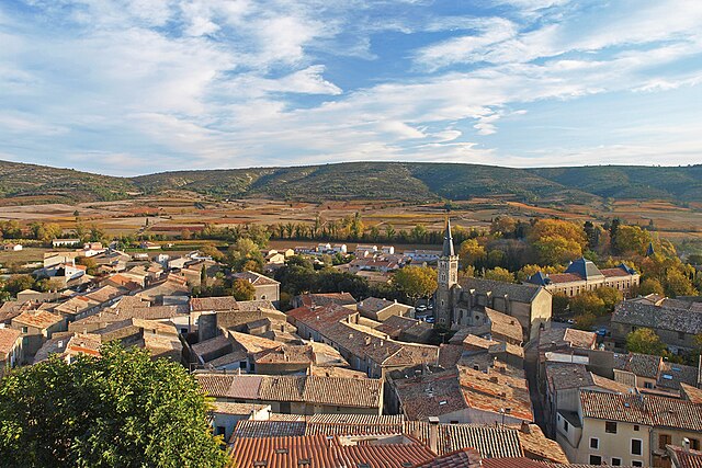
Douzens
- commune in Aude, France
- Country:
- Postal Code: 11700
- Coordinates: 43° 11' 9" N, 2° 35' 50" E
- GPS tracks (wikiloc): [Link]
- Area: 14.91 sq km
- Population: 718
Caunettes-en-Val
- commune in Aude, France
- Country:
- Postal Code: 11220
- Coordinates: 43° 3' 49" N, 2° 33' 13" E
- GPS tracks (wikiloc): [Link]
- Area: 8.71 sq km
- Population: 47

Tournissan
- commune in Aude, France
- Country:
- Postal Code: 11220
- Coordinates: 43° 4' 54" N, 2° 39' 52" E
- GPS tracks (wikiloc): [Link]
- Area: 11.53 sq km
- Population: 280

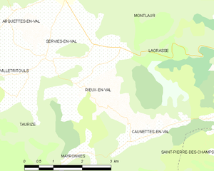
Rieux-en-Val
- commune in Aude, France
- Country:
- Postal Code: 11220
- Coordinates: 43° 4' 54" N, 2° 31' 51" E
- GPS tracks (wikiloc): [Link]
- Area: 6.9 sq km
- Population: 90

Camplong-d'Aude
- commune in Aude, France
- Country:
- Postal Code: 11200
- Coordinates: 43° 7' 43" N, 2° 39' 7" E
- GPS tracks (wikiloc): [Link]
- Area: 12.28 sq km
- Population: 353


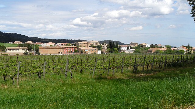
Talairan
- commune in Aude, France
- Country:
- Postal Code: 11220
- Coordinates: 43° 3' 5" N, 2° 39' 48" E
- GPS tracks (wikiloc): [Link]
- Area: 36.29 sq km
- Population: 465