Lambesc (Lambesc)
- commune in Bouches-du-Rhône, France
Lambesc, a charming commune in the Bouches-du-Rhône department of southern France, offers a variety of hiking opportunities that showcase the stunning landscapes and rich cultural heritage of the region. Here are some highlights of hiking in and around Lambesc:
Trails and Routes:
-
Cévennes de Lambesc: This area features several well-marked trails that meander through picturesque countryside, vineyards, and fragrant fields of lavender. The routes are suitable for hikers of different skill levels, ensuring everyone can enjoy the natural beauty.
-
Aigues de Lambesc: This scenic trail leads to the Aigues River, along which you can find peaceful spots for a picnic or just to take in the beauty of the surrounding nature. The trail often features varying terrain, making for an engaging experience.
-
Les Calanques: While not directly in Lambesc, the famous Calanques National Park is about a 30-minute drive away. The Calanques offer breathtaking coastal hikes with dramatic cliffs and crystal-clear waters, perfect for those willing to venture a little farther.
Points of Interest:
-
Vineyards and Olive Groves: Many of the trails in the Lambesc area pass by local vineyards and olive groves, where you can learn more about the region’s agricultural traditions.
-
Historical Sites: Along the hiking routes, you might encounter historical landmarks, such as old chapels and ruins, adding cultural depth to your outdoor adventure.
Best Times to Hike:
- Spring (April to June): This is an ideal time for hiking, as the weather is mild, and the wildflowers are in bloom.
- Fall (September to October): The temperatures are pleasant, and you can enjoy the changing colors of the foliage.
Hiking Tips:
- Footwear: Ensure you wear sturdy hiking boots for the varying terrain.
- Water and Snacks: Always carry enough water and some snacks, especially on longer hikes.
- Map and Navigation: Familiarize yourself with the trails and carry a map or GPS device, as some areas may not have cell service.
Local Resources:
Consider visiting the local tourist office in Lambesc for maps, trail information, and any guided hiking tours they may offer. Engaging with local hikers or joining a hiking group can enhance your experience and help you discover hidden gems in the area.
Whether you're seeking gentle strolls through vineyards or more challenging hikes with breathtaking views, Lambesc provides a wonderful setting for outdoor enthusiasts. Happy hiking!
- Country:

- Postal Code: 13410
- Coordinates: 43° 39' 14" N, 5° 15' 43" E


- GPS tracks (wikiloc): [Link]
- Area: 65.34 sq km
- Population: 9584
- Web site: http://www.lambesc.fr
- Wikipedia en: wiki(en)
- Wikipedia: wiki(fr)
- Wikidata storage: Wikidata: Q474025
- Wikipedia Commons Category: [Link]
- Freebase ID: [/m/02r0w1v]
- GeoNames ID: Alt: [3008208]
- SIREN number: [211300504]
- BnF ID: [152473325]
- VIAF ID: Alt: [126786208]
- Library of Congress authority ID: Alt: [n88680352]
- WOEID: [601031]
- EMLO location ID: [1abc3686-c6ed-4ade-867a-1a6a22759a0b]
- INSEE municipality code: 13050
Shares border with regions:
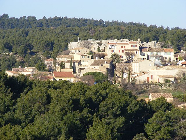
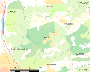
Aurons
- commune in Bouches-du-Rhône, France
- Country:

- Postal Code: 13121
- Coordinates: 43° 39' 54" N, 5° 9' 28" E


- GPS tracks (wikiloc): [Link]
- Area: 12.82 sq km
- Population: 533
- Web site: [Link]
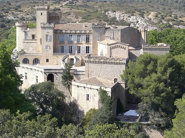

La Barben
- commune in Bouches-du-Rhône, France
- Country:

- Postal Code: 13330
- Coordinates: 43° 37' 48" N, 5° 10' 35" E


- GPS tracks (wikiloc): [Link]
- Area: 22.85 sq km
- Population: 814


Charleval
- commune in Bouches-du-Rhône, France
Charleval, located in the Bouches-du-Rhône department in the south of France, offers beautiful hiking opportunities amidst stunning natural landscapes. Here are some key points about hiking in Charleval:...
- Country:

- Postal Code: 13350
- Coordinates: 43° 43' 7" N, 5° 14' 44" E


- GPS tracks (wikiloc): [Link]
- Area: 14.41 sq km
- Population: 2731
- Web site: [Link]


Pélissanne
- commune in Bouches-du-Rhône, France
- Country:

- Postal Code: 13330
- Coordinates: 43° 37' 53" N, 5° 9' 2" E


- GPS tracks (wikiloc): [Link]
- Area: 19.11 sq km
- Population: 10055
- Web site: [Link]


Rognes
- commune in Bouches-du-Rhône, France
Rognes, located in the Bouches-du-Rhône department in the south of France, is a charming village surrounded by the beautiful landscapes of Provence. Hiking in and around Rognes offers a fantastic experience for outdoor enthusiasts, thanks to its scenic trails and natural beauty....
- Country:

- Postal Code: 13840
- Coordinates: 43° 39' 52" N, 5° 20' 50" E


- GPS tracks (wikiloc): [Link]
- Area: 58.32 sq km
- Population: 4795


Saint-Cannat
- commune in Bouches-du-Rhône, France
Saint-Cannat is a charming commune located in the Bouches-du-Rhône department in the Provence-Alpes-Côte d'Azur region of France. It offers a variety of hiking opportunities that allow visitors to experience the natural beauty and cultural heritage of the area....
- Country:

- Postal Code: 13760
- Coordinates: 43° 37' 17" N, 5° 17' 53" E


- GPS tracks (wikiloc): [Link]
- Area: 36.54 sq km
- Population: 5550
- Web site: [Link]
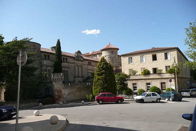
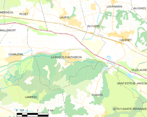
La Roque-d'Anthéron
- commune in Bouches-du-Rhône, France
La Roque-d'Anthéron is a charming village located in the Provence-Alpes-Côte d'Azur region of France, nestled in the heart of the Luberon Valley. Known for its scenic landscapes, rich history, and vibrant flora and fauna, it's a great base for hikers looking to explore the beautiful terrain....
- Country:

- Postal Code: 13640
- Coordinates: 43° 42' 53" N, 5° 18' 39" E


- GPS tracks (wikiloc): [Link]
- Area: 25.49 sq km
- Population: 5469
- Web site: [Link]
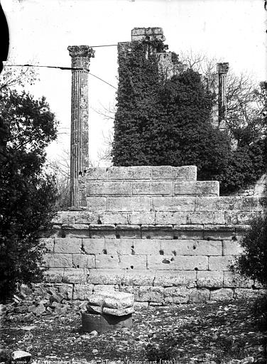

Vernègues
- commune in Bouches-du-Rhône, France
Vernègues is a charming village located in the Provence region of southern France. Hiking in and around Vernègues offers a wonderful mix of beautiful landscapes, rich history, and cultural experiences. Here are some key points about hiking in Vernègues:...
- Country:

- Postal Code: 13116
- Coordinates: 43° 41' 9" N, 5° 10' 17" E


- GPS tracks (wikiloc): [Link]
- Area: 15.89 sq km
- Population: 1701
- Web site: [Link]

