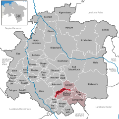
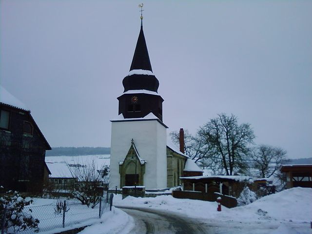
Lamspringe (Samtgemeinde Lamspringe)
- Samtgemeinde in Lower Saxony
Lamspringe, located in the Samtgemeinde in Lower Saxony, Germany, is a beautiful area that offers a variety of hiking opportunities amidst picturesque landscapes. Here’s an overview of hiking in Lamspringe and its surroundings:
Trails and Scenery
-
Local Trails: The region boasts several well-marked walking and hiking trails that cater to different skill levels. You can find paths that meander through forests, along rolling hills, and by streams, providing a mix of terrain and scenery.
-
Natura 2000 Sites: Lamspringe is close to protected areas that are part of the Natura 2000 network, which preserves diverse ecosystems. Hikes in these areas can also lead you to some unique flora and fauna.
-
Historic Sites: Incorporate some historical walking routes that might take you to the ruins of the Lamspringe Monastery or other significant landmarks that reflect the rich cultural heritage of the area.
Accessibility
-
Starting Points: Many trails can be accessed from the village itself, making it easy to begin a hike directly from Lamspringe.
-
Signage: Trails are usually well-marked, making navigation straightforward for both locals and visitors.
Tips for Hiking in Lamspringe
-
Weather: Check the weather forecast before heading out, as conditions can change quickly, especially in wooded areas.
-
Equipment: Wear appropriate hiking shoes, carry a map or GPS, and consider bringing trekking poles for stability on uneven terrain.
-
Local Regulations: Respect local wildlife and environmental regulations. Stick to marked trails to protect the habitat.
-
Hydration and Snacks: Bring plenty of water and some snacks, especially for longer hikes, as amenities might be limited on certain routes.
Nearby Attractions
- Consider exploring nearby towns or natural attractions, and check out local information centers for additional hiking maps and recommendations.
Whether you’re a seasoned hiker or a beginner, Lamspringe offers a serene environment and beautiful paths to explore the natural beauty of Lower Saxony. Always ensure you’re prepared, and enjoy your hiking adventure!
- Country:

- Coordinates: 51° 58' 0" N, 10° 1' 0" E


- GPS tracks (wikiloc): [Link]
- Web site: http://www.lamspringe.de/
- Wikipedia en: wiki(en)
- Wikipedia: wiki(de)
- Wikidata storage: Wikidata: Q532498
- Freebase ID: [/m/02v_w46]
- Freebase ID: [/m/02v_w46]
- German regional key: 032545403
- German regional key: 032545403
Includes regions:


Harbarnsen
- municipality of Germany
It seems that "Harbarnsen" might be a misspelling or a lesser-known location that's not widely recognized in hiking literature. However, if you're looking for hiking options in a specific region or country, I would be more than happy to help you find information about that area....
- Country:

- Postal Code: 31097
- Local Dialing Code: 05060
- Licence Plate Code: HI
- Coordinates: 51° 58' 59" N, 9° 58' 0" E


- GPS tracks (wikiloc): [Link]
- AboveSeaLevel: 189 м m
- Area: 15.03 sq km
- Web site: [Link]


Lamspringe
- municipality of Germany
Lamspringe is a charming village located in Lower Saxony, Germany, surrounded by beautiful landscapes that make it a great destination for hiking enthusiasts. Here are some highlights and tips for hiking in and around Lamspringe:...
- Country:

- Postal Code: 31195
- Local Dialing Code: 05183
- Licence Plate Code: HI
- Coordinates: 51° 57' 0" N, 10° 0' 0" E


- GPS tracks (wikiloc): [Link]
- AboveSeaLevel: 211 м m
- Area: 70.46 sq km
- Population: 5638
- Web site: [Link]


Sehlem, Lower Saxony
- municipality of Germany
 Hiking in Sehlem, Lower Saxony
Sehlem, a small village in Lower Saxony, Germany, is surrounded by beautiful natural landscapes that make it an appealing destination for hiking enthusiasts. While the village itself may not have well-marked trails like larger national parks, the surrounding area offers a variety of paths that allow you to immerse yourself in the tranquil countryside....
- Country:

- Postal Code: 31195
- Local Dialing Code: 05060
- Licence Plate Code: HI
- Coordinates: 52° 0' 49" N, 9° 58' 34" E


- GPS tracks (wikiloc): [Link]
- AboveSeaLevel: 140 м m
- Area: 12.77 sq km
- Population: 933
- Web site: [Link]


Woltershausen
- municipality of Germany
Woltershausen is a small village in Lower Saxony, Germany, known for its picturesque landscapes and proximity to nature, making it a great spot for hiking enthusiasts. While the area itself may not have extensive trails like larger national parks, there are several aspects to consider for hiking in and around Woltershausen:...
- Country:

- Postal Code: 31099
- Local Dialing Code: 05183
- Licence Plate Code: HI
- Coordinates: 51° 59' 0" N, 9° 57' 0" E


- GPS tracks (wikiloc): [Link]
- AboveSeaLevel: 192 м m
- Area: 16.38 sq km
- Web site: [Link]
Neuhof, Lower Saxony
- municipality of Germany
 Hiking in Neuhof, Lower Saxony
Neuhof, located in Lower Saxony, Germany, offers a peaceful setting for outdoor enthusiasts and hikers. While it may not be as widely known as some larger hiking destinations, it provides a tranquil experience surrounded by nature....
- Country:

- Postal Code: 31195
- Local Dialing Code: 05183
- Licence Plate Code: HI
- Coordinates: 51° 58' 59" N, 10° 3' 0" E


- GPS tracks (wikiloc): [Link]
- AboveSeaLevel: 216 м m
- Area: 10.30 sq km
- Population: 417
- Web site: [Link]