Zellerfeld District (Landkreis Zellerfeld)

- former district of Germany
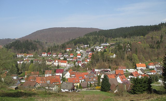
 Hiking in Zellerfeld District
Landkreis Zellerfeld, often referred to as the Zellerfeld district, is located in Germany within the state of Lower Saxony. This area is known for its beautiful natural landscapes, which provide excellent opportunities for hiking and outdoor activities.
Hiking Opportunities:
-
Harz National Park: Close to Zellerfeld, the Harz National Park features well-marked trails that range from easy to challenging. You can explore dense forests, rocky outcrops, and enjoy panoramic views from several peaks, such as the Brocken, the highest mountain in Northern Germany.
-
Historic Trails: The area is rich in history, and many hiking paths lead through sites of cultural significance, including old mines, traditional half-timbered houses, and historical towns like Clausthal-Zellerfeld.
-
The Harzer-Hexen-Stieg: This long-distance hiking trail is around 97 km and offers a unique blend of fairy-tale-like landscapes and folklore. The trail passes through various towns and natural sights, making it an engaging experience for hikers.
-
Family-Friendly Hikes: There are also shorter, well-maintained trails suitable for families and beginners. These often include educational signs about local flora and fauna, making them perfect for a leisurely hike.
Tips for Hiking in Landkreis Zellerfeld:
-
Weather: Be sure to check the weather conditions before heading out, as they can change quickly in mountainous areas.
-
Gear: Wear sturdy hiking boots and dress in layers to adapt to the changing temperatures. Don’t forget a map or a GPS device.
-
Safety: Inform someone about your hiking plans, especially if you’re heading into less populated areas, and carry a first-aid kit.
-
Stay on Trails: To protect the natural environment and avoid getting lost, stick to marked paths.
-
Refuel: Bring enough water and snacks to keep your energy levels up during your hike.
Overall, hiking in Landkreis Zellerfeld offers an opportunity to connect with nature and enjoy the area's scenic beauty, along with a touch of cultural exploration.
- Country:

- Licence Plate Code: CLZ
- Coordinates: 51° 30' 54" N, 10° 15' 10" E


- GPS tracks (wikiloc): [Link]
- Area: 532.71 sq km
- Population: 34200
- Wikidata storage: Wikidata: Q1613939
- VIAF ID: Alt: [246574431]
- GND ID: Alt: [4119230-8]
Includes regions:
Bad Grund
- human settlement in Germany
Hiking in Bad Grund
Bergstadt Bad Grund, located in the Harz mountain range in Germany, is a fantastic destination for hiking enthusiasts. The area is known for its picturesque landscapes, rich mining history, and well-maintained trails. Here's what you should know about hiking in this beautiful region:...
- Country:
- Postal Code: 37539
- Local Dialing Code: 05327
- Coordinates: 51° 48' 37" N, 10° 14' 13" E
- GPS tracks (wikiloc): [Link]
- AboveSeaLevel: 295 м m
- Population: 2129
Lonauerhammerhütte
- human settlement in Germany
Hiking in Lonauerhammerhütte
The Lonauerhammerhütte is a charming alpine hut located in the beautiful region of Austria’s Tyrol or Bavaria, though be sure to verify the exact location as names can overlap in various regions. This area is popular for hiking, offering scenic views and a range of trails suitable for various skill levels....
- Country:
- Coordinates: 51° 39' 46" N, 10° 21' 15" E
- GPS tracks (wikiloc): [Link]
- Population: 133

Lonau
- human settlement in Germany
Hiking in Lonau
Lonau is a picturesque village located in the Harz Mountains of Lower Saxony, Germany. It offers a wealth of hiking opportunities, thanks to its stunning natural landscapes, diverse ecosystems, and well-marked trails....
- Country:
- Postal Code: 37412
- Local Dialing Code: 05521
- Coordinates: 51° 41' 27" N, 10° 21' 33" E
- GPS tracks (wikiloc): [Link]
- Population: 293

Sieber
- village in the Harz Mountains, Germany
Hiking in Sieber
Sieber, a picturesque village located in the Harz region of Germany, offers a variety of hiking opportunities for outdoor enthusiasts. The surrounding Harz Mountains are characterized by lush forests, stunning landscapes, and a range of trails suitable for all skill levels. Here are some highlights and tips for hiking in and around Sieber:...
- Country:
- Postal Code: 37412
- Local Dialing Code: 05585
- Coordinates: 51° 41' 51" N, 10° 25' 25" E
- GPS tracks (wikiloc): [Link]
- Population: 469
- Web site: [Link]

Riefensbeek-Kamschlacken
- human settlement in Germany
Hiking in Riefensbeek-Kamschlacken
Riefensbeek-Kamschlacken is a quaint village located in the Harz Mountains region of Germany, renowned for its picturesque landscapes and various hiking opportunities. The area offers a mix of well-maintained trails that cater to different skill levels, making it suitable for both novice and experienced hikers....
- Country:
- Postal Code: 37520
- Local Dialing Code: 05522
- Coordinates: 51° 45' 11" N, 10° 22' 44" E
- GPS tracks (wikiloc): [Link]
- AboveSeaLevel: 360 м m
- Population: 242

Lerbach
- municipal district of Osterode am Harz in Lower Saxony, Germany
Hiking in Lerbach
Lerbach, located in the picturesque region of Osterode am Harz in Germany, offers a variety of hiking opportunities that cater to all levels of experience. Nestled in the Harz Mountains, the area is renowned for its stunning natural beauty, dense forests, and impressive rock formations....
- Country:
- Postal Code: 37520
- Local Dialing Code: 05522
- Coordinates: 51° 45' 31" N, 10° 18' 18" E
- GPS tracks (wikiloc): [Link]
- AboveSeaLevel: 331 м m
- Population: 990