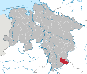
Hildesheim Government Region (Regierungsbezirk Hildesheim)

- former district of Pussia and Lower Saxony, Germany
 Hiking in Hildesheim Government Region
Regierungsbezirk Hildesheim, located in Lower Saxony, Germany, offers a variety of hiking opportunities set against picturesque landscapes, including rolling hills, dense forests, and charming villages. Here are some highlights and tips for hiking in this region:
Natural Attractions
-
Hildesheim Forest: A great place for hiking with numerous trails winding through dense trees. The vibrant flora and fauna provide a beautiful backdrop for your hike.
-
Ilme Valley: Featuring scenic landscapes and the Ilme River, this area offers pleasant river-side walks and an opportunity to enjoy nature.
-
Teutoburg Forest: Just a short drive away, this national park features well-marked trails, stunning vistas, and historic sites that are worth exploring.
Popular Hiking Trails
-
Hildesheimer Höhenweg: This trail runs around Hildesheim, offering panoramic views of the area. It’s suitable for all levels and features both challenging and easier sections.
-
Grenz- und Waldwege: Trails along the borders of forests that connect small villages, giving hikers the chance to experience local culture and nature simultaneously.
Tips for Hiking in Hildesheim
-
Trail Maps: It’s helpful to have a detailed trail map or a GPS app installed on your phone, as some trails can be less marked.
-
Weather Preparedness: The weather can change rapidly, so it's advisable to check the forecast before heading out and to dress in layers.
-
Hydration and Snacks: Carry enough water and snacks, especially if you're planning a longer hike.
-
Respect Nature: Stay on marked trails and respect wildlife and vegetation.
-
Local Recommendations: Engage with local hiking clubs or community centers for the best trails and hidden gems.
Accessibility
Many trails in this area are well-maintained and accessible by public transport, making it easy for hikers to reach starting points without a car.
Whether you are a seasoned hiker or a beginner, Regierungsbezirk Hildesheim has plenty to offer for all levels of experience. Enjoy the beauty of nature and the tranquility that comes with hiking in this lovely region of Germany!
- Country:

- Wikidata storage: Wikidata: Q896905
- VIAF ID: Alt: [151898556]
- GND ID: Alt: [1018020-5]
Includes regions:
Landkreis Münden
Hiking in Landkreis Münden
Landkreis Münden, located in Lower Saxony, Germany, is known for its beautiful natural landscapes, making it an excellent destination for hiking enthusiasts. The area is characterized by its lush forests, rolling hills, and picturesque rivers, particularly the confluence of the Fulda and Weser rivers at the town of Münden. Here are some highlights for hiking in this region:...
- Country:
- Coordinates: 51° 24' 56" N, 9° 39' 25" E


- GPS tracks (wikiloc): [Link]
Kreis Gronau
- district of Prussia
Hiking in Kreis Gronau
Kreis Gronau, located in North Rhine-Westphalia, Germany, offers a variety of scenic hiking opportunities that can cater to different skill levels. Although it may not be as famous as some of the larger mountain ranges in Germany, it has its own charm with picturesque landscapes, tranquil forests, and access to several nature reserves....
Duderstadt
Hiking in Duderstadt
Landkreis Duderstadt is an area in Lower Saxony, Germany, known for its picturesque landscapes and charming small towns. Hiking in this region offers a blend of natural beauty, historical sites, and cultural experiences. Here are some key aspects to consider for hiking in Landkreis Duderstadt:...
- Country:
- Coordinates: 51° 30' 54" N, 10° 15' 10" E
- GPS tracks (wikiloc): [Link]
Landkreis Marienburg
- district of Prussia
Hiking in Landkreis Marienburg
Landkreis Marienburg, located in the Hannover region of Lower Saxony, Germany, offers a range of hiking opportunities that showcase beautiful landscapes and natural scenery. While it may not be the most prominent hiking destination in Germany, there are still several trails and areas that can be enjoyed by outdoor enthusiasts....


Zellerfeld District
- former district of Germany
Hiking in Zellerfeld District
Landkreis Zellerfeld, often referred to as the Zellerfeld district, is located in Germany within the state of Lower Saxony. This area is known for its beautiful natural landscapes, which provide excellent opportunities for hiking and outdoor activities....
- Country:
- Licence Plate Code: CLZ
- Coordinates: 51° 30' 54" N, 10° 15' 10" E
- GPS tracks (wikiloc): [Link]
- Area: 532.71 sq km
- Population: 34200
Landkreis Einbeck
Hiking in Landkreis Einbeck
Landkreis Einbeck, located in Lower Saxony, Germany, is known for its picturesque landscapes, charming towns, and rich natural heritage, making it a great location for hiking enthusiasts. The area features a variety of trails that cater to different skill levels, ensuring that both beginners and experienced hikers can find suitable routes....
- Country:
- Coordinates: 51° 49' 0" N, 9° 52' 0" E
- GPS tracks (wikiloc): [Link]
Kreis Ilfeld
Hiking in Kreis Ilfeld
Kreis Ilfeld, located in the Harz region of Germany, offers a variety of beautiful hiking opportunities. The Harz Mountains are known for their lush forests, scenic landscapes, and rich historical sites, making it a great destination for both casual hikers and more seasoned trekkers....
Uslar
Hiking in Uslar
Kreis Uslar, located in the picturesque region of Lower Saxony, Germany, offers a variety of hiking opportunities that cater to both casual walkers and seasoned hikers. The area is characterized by its rolling hills, dense forests, and charming villages, making it an ideal destination for those looking to immerse themselves in nature....
- Coordinates: 51° 39' 35" N, 9° 38' 9" E
- GPS tracks (wikiloc): [Link]
Alfeld
Hiking in Alfeld
Landkreis Alfeld (Leine), located in Lower Saxony, Germany, offers a unique blend of scenic landscapes, cultural heritage, and a variety of hiking trails that cater to different levels of experience. The region is characterized by rolling hills, lush forests, and picturesque villages, making it an attractive destination for outdoor enthusiasts....
- Country:
- Coordinates: 51° 59' 0" N, 9° 50' 0" E
- GPS tracks (wikiloc): [Link]

Osterode
- former district in Lower Saxony, Germany
Hiking in Osterode
Osterode, located in the Lower Saxony region of Germany, offers a variety of hiking opportunities, particularly given its picturesque landscapes and proximity to the Harz Mountains. Here are some key points to consider for hiking in the Osterode district:...
- Country:
- Licence Plate Code: OHA
- Coordinates: 51° 40' 12" N, 10° 19' 48" E
- GPS tracks (wikiloc): [Link]
- AboveSeaLevel: 505 м m
- Area: 636.00 sq km
- Population: 75245
- Web site: [Link]