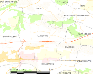
Landorthe (Landorthe)
- commune in Haute-Garonne, France
- Country:

- Postal Code: 31800
- Coordinates: 43° 7' 53" N, 0° 47' 2" E


- GPS tracks (wikiloc): [Link]
- Area: 9.65 sq km
- Population: 980
- Web site: http://www.mairie-landorthe.fr
- Wikipedia en: wiki(en)
- Wikipedia: wiki(fr)
- Wikidata storage: Wikidata: Q1611329
- Wikipedia Commons Category: [Link]
- Freebase ID: [/m/03ns_53]
- Freebase ID: [/m/03ns_53]
- GeoNames ID: Alt: [6431629]
- GeoNames ID: Alt: [6431629]
- SIREN number: [213102700]
- SIREN number: [213102700]
- BnF ID: [15255265k]
- BnF ID: [15255265k]
- INSEE municipality code: 31270
- INSEE municipality code: 31270
Shares border with regions:
Savarthès
- commune in Haute-Garonne, France
- Country:

- Postal Code: 31800
- Coordinates: 43° 7' 14" N, 0° 48' 22" E


- GPS tracks (wikiloc): [Link]
- Area: 3.05 sq km
- Population: 174
Estancarbon
- commune in Haute-Garonne, France
- Country:

- Postal Code: 31800
- Coordinates: 43° 6' 16" N, 0° 47' 9" E


- GPS tracks (wikiloc): [Link]
- Area: 6.23 sq km
- Population: 607
- Web site: [Link]


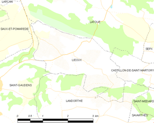
Lieoux
- commune in Haute-Garonne, France
- Country:

- Postal Code: 31800
- Coordinates: 43° 9' 18" N, 0° 46' 10" E


- GPS tracks (wikiloc): [Link]
- Area: 5.83 sq km
- Population: 125
- Web site: [Link]


Saint-Gaudens
- commune in Haute-Garonne, France
- Country:

- Postal Code: 31800
- Coordinates: 43° 6' 29" N, 0° 43' 24" E


- GPS tracks (wikiloc): [Link]
- AboveSeaLevel: 405 м m
- Area: 27.35 sq km
- Population: 11327
- Web site: [Link]
Saint-Médard
- commune in Haute-Garonne, France
- Country:

- Postal Code: 31360
- Coordinates: 43° 7' 42" N, 0° 50' 5" E


- GPS tracks (wikiloc): [Link]
- AboveSeaLevel: 400 м m
- Area: 5.32 sq km
- Population: 221
Castillon-de-Saint-Martory
- commune in Haute-Garonne, France
- Country:

- Postal Code: 31360
- Coordinates: 43° 8' 4" N, 0° 51' 33" E


- GPS tracks (wikiloc): [Link]
- Area: 10.98 sq km
- Population: 376
