Landres (Landres)
- commune in Meurthe-et-Moselle, France
- Country:

- Postal Code: 54970
- Coordinates: 49° 19' 17" N, 5° 48' 19" E


- GPS tracks (wikiloc): [Link]
- Area: 8.04 sq km
- Population: 980
- Web site: http://www.landres.mairie.com
- Wikipedia en: wiki(en)
- Wikipedia: wiki(fr)
- Wikidata storage: Wikidata: Q1060571
- Wikipedia Commons Category: [Link]
- Freebase ID: [/m/03qdjkm]
- Freebase ID: [/m/03qdjkm]
- Freebase ID: [/m/03qdjkm]
- GeoNames ID: Alt: [3007825]
- GeoNames ID: Alt: [3007825]
- GeoNames ID: Alt: [3007825]
- SIREN number: [215402959]
- SIREN number: [215402959]
- SIREN number: [215402959]
- BnF ID: [15264364g]
- BnF ID: [15264364g]
- BnF ID: [15264364g]
- VIAF ID: Alt: [234401367]
- VIAF ID: Alt: [234401367]
- VIAF ID: Alt: [234401367]
- Library of Congress authority ID: Alt: [n2011006308]
- Library of Congress authority ID: Alt: [n2011006308]
- Library of Congress authority ID: Alt: [n2011006308]
- INSEE municipality code: 54295
- INSEE municipality code: 54295
- INSEE municipality code: 54295
- US National Archives Identifier: 10037864
- US National Archives Identifier: 10037864
- US National Archives Identifier: 10037864
Shares border with regions:


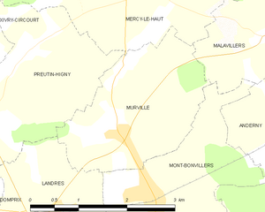
Murville
- commune in Meurthe-et-Moselle, France
- Country:

- Postal Code: 54490
- Coordinates: 49° 20' 17" N, 5° 49' 33" E


- GPS tracks (wikiloc): [Link]
- Area: 5.57 sq km
- Population: 239


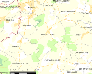
Norroy-le-Sec
- commune in Meurthe-et-Moselle, France
- Country:

- Postal Code: 54150
- Coordinates: 49° 16' 48" N, 5° 48' 39" E


- GPS tracks (wikiloc): [Link]
- Area: 13.77 sq km
- Population: 417


Preutin-Higny
- commune in Meurthe-et-Moselle, France
- Country:

- Postal Code: 54490
- Coordinates: 49° 20' 40" N, 5° 47' 29" E


- GPS tracks (wikiloc): [Link]
- Area: 7.02 sq km
- Population: 140


Mont-Bonvillers
- commune in Meurthe-et-Moselle, France
- Country:

- Postal Code: 54111
- Coordinates: 49° 19' 36" N, 5° 50' 6" E


- GPS tracks (wikiloc): [Link]
- Area: 7.44 sq km
- Population: 957


Mairy-Mainville
- commune in Meurthe-et-Moselle, France
- Country:

- Postal Code: 54150
- Coordinates: 49° 18' 13" N, 5° 51' 32" E


- GPS tracks (wikiloc): [Link]
- AboveSeaLevel: 200 м m
- Area: 12.42 sq km
- Population: 561


Piennes
- commune in Meurthe-et-Moselle, France
- Country:

- Postal Code: 54490
- Coordinates: 49° 18' 24" N, 5° 47' 11" E


- GPS tracks (wikiloc): [Link]
- Area: 4.67 sq km
- Population: 2480


Domprix
- commune in Meurthe-et-Moselle, France
- Country:

- Postal Code: 54490
- Coordinates: 49° 19' 51" N, 5° 45' 29" E


- GPS tracks (wikiloc): [Link]
- Area: 7.7 sq km
- Population: 81
