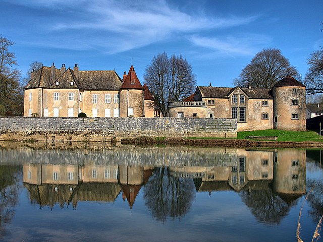
Larians-et-Munans (Larians-et-Munans)

- commune in Haute-Saône, France
 Hiking in Larians-et-Munans
Larians-et-Munans is a small commune located in the Doubs department of the Bourgogne-Franche-Comté region in eastern France. While it may not be as widely known for hiking as other locations, it offers a peaceful natural environment that can be explored through various hiking trails.
Hiking in Larians-et-Munans
-
Scenic Views: The area around Larians-et-Munans is characterized by rolling hills, forests, and picturesque landscapes, making it ideal for nature walks and hiking.
-
Trail Options: While specific trails within Larians-et-Munans may not be extensively documented, exploring rural and forest paths can reveal beautiful scenery and local flora and fauna. You may find less crowded trails that allow for a more intimate experience with nature.
-
Nearby Hiking Areas: If you’re looking for more structured hiking trails, consider venturing out to nearby parks or protected areas. The Jura Mountains to the east provide numerous hiking opportunities with established trails and breathtaking vantage points.
-
Wildlife Observation: The region is home to diverse wildlife, so hikers may have chances to spot various birds, deer, and other animals while on the trails.
-
Accessibility: Ensure you’re prepared for varying trail conditions. Check local guides or community resources for maps and trail conditions to ensure a safe hiking experience.
-
Safety Tips: Always carry plenty of water, wear appropriate footwear, and inform someone about your hiking plans. It's also wise to check the weather forecast before heading out.
Conclusion
Larians-et-Munans offers a quaint hiking experience with opportunities to connect with nature. Whether embarking on your own or seeking out trails in surrounding areas, there's plenty to discover in this serene part of France. Happy hiking!
- Country:

- Postal Code: 70230
- Coordinates: 47° 24' 57" N, 6° 14' 9" E


- GPS tracks (wikiloc): [Link]
- Area: 2.5 sq km
- Population: 243
- Wikipedia en: wiki(en)
- Wikipedia: wiki(fr)
- Wikidata storage: Wikidata: Q918893
- Wikipedia Commons Category: [Link]
- Freebase ID: [/m/03ntfd4]
- GeoNames ID: Alt: [6441982]
- SIREN number: [217002963]
- BnF ID: [152726881]
- INSEE municipality code: 70296
Shares border with regions:


Cendrey
- commune in Doubs, France
Hiking in Cendrey
Cendrey is a lesser-known area that offers beautiful natural landscapes, ideal for hiking enthusiasts seeking tranquility and stunning views. While it’s not as popular as some other hiking destinations, it can provide a unique experience away from crowded trails....
- Country:
- Postal Code: 25640
- Coordinates: 47° 24' 14" N, 6° 14' 41" E
- GPS tracks (wikiloc): [Link]
- Area: 5.52 sq km
- Population: 187

Ollans
- commune in Doubs, France
Hiking in Ollans
Ollans is a charming village located in the Rhône-Alpes region of France, known for its picturesque landscapes and outdoor activities, including hiking. While specific hiking trails can vary and are subject to seasonal changes, here are some general tips and information about hiking in and around Ollans:...
- Country:
- Postal Code: 25640
- Coordinates: 47° 25' 3" N, 6° 14' 41" E
- GPS tracks (wikiloc): [Link]
- Area: 2.31 sq km
- Population: 38


Flagey-Rigney
- commune in Doubs, France
Hiking in Flagey-Rigney
Flagey-Rigney, located in the Walloon region of Belgium, offers a picturesque setting that is ideal for hiking enthusiasts. Nestled in the beautiful countryside, this area features a mix of woodlands, fields, and rolling hills, providing a variety of landscapes to explore....
- Country:
- Postal Code: 25640
- Coordinates: 47° 25' 8" N, 6° 13' 25" E
- GPS tracks (wikiloc): [Link]
- Area: 3.03 sq km
- Population: 108
- Web site: [Link]


Maussans
- commune in Haute-Saône, France
Hiking in Maussans
Maussans is a charming small town located in the scenic region of France, known for its stunning natural landscapes and outdoor activities, including hiking. While hiking options can vary based on the exact area of Maussans you are interested in, here are some general tips and recommendations for hiking in and around this region:...
- Country:
- Postal Code: 70230
- Coordinates: 47° 25' 52" N, 6° 15' 11" E
- GPS tracks (wikiloc): [Link]
- Area: 3.92 sq km
- Population: 67


Loulans-Verchamp
- commune in Haute-Saône, France
- Country:
- Postal Code: 70230
- Coordinates: 47° 26' 48" N, 6° 12' 22" E
- GPS tracks (wikiloc): [Link]
- AboveSeaLevel: 254 м m
- Area: 8.16 sq km
- Population: 460
- Web site: [Link]