Larmor-Plage (Larmor-Plage)

- commune in Morbihan, France
- Country:

- Postal Code: 56260
- Coordinates: 47° 42' 23" N, 3° 23' 3" E


- GPS tracks (wikiloc): [Link]
- AboveSeaLevel: 9 м m
- Area: 7.27 sq km
- Population: 8182
- Web site: http://www.larmor-plage.com
- Wikipedia en: wiki(en)
- Wikipedia: wiki(fr)
- Wikidata storage: Wikidata: Q71044
- Wikipedia Commons Category: [Link]
- Freebase ID: [/m/03c64dp]
- GeoNames ID: Alt: [3006876]
- SIREN number: [215601071]
- BnF ID: [152653563]
- VIAF ID: Alt: [158714949]
- GND ID: Alt: [4244122-5]
- Library of Congress authority ID: Alt: [nr91024677]
- WOEID: [12645692]
- Quora topic ID: [Larmor-Plage]
- INSEE municipality code: 56107
Shares border with regions:


Ploemeur
- commune in Morbihan, France
- Country:
- Postal Code: 56270
- Coordinates: 47° 44' 9" N, 3° 25' 52" E
- GPS tracks (wikiloc): [Link]
- Area: 39.72 sq km
- Population: 17847
- Web site: [Link]

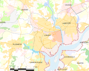
Lorient
- commune in Morbihan, France
- Country:
- Postal Code: 56100
- Coordinates: 47° 44' 45" N, 3° 21' 59" E
- GPS tracks (wikiloc): [Link]
- Area: 17.48 sq km
- Population: 57567
- Web site: [Link]