Le Breuil-sur-Couze (Le Breuil-sur-Couze)

- commune in Puy-de-Dôme, France
- Country:

- Postal Code: 63340
- Coordinates: 45° 28' 7" N, 3° 15' 47" E


- GPS tracks (wikiloc): [Link]
- Area: 5.94 sq km
- Population: 1064
- Web site: http://www.lebreuilsurcouze.fr
- Wikipedia en: wiki(en)
- Wikipedia: wiki(fr)
- Wikidata storage: Wikidata: Q1047198
- Wikipedia Commons Category: [Link]
- Freebase ID: [/m/03qh889]
- GeoNames ID: Alt: [6457007]
- SIREN number: [216300525]
- BnF ID: [15269402d]
- INSEE municipality code: 63052
Shares border with regions:


Orsonnette
- former commune in Puy-de-Dôme, France
- Country:
- Postal Code: 63340
- Coordinates: 45° 28' 31" N, 3° 17' 57" E
- GPS tracks (wikiloc): [Link]
- Area: 3.05 sq km
- Population: 197


Saint-Germain-Lembron
- commune in Puy-de-Dôme, France
- Country:
- Postal Code: 63340
- Coordinates: 45° 27' 29" N, 3° 14' 23" E
- GPS tracks (wikiloc): [Link]
- Area: 15.7 sq km
- Population: 1934


Beaulieu
- commune in Puy-de-Dôme, France
- Country:
- Postal Code: 63570
- Coordinates: 45° 26' 42" N, 3° 17' 8" E
- GPS tracks (wikiloc): [Link]
- Area: 8.65 sq km
- Population: 423

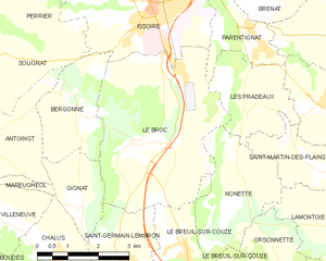
Le Broc
- commune in Puy-de-Dôme, France
- Country:
- Postal Code: 63500
- Coordinates: 45° 30' 3" N, 3° 14' 38" E
- GPS tracks (wikiloc): [Link]
- Area: 17.45 sq km
- Population: 672