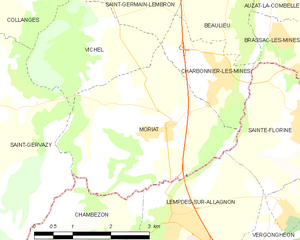
canton of Saint-Germain-Lembron (canton de Saint-Germain-Lembron)
- canton of France (until March 2015)
- Country:

- Capital: Saint-Germain-Lembron
- Coordinates: 45° 27' 21" N, 3° 13' 59" E


- GPS tracks (wikiloc): [Link]
- Wikidata storage: Wikidata: Q276571
- INSEE canton code: [6340]
Includes regions:


Collanges
- commune in Puy-de-Dôme, France
- Country:
- Postal Code: 63340
- Coordinates: 45° 26' 15" N, 3° 13' 4" E
- GPS tracks (wikiloc): [Link]
- Area: 4.45 sq km
- Population: 152
Le Breuil-sur-Couze
- commune in Puy-de-Dôme, France
- Country:
- Postal Code: 63340
- Coordinates: 45° 28' 7" N, 3° 15' 47" E
- GPS tracks (wikiloc): [Link]
- Area: 5.94 sq km
- Population: 1064
- Web site: [Link]


Saint-Gervazy
- commune in Puy-de-Dôme, France
- Country:
- Postal Code: 63340
- Coordinates: 45° 24' 54" N, 3° 12' 59" E
- GPS tracks (wikiloc): [Link]
- Area: 14.23 sq km
- Population: 320


Orsonnette
- former commune in Puy-de-Dôme, France
- Country:
- Postal Code: 63340
- Coordinates: 45° 28' 31" N, 3° 17' 57" E
- GPS tracks (wikiloc): [Link]
- Area: 3.05 sq km
- Population: 197


Villeneuve
- commune in Puy-de-Dôme, France
- Country:
- Postal Code: 63340
- Coordinates: 45° 28' 26" N, 3° 11' 19" E
- GPS tracks (wikiloc): [Link]
- Area: 4.23 sq km
- Population: 162


Charbonnier-les-Mines
- commune in Puy-de-Dôme, France
- Country:
- Postal Code: 63340
- Coordinates: 45° 25' 0" N, 3° 17' 6" E
- GPS tracks (wikiloc): [Link]
- Area: 3.36 sq km
- Population: 901
- Web site: [Link]


Vichel
- commune in Puy-de-Dôme, France
- Country:
- Postal Code: 63340
- Coordinates: 45° 25' 43" N, 3° 14' 34" E
- GPS tracks (wikiloc): [Link]
- Area: 5.71 sq km
- Population: 342


Gignat
- commune in Puy-de-Dôme, France
- Country:
- Postal Code: 63340
- Coordinates: 45° 28' 48" N, 3° 13' 13" E
- GPS tracks (wikiloc): [Link]
- Area: 3.49 sq km
- Population: 242


Saint-Germain-Lembron
- commune in Puy-de-Dôme, France
- Country:
- Postal Code: 63340
- Coordinates: 45° 27' 29" N, 3° 14' 23" E
- GPS tracks (wikiloc): [Link]
- Area: 15.7 sq km
- Population: 1934


Beaulieu
- commune in Puy-de-Dôme, France
- Country:
- Postal Code: 63570
- Coordinates: 45° 26' 42" N, 3° 17' 8" E
- GPS tracks (wikiloc): [Link]
- Area: 8.65 sq km
- Population: 423


Nonette
- former commune in Puy-de-Dôme, France
- Country:
- Postal Code: 63340
- Coordinates: 45° 28' 38" N, 3° 16' 44" E
- GPS tracks (wikiloc): [Link]
- Area: 7.6 sq km
- Population: 353


Antoingt
- commune in Puy-de-Dôme, France
- Country:
- Postal Code: 63340
- Coordinates: 45° 29' 45" N, 3° 10' 44" E
- GPS tracks (wikiloc): [Link]
- Area: 7.83 sq km
- Population: 386


Boudes
- commune in Puy-de-Dôme, France
- Country:
- Postal Code: 63340
- Coordinates: 45° 27' 34" N, 3° 11' 4" E
- GPS tracks (wikiloc): [Link]
- Area: 7.92 sq km
- Population: 283


Mareugheol
- commune in Puy-de-Dôme, France
- Country:
- Postal Code: 63340
- Coordinates: 45° 29' 17" N, 3° 9' 55" E
- GPS tracks (wikiloc): [Link]
- Area: 7.54 sq km
- Population: 190
Moriat
- commune in Puy-de-Dôme, France
- Country:
- Postal Code: 63340
- Coordinates: 45° 24' 18" N, 3° 15' 41" E
- GPS tracks (wikiloc): [Link]
- AboveSeaLevel: 460 м m
- Area: 10.81 sq km
- Population: 362


Chalus
- commune in Puy-de-Dôme, France
- Country:
- Postal Code: 63340
- Coordinates: 45° 27' 59" N, 3° 12' 35" E
- GPS tracks (wikiloc): [Link]
- Area: 6.58 sq km
- Population: 175