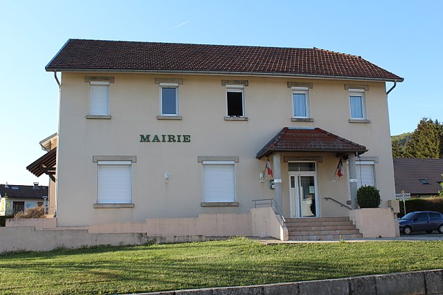
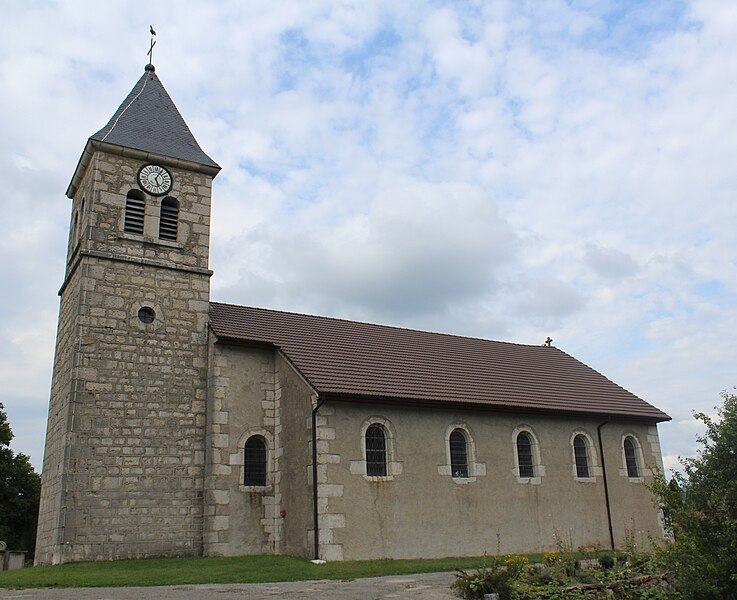
Le Grand-Abergement (Le Grand-Abergement)
- former commune in Ain, France
Le Grand-Abergement is a picturesque commune located in the Ain department of the Auvergne-Rhône-Alpes region in France. Surrounded by lush landscapes, it offers a range of hiking opportunities that cater to different skill levels, making it an excellent destination for outdoor enthusiasts.
Hiking Trails
-
Local Trails: There are several well-marked local trails that allow hikers to explore the beautiful countryside, offering stunning views of the surrounding mountains and valleys. The routes often pass through charming villages and past historical sites.
-
Nearby Natural Parks: The region is close to several natural parks, such as the Parc Naturel Régional du Haut-Jura, which offers an extensive network of trails through forests, pastures, and along rivers. Here, you can find hikes that vary from easy walks to challenging ascents.
-
Views and Flora: Many trails feature scenic overlooks where hikers can enjoy the breathtaking landscape. The region is rich in diverse flora and fauna, and depending on the season, you may encounter wildflowers, spectacular fall foliage, or even snow-capped peaks.
Tips for Hiking in Le Grand-Abergement
- Weather: Before heading out, check the local weather conditions, as they can change rapidly in mountainous areas.
- Equipment: Wear sturdy hiking boots and carry a map or GPS device. Having hiking poles can also help on uneven terrain.
- Hydration and Snacks: Always bring enough water and energy snacks to keep your stamina up during longer hikes.
- Wildlife Respect: Keep a respectful distance from wildlife and follow Leave No Trace principles to maintain the beauty of the area.
Local Amenities
- Accommodations: There are various accommodations nearby including hotels, lodges, and camping facilities suitable for different budgets.
- Guided Tours: Consider joining a guided hiking tour if you're unfamiliar with the area, as local guides can offer valuable insights and ensure safety.
Hiking in Le Grand-Abergement can be a rewarding experience, providing a great mix of physical activity and the chance to enjoy the stunning natural beauty of the Auvergne-Rhône-Alpes region. Whether you're a seasoned hiker or just starting, there’s something for everyone!
- Country:

- Postal Code: 01260
- Coordinates: 46° 2' 2" N, 5° 40' 30" E


- GPS tracks (wikiloc): [Link]
- Area: 31.92 sq km
- Population: 134
- Wikipedia en: wiki(en)
- Wikipedia: wiki(fr)
- Wikidata storage: Wikidata: Q244704
- Wikipedia Commons Category: [Link]
- Wikipedia Commons Maps Category: [Link]
- Freebase ID: [/m/03h3qk6]
- Freebase ID: [/m/03h3qk6]
- Freebase ID: [/m/03h3qk6]
- GeoNames ID: Alt: [6455421]
- GeoNames ID: Alt: [6455421]
- GeoNames ID: Alt: [6455421]
- VIAF ID: Alt: [248728474]
- VIAF ID: Alt: [248728474]
- VIAF ID: Alt: [248728474]
- INSEE municipality code: 01176
- INSEE municipality code: 01176
- INSEE municipality code: 01176
Shares border with regions:

Châtillon-en-Michaille
- commune in Ain, France
 Hiking in Châtillon-en-Michaille
Châtillon-en-Michaille, located in the Auvergne-Rhône-Alpes region of France, is a great destination for hiking enthusiasts. Nestled at the foothills of the Jura Mountains and close to the Swiss border, this area offers a variety of hiking trails that cater to different skill levels....
- Country:

- Postal Code: 01200
- Coordinates: 46° 8' 40" N, 5° 48' 0" E


- GPS tracks (wikiloc): [Link]
- Area: 37.62 sq km
- Population: 3448
- Web site: [Link]

Haut-Valromey
- commune in Ain, France
Haut-Valromey is a beautiful region located in the French Alps, known for its stunning landscapes and outdoor activities, particularly hiking. Here are some key points to consider if you plan to hike in Haut-Valromey:...
- Country:

- Postal Code: 01260
- Coordinates: 45° 59' 51" N, 5° 41' 42" E


- GPS tracks (wikiloc): [Link]
- Area: 107.85 sq km
- Web site: [Link]

Le Poizat-Lalleyriat
- commune in Ain, France
 Hiking in Le Poizat-Lalleyriat
Le Poizat-Lalleyriat is a picturesque village located in the Ain department of the Auvergne-Rhône-Alpes region in France. It's nestled in the Jura Mountains, making it a fantastic destination for hiking enthusiasts. Here are some highlights and tips for hiking in this area:...
- Country:

- Postal Code: 01130
- Coordinates: 46° 8' 42" N, 5° 41' 46" E


- GPS tracks (wikiloc): [Link]
- Area: 33.15 sq km
- Web site: [Link]

Hotonnes
- former commune in Ain, France
Hotonnes is a beautiful destination located in the French Alps, offering hikers a range of scenic trails and stunning landscapes. Known for its mountainous terrain, lush pastures, and diverse wildlife, it's an excellent spot for both novice and experienced hikers....
- Country:

- Postal Code: 01260
- Coordinates: 45° 59' 52" N, 5° 41' 36" E


- GPS tracks (wikiloc): [Link]
- Area: 28.4 sq km
- Population: 298
- Web site: [Link]

Villes
- commune in Ain, France
It seems like you might be referring to a specific location, but "Villes" isn't a widely recognized hiking destination. However, if you're referring to hiking in a general area or region known as Villes, could you please provide more details, such as the country or state? If you meant a specific village or area with that name but are unsure of the exact spelling, clarifying that would also help me provide you with more relevant information....
- Country:

- Postal Code: 01200
- Coordinates: 46° 5' 18" N, 5° 47' 6" E


- GPS tracks (wikiloc): [Link]
- Area: 9.21 sq km
- Population: 354
- Web site: [Link]

Le Petit-Abergement
- former commune in Ain, France
Le Petit-Abergement is a charming village located in the Auvergne-Rhône-Alpes region of France, nestled in the stunning landscapes of the Jura Mountains. This area offers a variety of hiking opportunities for all skill levels, whether you're an experienced hiker or a beginner looking for a scenic day out....
- Country:

- Postal Code: 01260
- Coordinates: 46° 1' 57" N, 5° 39' 49" E


- GPS tracks (wikiloc): [Link]
- Area: 26.95 sq km
- Population: 133


Lalleyriat
- former commune in Ain, France
Lalleyriat is not a widely recognized hiking destination, and it seems there might be a typographical error or confusion regarding the name. If you meant a specific hiking area, mountain, or region, please clarify its name or provide more context....
- Country:

- Postal Code: 01130
- Coordinates: 46° 9' 17" N, 5° 42' 53" E


- GPS tracks (wikiloc): [Link]
- Area: 15.25 sq km
- Population: 249

Les Neyrolles
- commune in Ain, France
Les Neyrolles, located in the Jura Mountains of France, offers a fantastic setting for hiking enthusiasts. This region is known for its lush greenery, rolling hills, and panoramic views. Here are some highlights and tips for hiking in Les Neyrolles:...
- Country:

- Postal Code: 01130
- Coordinates: 46° 8' 30" N, 5° 38' 1" E


- GPS tracks (wikiloc): [Link]
- Area: 9.5 sq km
- Population: 635

Ruffieu
- commune in Ain, France
Ruffieu is a charming village located in the Ain department of the Auvergne-Rhône-Alpes region in France. It’s nestled in the picturesque landscapes of the Jura mountains, offering a variety of hiking opportunities that cater to different levels of experience....
- Country:

- Postal Code: 01260
- Coordinates: 45° 59' 39" N, 5° 39' 48" E


- GPS tracks (wikiloc): [Link]
- Area: 14.03 sq km
- Population: 182
- Web site: [Link]

Le Poizat
- former commune in Ain, France
Le Poizat is a charming village located in the Ain department of the Auvergne-Rhône-Alpes region in eastern France. It is situated at the foothills of the Jura Mountains, making it an excellent location for hiking enthusiasts....
- Country:

- Postal Code: 01130
- Coordinates: 46° 8' 39" N, 5° 41' 44" E


- GPS tracks (wikiloc): [Link]
- Area: 17.9 sq km
- Population: 454