Haut-Valromey (Haut Valromey)
- commune in Ain, France
Haut-Valromey is a beautiful region located in the French Alps, known for its stunning landscapes and outdoor activities, particularly hiking. Here are some key points to consider if you plan to hike in Haut-Valromey:
Scenic Trails
- Diverse Terrain: The area offers a variety of trails ranging from easy walks to challenging hikes. You’ll encounter lush forests, rolling hills, alpine meadows, and panoramic mountain views.
- Marked Paths: Most trails are well-marked with signs, making it easier for hikers to navigate. It is advisable to carry a map or use GPS, especially on less frequented paths.
Notable Hiking Routes
- Monts de la Balme: This area features several trails that provide stunning views of the surrounding mountains and valleys. The ascent is moderate, suitable for families and casual hikers.
- Col de la Faucille: A popular starting point for several hiking routes, this area allows hikers to enjoy views of the Jura Mountains and Lake Geneva.
- Le Grand Colombier: For more seasoned hikers, this peak offers a rigorous hike with rewarding views from the summit.
Flora and Fauna
- The Haut-Valromey region is rich in biodiversity. As you hike, keep an eye out for local wildlife such as deer, birds, and various alpine flowers, especially in spring and early summer.
Seasonal Considerations
- Summer: Ideal for hiking, with most trails accessible. However, be prepared for varying weather conditions, from sunny days to sudden rain showers.
- Autumn: Offers stunning fall foliage and cooler temperatures, making it an excellent time for hiking.
- Winter: Some trails may be used for snowshoeing or cross-country skiing. Always check trail conditions and safety measures during winter months.
Safety Tips
- Stay Hydrated: Bring plenty of water, especially on longer hikes.
- Wear Appropriate Gear: Ensure you have proper footwear, layered clothing, and weather-appropriate gear.
- Hiking Buddy: It’s advisable to hike with a partner or group, especially on less populated trails.
Local Amenities
- The region has small villages where you can find accommodations, restaurants, and local shops. It’s a good idea to try local delicacies and learn about the culture.
Before heading out, always check local regulations, trail conditions, and weather forecasts to ensure a safe and enjoyable hiking experience in Haut-Valromey. Happy hiking!
- Country:

- Postal Code: 01260
- Coordinates: 45° 59' 51" N, 5° 41' 42" E


- GPS tracks (wikiloc): [Link]
- Area: 107.85 sq km
- Web site: http://www.hautvalromey.fr
- Wikipedia en: wiki(en)
- Wikipedia: wiki(fr)
- Wikidata storage: Wikidata: Q21294380
- Wikipedia Commons Category: [Link]
- SIREN number: [200053676]
- OpenCorporates ID: [fr/200053676]
- INSEE municipality code: 01187
Shares border with regions:

Châtillon-en-Michaille
- commune in Ain, France
 Hiking in Châtillon-en-Michaille
Châtillon-en-Michaille, located in the Auvergne-Rhône-Alpes region of France, is a great destination for hiking enthusiasts. Nestled at the foothills of the Jura Mountains and close to the Swiss border, this area offers a variety of hiking trails that cater to different skill levels....
- Country:

- Postal Code: 01200
- Coordinates: 46° 8' 40" N, 5° 48' 0" E


- GPS tracks (wikiloc): [Link]
- Area: 37.62 sq km
- Population: 3448
- Web site: [Link]

Champagne-en-Valromey
- commune in Ain, France
 Hiking in Champagne-en-Valromey
Champagne-en-Valromey is a charming commune located in the Ain department in the Auvergne-Rhône-Alpes region of France. This area is known for its splendid natural landscapes, making it a great destination for hiking enthusiasts....
- Country:

- Postal Code: 01260
- Coordinates: 45° 54' 16" N, 5° 40' 39" E


- GPS tracks (wikiloc): [Link]
- Area: 18.16 sq km
- Population: 819
- Web site: [Link]

Brénod
- commune in Ain, France
Brénod is a charming commune located in the Ain department in the Auvergne-Rhône-Alpes region of France. It is situated at the foothills of the Jura mountains, making it a great starting point for various hiking adventures....
- Country:

- Postal Code: 01110
- Coordinates: 46° 3' 39" N, 5° 36' 22" E


- GPS tracks (wikiloc): [Link]
- Area: 23.79 sq km
- Population: 536
- Web site: [Link]

Billiat
- commune in Ain, France
Billiat, which is located in Zimbabwe, is not only known for its beautiful landscapes and wildlife but also offers some fantastic hiking opportunities for outdoor enthusiasts. Although it may not be as popular as other hiking destinations, it features some stunning trails and natural beauty. Here are some points to consider if you're thinking about hiking in the Billiat area:...
- Country:

- Postal Code: 01200
- Coordinates: 46° 4' 37" N, 5° 47' 7" E


- GPS tracks (wikiloc): [Link]
- Area: 13.7 sq km
- Population: 601


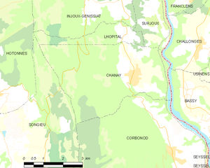
Chanay
- commune in Ain, France
Hiking in Chanay, a picturesque destination in the Auvergne-Rhône-Alpes region of France, offers a variety of trails that cater to different skill levels, from easy walks suitable for families to more challenging hikes for experienced adventurers. The area is characterized by its stunning landscapes, featuring rolling hills, dense forests, and breathtaking views of the surrounding mountains....
- Country:

- Postal Code: 01420
- Coordinates: 46° 0' 22" N, 5° 47' 8" E


- GPS tracks (wikiloc): [Link]
- Area: 18.1 sq km
- Population: 640
- Web site: [Link]

Brénaz
- commune in Ain, France
Brénaz, located in the Auvergne-Rhône-Alpes region of France, is surrounded by beautiful natural landscapes that offer excellent hiking opportunities. While the area may not be as well-known as some of the larger national parks, it features scenic trails that provide a chance to explore its charming countryside, varied terrain, and local flora and fauna....
- Country:

- Postal Code: 01260
- Coordinates: 45° 56' 54" N, 5° 43' 22" E


- GPS tracks (wikiloc): [Link]
- Area: 9.79 sq km
- Population: 100

Le Poizat-Lalleyriat
- commune in Ain, France
 Hiking in Le Poizat-Lalleyriat
Le Poizat-Lalleyriat is a picturesque village located in the Ain department of the Auvergne-Rhône-Alpes region in France. It's nestled in the Jura Mountains, making it a fantastic destination for hiking enthusiasts. Here are some highlights and tips for hiking in this area:...
- Country:

- Postal Code: 01130
- Coordinates: 46° 8' 42" N, 5° 41' 46" E


- GPS tracks (wikiloc): [Link]
- Area: 33.15 sq km
- Web site: [Link]

Champdor-Corcelles
- commune in Ain, France
Champdor-Corcelles is a small village located in the Ain department in the Auvergne-Rhône-Alpes region of France. It offers beautiful landscapes, making it an excellent destination for hiking enthusiasts. Here are some key points to consider when hiking in this area:...
- Country:

- Postal Code: 01080
- Coordinates: 46° 1' 5" N, 5° 35' 52" E


- GPS tracks (wikiloc): [Link]
- Area: 31.53 sq km
- Web site: [Link]

Corbonod
- commune in Ain, France
Corbonod is a picturesque village located in the Auvergne-Rhône-Alpes region of southeastern France, nestled within the beautiful landscapes of the French Alps. Hiking in this area offers stunning views, diverse terrains, and a chance to explore the natural beauty of the region. Here are some things to consider when hiking in Corbonod:...
- Country:

- Postal Code: 01420
- Coordinates: 45° 58' 11" N, 5° 48' 37" E


- GPS tracks (wikiloc): [Link]
- Area: 31.59 sq km
- Population: 1246
- Web site: [Link]

Injoux-Génissiat
- commune in Ain, France
Injoux-Génissiat is a charming commune located in the Ain department of the Auvergne-Rhône-Alpes region in southeastern France. The area is known for its natural beauty, making it a great destination for hiking enthusiasts. Here are some key points about hiking in Injoux-Génissiat:...
- Country:

- Postal Code: 01200
- Coordinates: 46° 3' 5" N, 5° 48' 9" E


- GPS tracks (wikiloc): [Link]
- Area: 29.61 sq km
- Population: 1144
- Web site: [Link]

Lompnieu
- commune in Ain, France
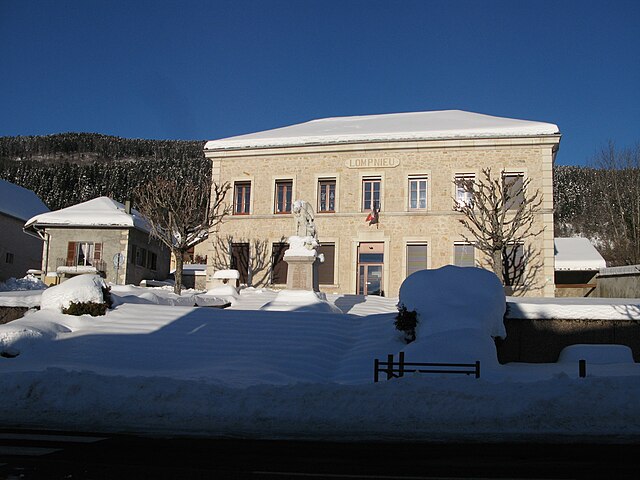
Lompnieu is a charming village located in the Auvergne-Rhône-Alpes region of France, nestled in the beautiful Jura mountains. This area offers stunning landscapes, lush forests, and a variety of trails that cater to hikers of all levels. Here are some key points about hiking in Lompnieu:...
- Country:

- Postal Code: 01260
- Coordinates: 45° 57' 42" N, 5° 39' 39" E


- GPS tracks (wikiloc): [Link]
- Area: 11.35 sq km
- Population: 113
- Web site: [Link]

Villes
- commune in Ain, France
It seems like you might be referring to a specific location, but "Villes" isn't a widely recognized hiking destination. However, if you're referring to hiking in a general area or region known as Villes, could you please provide more details, such as the country or state? If you meant a specific village or area with that name but are unsure of the exact spelling, clarifying that would also help me provide you with more relevant information....
- Country:

- Postal Code: 01200
- Coordinates: 46° 5' 18" N, 5° 47' 6" E


- GPS tracks (wikiloc): [Link]
- Area: 9.21 sq km
- Population: 354
- Web site: [Link]

Les Neyrolles
- commune in Ain, France
Les Neyrolles, located in the Jura Mountains of France, offers a fantastic setting for hiking enthusiasts. This region is known for its lush greenery, rolling hills, and panoramic views. Here are some highlights and tips for hiking in Les Neyrolles:...
- Country:

- Postal Code: 01130
- Coordinates: 46° 8' 30" N, 5° 38' 1" E


- GPS tracks (wikiloc): [Link]
- Area: 9.5 sq km
- Population: 635

Ruffieu
- commune in Ain, France
Ruffieu is a charming village located in the Ain department of the Auvergne-Rhône-Alpes region in France. It’s nestled in the picturesque landscapes of the Jura mountains, offering a variety of hiking opportunities that cater to different levels of experience....
- Country:

- Postal Code: 01260
- Coordinates: 45° 59' 39" N, 5° 39' 48" E


- GPS tracks (wikiloc): [Link]
- Area: 14.03 sq km
- Population: 182
- Web site: [Link]


Lhôpital
- commune in Ain, France
Lhôpital is a village located in the northeastern part of France, near the border with Germany. While it may not be widely recognized as a major hiking destination, the surrounding region offers scenic trails and outdoor activities that can appeal to hikers looking to explore the Alsace region....
- Country:

- Postal Code: 01420
- Coordinates: 46° 1' 18" N, 5° 46' 42" E


- GPS tracks (wikiloc): [Link]
- Area: 3.68 sq km
- Population: 47

Songieu
- former commune in Ain, France
It seems there might be a typo in your query as there is no widely recognized hiking destination by the name of "Songieu." However, if you meant "Sonjieu," "Songyue," or a similar location, I can still provide general information about hiking in various regions or help with hiking tips and trails in any well-known national parks or hiking areas....
- Country:

- Postal Code: 01260
- Coordinates: 45° 58' 24" N, 5° 42' 8" E


- GPS tracks (wikiloc): [Link]
- Area: 20.58 sq km
- Population: 128