Le Malzieu-Forain (Le Malzieu-Forain)

- commune in Lozère, France
- Country:

- Postal Code: 48140
- Coordinates: 44° 51' 16" N, 3° 19' 42" E


- GPS tracks (wikiloc): [Link]
- AboveSeaLevel: 1200 м m
- Area: 48.65 sq km
- Population: 460
- Wikipedia en: wiki(en)
- Wikipedia: wiki(fr)
- Wikidata storage: Wikidata: Q721334
- Wikipedia Commons Category: [Link]
- Freebase ID: [/m/02z0y44]
- Freebase ID: [/m/02z0y44]
- GeoNames ID: Alt: [6616888]
- GeoNames ID: Alt: [6616888]
- SIREN number: [214800898]
- SIREN number: [214800898]
- BnF ID: [152614959]
- BnF ID: [152614959]
- INSEE municipality code: 48089
- INSEE municipality code: 48089
Shares border with regions:


Chanaleilles
- commune in Haute-Loire, France
- Country:
- Postal Code: 43170
- Coordinates: 44° 51' 40" N, 3° 29' 17" E
- GPS tracks (wikiloc): [Link]
- Area: 48.52 sq km
- Population: 186


Lajo
- commune in Lozère, France
- Country:
- Postal Code: 48120
- Coordinates: 44° 50' 15" N, 3° 25' 36" E
- GPS tracks (wikiloc): [Link]
- Area: 18.58 sq km
- Population: 103


Grèzes
- commune in Haute-Loire, France
- Country:
- Postal Code: 43170
- Coordinates: 44° 55' 11" N, 3° 29' 14" E
- GPS tracks (wikiloc): [Link]
- Area: 35.79 sq km
- Population: 200


Saint-Alban-sur-Limagnole
- commune in Lozère, France
- Country:
- Postal Code: 48120
- Coordinates: 44° 46' 51" N, 3° 23' 18" E
- GPS tracks (wikiloc): [Link]
- Area: 51.23 sq km
- Population: 1341

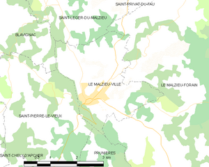
Le Malzieu-Ville
- commune in Lozère, France
- Country:
- Postal Code: 48140
- Coordinates: 44° 51' 22" N, 3° 19' 51" E
- GPS tracks (wikiloc): [Link]
- Area: 7.8 sq km
- Population: 740
- Web site: [Link]
Saint-Privat-du-Fau
- commune in Lozère, France
- Country:
- Postal Code: 48140
- Coordinates: 44° 55' 1" N, 3° 20' 24" E
- GPS tracks (wikiloc): [Link]
- Area: 22.16 sq km
- Population: 136

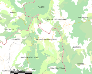
Paulhac-en-Margeride
- commune in Lozère, France
- Country:
- Postal Code: 48140
- Coordinates: 44° 56' 49" N, 3° 22' 50" E
- GPS tracks (wikiloc): [Link]
- Area: 15.79 sq km
- Population: 100


Prunières
- commune in Lozère, France
- Country:
- Postal Code: 48200
- Coordinates: 44° 49' 35" N, 3° 20' 32" E
- GPS tracks (wikiloc): [Link]
- Area: 13.09 sq km
- Population: 261

Saint-Léger-du-Malzieu
- commune in Lozère, France
- Country:
- Postal Code: 48140
- Coordinates: 44° 53' 17" N, 3° 18' 35" E
- GPS tracks (wikiloc): [Link]
- Area: 18.92 sq km
- Population: 212

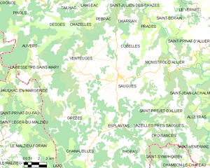
Saugues
- commune in Haute-Loire, France
- Country:
- Postal Code: 43170
- Coordinates: 44° 57' 36" N, 3° 32' 51" E
- GPS tracks (wikiloc): [Link]
- Area: 78.8 sq km
- Population: 1815
- Web site: [Link]